 |
|
| Tambacounda Airport |
| IATA: TUD – ICAO: GOTT |
| Summary |
| Airport type |
Public |
| Serves |
Tambacounda, Senegal |
| Elevation AMSL |
161 ft / 49 m |
| Coordinates |
13°44′12″N 013°39′11″W / 13.73667°N 13.65306°W / 13.73667; -13.65306 |
| Runways |
| Direction |
Length |
Surface |
| m |
ft |
| 06/24 |
2,000 |
6,561 |
Asphalt |
| Source: DAFIF |
Tambacounda Airport (IATA: TUD, ICAO: GOTT) is an airport serving Tambacounda, the capital of the Tambacounda Region in Senegal.
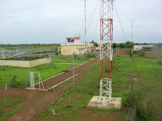 | |
Airport telecommunication antennas and towers, with terminal in background, 2006. |
The above content comes from Wikipedia and is published under free licenses – click here to read more.
| General Info
|
| Country |
Senegal
|
| ICAO ID |
GOTT
|
| Time |
UTC 0
|
| Latitude |
13.736817
13° 44' 12.54" N
|
| Longitude |
-13.653122
013° 39' 11.24" W
|
| Elevation |
161 feet
49 meters
|
| Type |
Civil
|
| Magnetic Variation |
007° W (01/06)
|
| Operating Agency |
CIVIL GOVERNMENT, (LANDING FEES AND DIPLOMATIC CLEARANCE MAY BE REQUIRED)
|
| Operating Hours |
SEE REMARKS FOR OPERATING HOURS OR COMMUNICATIONS FOR POSSIBLE HOURS
|
| Communications
|
| AFIS INFO |
118.7
|
| RDO |
5680
|
| Runways
|
| ID |
Dimensions |
Surface |
PCN |
ILS
|
| 06/24 |
6562 x 98 feet
2000 x 30 meters |
ASPHALT |
- |
NO
|
| Navaids
|
| Type |
ID |
Name |
Channel |
Freq |
Distance From Field |
Bearing From Navaid
|
| VOR |
TD |
TAMBACOUNDA |
- |
114.5 |
At Field |
-
|
| NDB |
STD |
TAMBACOUNDA |
- |
370 |
At Field |
-
|
| Supplies/Equipment
|
| Fuel |
100/130 octane gasoline, leaded, MIL-L-5572F (GREEN)
|
| Remarks
|
| FUEL |
(NC-100LL)
|
| OPR HOURS |
Opr 0700-1900Z O/R with 12 hr PN.
|
| RSTD |
Arpt clsd at ngt due to defective lgt.
|
The content above was published at Airports-Worldwide.com in 2010.
We don't guarantee the information is fresh and accurate. The data may be wrong or outdated.
For more up-to-date information please refer to other sources.
|
|


