|
|
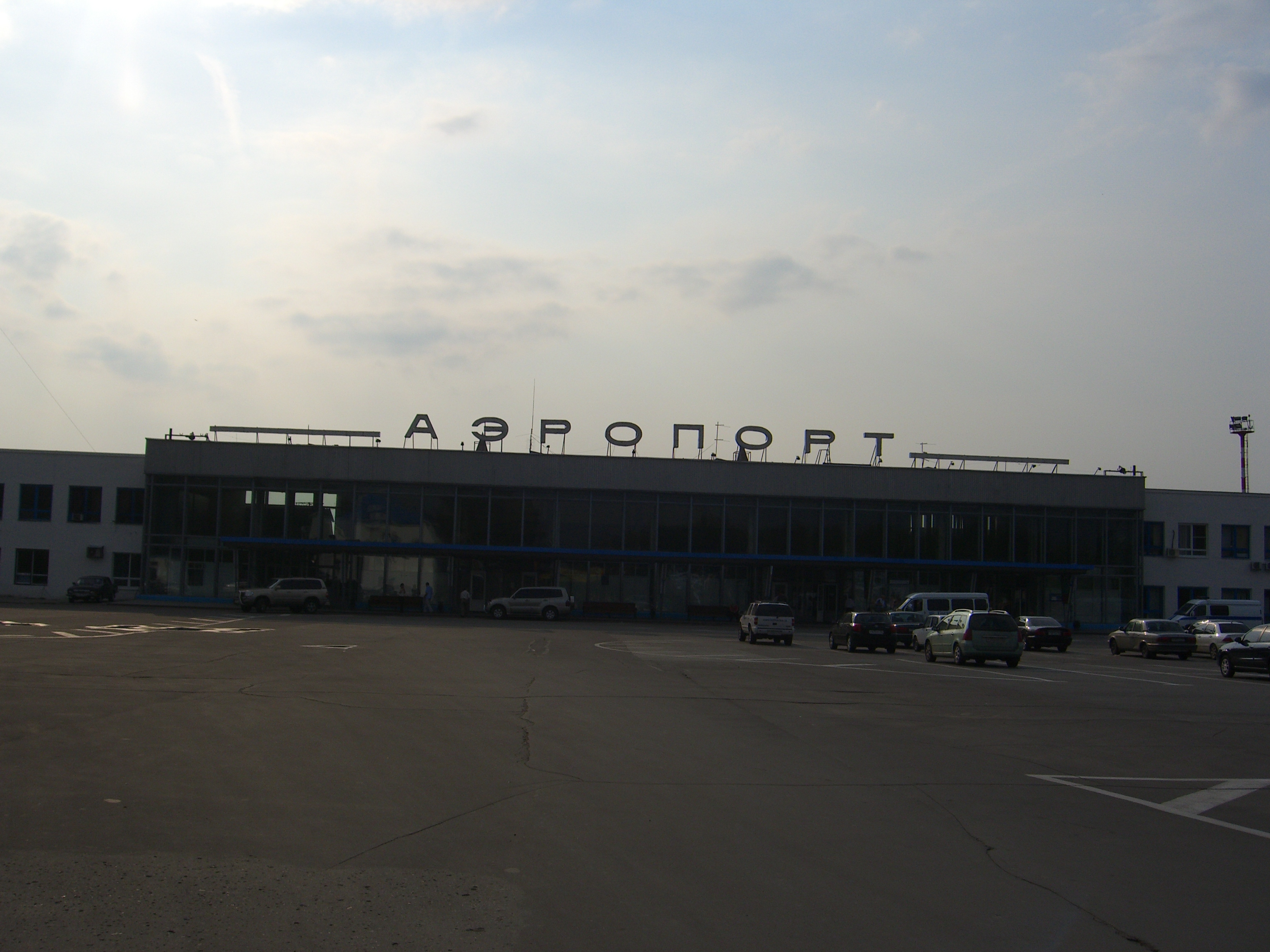
Nizhny Novgorod International Airport
Международный аэропорт Нижний Новгород |
 |
 |
| IATA: GOJ – ICAO: UWGG |
| Summary |
| Airport type |
Public |
| Operator |
JSC "Nizhny Novgorod International Airport" |
| Location |
Nizhny Novgorod |
| Elevation AMSL |
256 ft / 78 m |
| Coordinates |
56°13′48″N 043°47′12″E / 56.23°N 43.78667°E / 56.23; 43.78667 |
| Runways |
| Direction |
Length |
Surface |
| m |
ft |
| 06/24 |
500 |
1,640 |
Asphalt |
| 15/33 |
600 |
1,969 |
Asphalt |
| 18R/36L |
2,805 |
9,203 |
Concrete |
| 18L/36R |
2,509 |
8,232 |
Asphalt |
| Statistics (2007) |
| Passengers (regular flights) |
210,483 |
| Passengers (charter flights) |
70,238 |
Nizhny Novgorod International Airport (Russian: Международный аэропорт Нижний Новгород) (IATA: GOJ, ICAO: UWGG) (sometimes referred to as Strigino Airport (Russian: Аэропорт Стригино)) is the international airport serving the city of Nizhny Novgorod, Russia. It is located on the outskirts of the city's Avtozavodsky District, 14 km southwest of city center.
It was founded in 1936.
The civil terminal offers a very large apron that can accommodate 44 aircraft. The airfield supports 24-hour flight operations. Several Ministry of Interior Ilyushin Il-76 aircraft are based here. Lufthansa has a regular service to Frankfurt from this airport. Transport
The airport can be reached by:
- taxi
- bus #11 - from Metro station 'Park kultury'
- microbus (marshrutka) #29 - from Metro station 'Park Kultury'
- bus#20 - from railway station
The Nizhny Novgorod - Arzamas railway line runs close to the airport, and the authorities are currently (2008) studying the feasibility of constructing a railway branch into the airport, and a train station there, with a view to running trains from there to Nizhny Novgorod's main railway station.
Airlines and destinations
| Airlines |
Destinations |
| Armavia |
Yerevan |
| Lufthansa |
Frankfurt |
| Region Avia Airlines |
Moscow-Domodedovo, St Petersburg |
| S7 Airlines |
Moscow-Domodedovo |
| UTair Aviation |
Baku, Moscow-Vnukovo, Samara, Surgut, Yekaterinburg, Anapa |
| Kavminvodyavia |
Belgorod |
The above content comes from Wikipedia and is published under free licenses – click here to read more.
| General Info
|
| Country |
Russia
|
| ICAO ID |
UWGG
|
| Time |
UTC+3(+4DT)
|
| Latitude |
56.230119
56° 13' 48.43" N
|
| Longitude |
43.784042
043° 47' 02.55" E
|
| Elevation |
256 feet
78 meters
|
| Type |
Civil
|
| Magnetic Variation |
011° E (01/06)
|
| Operating Agency |
CIVIL GOVERNMENT, (LANDING FEES AND DIPLOMATIC CLEARANCE MAY BE REQUIRED)
|
| Near City |
Nizhny Novgorod
|
| Operating Hours |
24 HOUR OPERATIONS
|
| Daylight Saving Time |
Last Sunday in March to last Sunday in October
|
| Communications
|
NIZHNY TWR
Call START.
|
120.4
|
| NIZHNY TAXIING |
121.8
|
| NIZHNY ATIS |
127.8
|
| NIZHNY KRUG |
120.8
|
| NIZHNY APP |
124.7
|
| Runways
|
| ID |
Dimensions |
Surface |
PCN |
ILS
|
| 06/24 |
1640 x 72 feet
500 x 22 meters |
ASPHALT |
- |
NO
|
| 15/33 |
1969 x 72 feet
600 x 22 meters |
ASPHALT |
- |
NO
|
| 18R/36L |
9203 x 148 feet
2805 x 45 meters |
CONCRETE. |
030RAWT |
YES
|
| 18L/36R |
8232 x 148 feet
2509 x 45 meters |
ASPHALT |
028RCXT |
NO
|
| Navaids
|
| Type |
ID |
Name |
Channel |
Freq |
Distance From Field |
Bearing From Navaid
|
| NDB |
UV |
NIZHNY NOVGOROD |
- |
327 |
1.3 NM |
193.5
|
The content above was published at Airports-Worldwide.com in 2010.
We don't guarantee the information is fresh and accurate. The data may be wrong or outdated.
For more up-to-date information please refer to other sources.
|
|