|
|
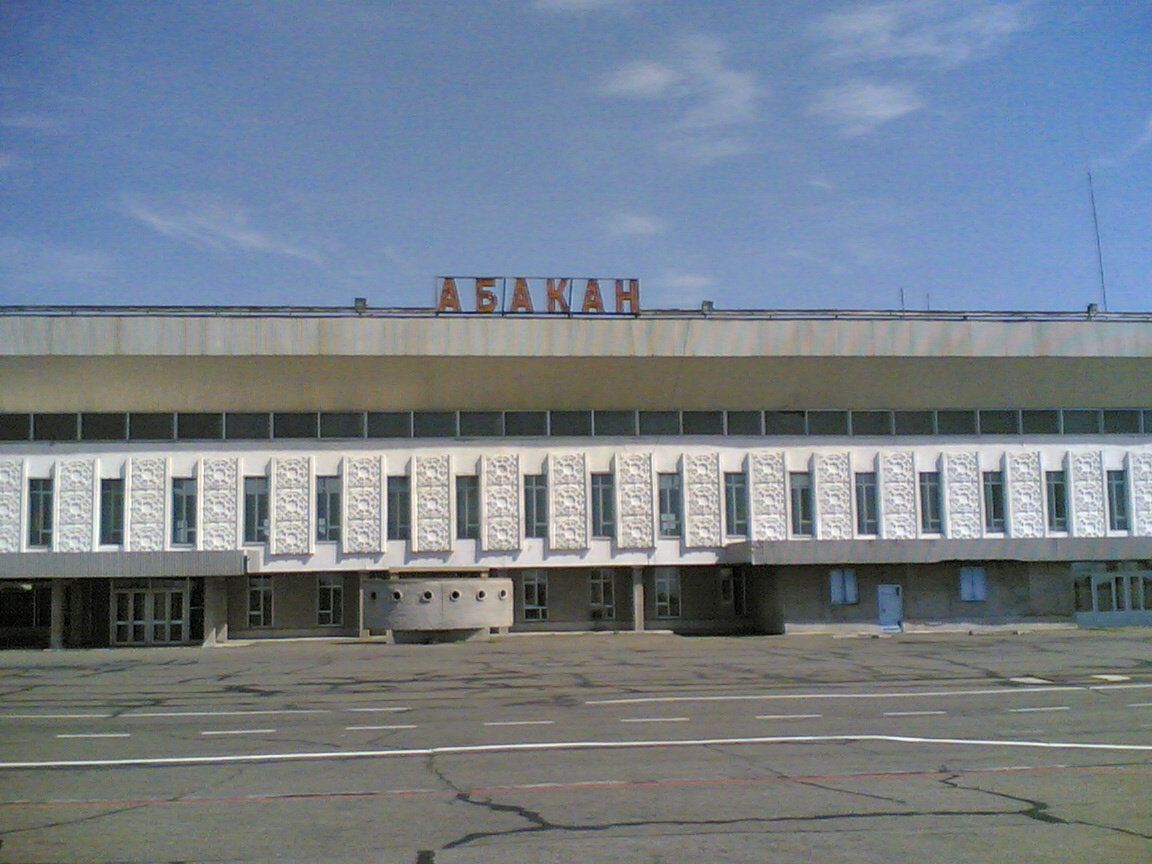
Abakan International Airport
Международный Аэропорт «Абакан» |
 |
| IATA: ABA – ICAO: UNAA |
| Summary |
| Airport type |
Public |
| Operator |
JSC "Aeroport Abakan" |
| Serves |
Abakan |
| Elevation AMSL |
253 m / 830 ft |
| Coordinates |
53°45′N 91°24′E / 53.75°N 91.4°E / 53.75; 91.4Coordinates: 53°45′N 91°24′E / 53.75°N 91.4°E / 53.75; 91.4 |
| Website |
http://www.abakan-airport.ru |
| Runways |
| Direction |
Length |
Surface |
| m |
ft |
| 2/20 |
3250 |
10600 |
bitumen concrete |
Abakan International Airport (Russian: Международный Аэропорт Абакан) (IATA: ABA, ICAO: UNAA) is an airport located in Abakan, Republic of Khakassia, Russia. Airport description
The airport is located to the north of the city not far from the city limits. City bus and trolleybus connections are available. It is the only airport in the region (Khakassia and south of Krasnoyarsk Kray) suitable for all types of aircraft.
Airlines and destinations
Passenger airlines
- S7 Airlines (Moscow-Domodedovo)
- Vladivostok Air (Moscow-Vnukovo, Vladivostok)
Cargo airlines
- Airstars (Chelyabinsk-Balandino, Jinan, Shijiazhuang, Tianjin, Ulyanovsk)
- Grizodubova Air Company (Chelyabinsk-Balandino, Tianjin)
- Volga-Dnepr (Guangzhou, Moscow-Domodedovo, Shanghai-Pudong, Tianjin)
Accidents and incidents
On November 27, 1996, 8 minutes after taking off from Abakan Airport, an Ilyushin Il-76 transport aircraft (registered RA-78804) crashed into a mountain near Minusinsk on the right bank of Yenisey river. The aircraft transported consumer goods and food. Everyone on board (23 people, including 13 passengers) have died. The cause of the crash was that the aircraft was overloaded and climbed very slowly.
The above content comes from Wikipedia and is published under free licenses – click here to read more.
| General Info
|
| Country |
Russia
|
| ICAO ID |
UNAA
|
| Time |
UTC+7(+8DT)
|
| Latitude |
53.740000
53° 44' 24.00" N
|
| Longitude |
91.385000
091° 23' 06.00" E
|
| Elevation |
831 feet
253 meters
|
| Type |
Civil
|
| Magnetic Variation |
004° E (01/06)
|
| Operating Agency |
CIVIL GOVERNMENT, (LANDING FEES AND DIPLOMATIC CLEARANCE MAY BE REQUIRED)
|
| Operating Hours |
24 HOUR OPERATIONS
|
| Daylight Saving Time |
Last Sunday in March to last Sunday in October
|
| Communications
|
START
Opr HO. Also svc as TWR and TAXIING.
|
122.0
|
| ATIS |
126.2
|
KRUG
Opr HO.
|
120.6
|
APP
Opr HO.
|
134.3
|
| Runways
|
| ID |
Dimensions |
Surface |
PCN |
ILS
|
| 02C/20C |
8202 x 263 feet
2500 x 80 meters |
GRASS OR EARTH NOT GRADED OR ROLLED. |
- |
NO
|
| 02R/20L |
10663 x 148 feet
3250 x 45 meters |
ASPHALT |
098FBWT |
YES
|
| 02L/20R |
4265 x 92 feet
1300 x 28 meters |
ASPHALT |
- |
NO
|
| Navaids
|
| Type |
ID |
Name |
Channel |
Freq |
Distance From Field |
Bearing From Navaid
|
| VOR-DME |
ABK |
ABAKAN |
080X |
113.3 |
At Field |
-
|
| NDB |
AK |
ABAKAN |
- |
360 |
1.8 NM |
204.0
|
| Remarks
|
| FUEL |
(NC-TS1)
|
| RSTD |
First 492' of Rwy 20L unuse for tkof.
|
The content above was published at Airports-Worldwide.com in 2010.
We don't guarantee the information is fresh and accurate. The data may be wrong or outdated.
For more up-to-date information please refer to other sources.
|
|