 |
|
Roxas Airport
Paliparan ng Roxas
Hulugpaan sang Roxas |
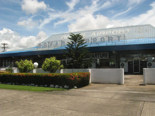 |
| Exterior of Roxas Airport |
| IATA: RXS – ICAO: RPVR |
| Summary |
| Airport type |
Public |
| Operator |
Air Transportation Office |
| Serves |
Roxas City |
| Location |
Barangay Gabuan, Roxas City |
| Elevation AMSL |
3 m / 10 ft |
| Coordinates |
11°35′51.61″N 122°45′06.01″E / 11.5976694°N 122.7516694°E / 11.5976694; 122.7516694 |
| Runways |
| Direction |
Length |
Surface |
| m |
ft |
| 14/32 |
1,890 |
6,201 |
Concrete |
| Statistics (2008) |
| Passengers |
115,375 |
| Aircraft movements |
1,498 |
| Metric tonnes of cargo |
1,347 |
| Statistics from the Air Transportation Office. |
Roxas Airport (Filipino: Paliparan ng Roxas, Hiligaynon: Hulugpaan sang Roxas) (IATA: RXS, ICAO: RPVR) is an airport serving the general area of Roxas City, the capital of the province of Capiz, in the Philippines. The airport is classified as a trunkline airport, or a major commercial domestic airport, by the Air Transportation Office, a body of the Department of Transportation and Communications that is responsible for the operations of not only this airport but also of all other airports in the Philippines except the major international airports. Airlines and destinations
| Airlines |
Destinations |
| Cebu Pacific |
Manila |
| Philippine Airlines |
Manila |
The above content comes from Wikipedia and is published under free licenses – click here to read more.
| General Info
|
| Country |
Philippines
|
| ICAO ID |
RPVR
|
| Time |
UTC+8
|
| Latitude |
11.597669
11° 35' 51.61" N
|
| Longitude |
122.751669
122° 45' 06.01" E
|
| Elevation |
10 feet
3 meters
|
| Magnetic Variation |
000° W (01/06)
|
| Beacon |
Yes
|
| Operating Agency |
CIVIL GOVERNMENT, (LANDING FEES AND DIPLOMATIC CLEARANCE MAY BE REQUIRED)
|
| Island Group |
Panay I
|
| Operating Hours |
SEE REMARKS FOR OPERATING HOURS OR COMMUNICATIONS FOR POSSIBLE HOURS
|
| Communications
|
| TWR |
118.5
5205
3872
|
| Communications Remarks |
|
| TWR |
OT 24 hr PN.
|
| Runways
|
| ID |
Dimensions |
Surface |
PCN |
ILS
|
| 14/32 |
6201 x 148 feet
1890 x 45 meters |
CONCRETE. |
047RBWU |
NO
|
| Navaids
|
| Type |
ID |
Name |
Channel |
Freq |
Distance From Field |
Bearing From Navaid
|
| VOR-DME |
ROX |
ROXAS |
076X |
112.9 |
At Field |
-
|
| Remarks
|
| CAUTION |
Apch zones Rwy 32 obst by trees and ant.
|
| FUEL |
(NC-100LL, A1)
|
| LGT |
Rwy lgt on req. Rwy 14 PAPI GS 2.95 .
|
| OPR HOURS |
Opr 2100-0500Z.
|
The content above was published at Airports-Worldwide.com in 2010.
We don't guarantee the information is fresh and accurate. The data may be wrong or outdated.
For more up-to-date information please refer to other sources.
|
|


