 |
|
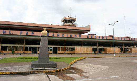
Coronel Francisco Secada Vignetta Intl Airport |
| Crnl. FAP Francisco Secada Vignetta International Airport |
 |
| IATA: IQT – ICAO: SPQT |
| Summary |
| Airport type |
Public |
| Operator |
ADP |
| Location |
Iquitos |
| Elevation AMSL |
406 ft / 124 m |
| Coordinates |
3°47′5″S 73°18′31″W / 3.78472°S 73.30861°W / -3.78472; -73.30861Coordinates: 3°47′5″S 73°18′31″W / 3.78472°S 73.30861°W / -3.78472; -73.30861 |
| Runways |
| Direction |
Length |
Surface |
| ft |
m |
| 06/24 |
8,202 |
2,500 |
Asphalt |
Coronel FAP Francisco Secada Vignetta International Airport (IATA: IQT, ICAO: SPQT) is an airport serving Peru's fifth largest city, Iquitos. It and Pucallpa's Captain Rolden International Airport are the main air hubs in the Peruvian Amazon. It is used as a connecting point for many small cities, towns, and other urbanizations located in the jungle. In the nearby past it has served Brazilian destinations and Miami, Florida, USA but these scheduled flights are no longer available. There has been many ongoing talks of direct Cusco-Iquitos flights but there currently aren't any. Its runways are fully paved. It has flights to other destinations in the country with various airlines. It is the main gateway for tourists visiting the city of Iquitos, spectacular jungle lodges, and the Amazon Rainforest, the world's largest rain forest.
Airlines and destinations
| Airlines |
Destinations |
| LAN Perú |
Lima, Pucallpa [seasonal], Tarapoto [seasonal] |
| Peruvian Airlines |
Lima |
| Star Perú |
Lima, Pucallpa, Tarapoto |
Cargo Airlines
| Airlines |
Destinations |
| Centurion Air Cargo |
Miami |
| Tradewinds Airlines |
Lima, Miami |
The above content comes from Wikipedia and is published under free licenses – click here to read more.
| General Info
|
| Country |
Peru
|
| ICAO ID |
SPQT
|
| Time |
UTC-5
|
| Latitude |
-3.784739
03° 47' 05.06" S
|
| Longitude |
-73.308806
073° 18' 31.70" W
|
| Elevation |
306 feet
93 meters
|
| Type |
Joint (Civil and Military)
|
| Magnetic Variation |
004° W (01/06)
|
| Beacon |
Yes
|
| Operating Agency |
MILITARY - CIVIL JOINT USE AIRPORT
|
| Near City |
Iquitos
|
| International Clearance Status |
Airport of Entry
|
| Communications
|
| IQUITOS TWR |
118.5
|
| IQUITOS APP |
124.1
|
| Runways
|
| ID |
Dimensions |
Surface |
PCN |
ILS
|
| 06/24 |
8202 x 148 feet
2500 x 45 meters |
CONCRETE. |
045RCXU |
YES
|
| Navaids
|
| Type |
ID |
Name |
Channel |
Freq |
Distance From Field |
Bearing From Navaid
|
| VOR-DME |
IQT |
IQUITOS |
112X |
116.5 |
At Field |
-
|
| NDB |
EC |
IQUITOS |
- |
335 |
1.2 NM |
061.3
|
| Supplies/Equipment
|
| Fuel |
Jet A1, without icing nhibitor.
|
| Remarks
|
| CAUTION |
Bird haz. Rubber polution Rwy 06.
|
| FUEL |
A1 (PETROPERU, Petro Peru C516-589-1705)
|
The content above was published at Airports-Worldwide.com in 2010.
We don't guarantee the information is fresh and accurate. The data may be wrong or outdated.
For more up-to-date information please refer to other sources.
|
|


