|
|
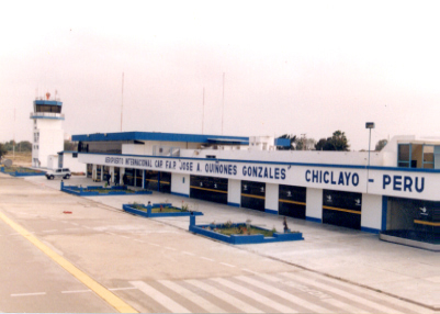
Capt Jose A Quinones Gonzales Intl Airport |
| Cap. FAP José A. Quiñones Gonzáles International Airport |
 |
| IATA: CIX – ICAO: SPHI |
| Summary |
| Airport type |
Public |
| Operator |
ADP |
| Location |
Chiclayo |
| Elevation AMSL |
97 ft / 30 m |
| Coordinates |
06°47′14″S 79°49′41″W / 6.78722°S 79.82806°W / -6.78722; -79.82806Coordinates: 06°47′14″S 79°49′41″W / 6.78722°S 79.82806°W / -6.78722; -79.82806 |
| Runways |
| Direction |
Length |
Surface |
| ft |
m |
| 01/19 |
8,266 |
2,519 |
Asphalt |
Capitán FAP José A. Quiñones Gonzáles International Airport (IATA: CIX, ICAO: SPHI) is an airport serving Chiclayo, Peru and the surrounding metropolitan area. It is run by ADP a private airport operator that operates various airports in northem Peru. It is the main airport of the Lambayeque Region, one of the most populous of the country.
Airlines and destinations
| Airlines |
Destinations |
| LAN Perú |
Lima |
| Star Perú |
Cuenca [begins November 3], Lima, Trujillo |
The above content comes from Wikipedia and is published under free licenses – click here to read more.
| General Info
|
| Country |
Peru
|
| ICAO ID |
SPHI
|
| Time |
UTC-5
|
| Latitude |
-6.787475
06° 47' 14.91" S
|
| Longitude |
-79.828097
079° 49' 41.15" W
|
| Elevation |
97 feet
30 meters
|
| Type |
Civil
|
| Magnetic Variation |
000° E (01/06)
|
| Beacon |
Yes
|
| Operating Agency |
CIVIL GOVERNMENT, (LANDING FEES AND DIPLOMATIC CLEARANCE MAY BE REQUIRED)
|
| Near City |
Chiclayo
|
| Communications
|
| CHICLAYO APP/TWR |
118.3
|
| CHICLAYO RDO |
126.9
|
| GND |
121.9
|
| Runways
|
| ID |
Dimensions |
Surface |
PCN |
ILS
|
| 01/19 |
8266 x 148 feet
2519 x 45 meters |
ASPHALT |
051FBXT |
YES
|
| Navaids
|
| Type |
ID |
Name |
Channel |
Freq |
Distance From Field |
Bearing From Navaid
|
| VOR-DME |
CLA |
CHICLAYO |
096X |
114.9 |
4.2 NM |
186.1
|
| NDB |
HIC |
CHICLAYO |
- |
305 |
At Field |
-
|
| Supplies/Equipment
|
| Fuel |
Jet A1+, Jet A1 with icing inhibitor.
100/130 octane gasoline, leaded, MIL-L-5572F (GREEN)
|
| Remarks
|
| CAUTION |
Bird haz.
|
| FUEL |
(NC-A1)
|
| RSTD |
After ldg Rwy 19 cont to end, turn lt and rqt progressive taxi, 180 turn on rwy not auth.
|
The content above was published at Airports-Worldwide.com in 2010.
We don't guarantee the information is fresh and accurate. The data may be wrong or outdated.
For more up-to-date information please refer to other sources.
|
|