 |
 |
|
||||
|
Address: Private Bag 1002 Whakatane New Zealand Phone: (07) 307 9800 Fax: (07) 307 0718 E-mail:
-
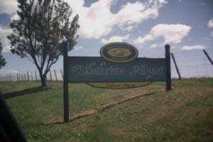
Images and information placed above are from http://www.airportsnewzealand.com/ We thank www.airportsnewzealand.com for the data.
Runway 09R/27L 2461 x 98 feet
|
|||||||||||||||||||||||||||||||||||||||||||||||||||||||||||||||||||||||||||||||||||||||||||||||||||||||||||||||||||||||||||||||||||||||||||||||||||||||||||||||||||||||||||||||||||||||||||||||||||||||||||||||||||||||||
| Runway 09R | |
|---|---|
| Surface | GRASS OR EARTH NOT GRADED OR ROLLED. |
| True Heading | 113.1 |
| Latitude | 0.000000 - |
| Longitude | 0.000000 - |
| Elevation | 19.0 feet 6 meters |
| Landing Distance | 2461 feet 750 meters |
| Takeoff Distance | 2461 feet 750 meters |
| Runway 27L | |
|---|---|
| Surface | GRASS OR EARTH NOT GRADED OR ROLLED. |
| True Heading | 293.1 |
| Latitude | 0.000000 - |
| Longitude | 0.000000 - |
| Elevation | 19.0 feet 6 meters |
| Landing Distance | 2461 feet 750 meters |
| Takeoff Distance | 2461 feet 750 meters |
| Runway 09L | |
|---|---|
| Surface | ASPHALT |
| True Heading | 113.0 |
| Latitude | -37.916611 37° 54' 59.80" S |
| Longitude | 176.908950 176° 54' 32.22" E |
| Elevation | 19.0 feet 6 meters |
| Slope | 0.0° |
| Landing Distance | 4200 feet 1280 meters |
| Takeoff Distance | 4200 feet 1280 meters |
| Lighting System | PCL
LIRL V |
| Runway 27R | |
|---|---|
| Surface | ASPHALT |
| True Heading | 293.0 |
| Latitude | -37.921528 37° 55' 17.50" S |
| Longitude | 176.922269 176° 55' 20.17" E |
| Elevation | 20.0 feet 6 meters |
| Slope | 0.0° |
| Landing Distance | 4200 feet 1280 meters |
| Takeoff Distance | 4200 feet 1280 meters |
| Lighting System | PCL
LIRL V |
| WHAKATANE | |||||
|---|---|---|---|---|---|
| Type | ID | Channel | Freq | Country | State |
| NDB-DME | WK | 124X | 362 | New Zealand | - |
| Latitude | Longitude | Airport |
| -37.924658 37° 55' 28.77" S |
176.915456 176° 54' 55.64" E |
NZWK |
The content above was published at Airports-Worldwide.com in 2004.
We don't guarantee the information is fresh and accurate. The data may be wrong or outdated.
For more up-to-date information please refer to other sources.

 |
|
Copyright 2004-2026 © by Airports-Worldwide.com, Vyshenskoho st. 36, Lviv 79010, Ukraine Legal Disclaimer |
 Operator:
Whakatane District Council
Operator:
Whakatane District Council