 |
 |
|
||||
|
Operator: Paraparaumu Airport Limited Address: PO Box 376 Paraparaumu New Zealand Phone: (04) 297 0916 Fax: - E-mail:
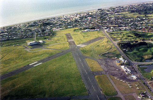
- Images
and information placed above are from We thank them for the data!
Runway 11R/29L 1345 x 295 feet
|
|||||||||||||||||||||||||||||||||||||||||||||||||||||||||||||||||||||||||||||||||||||||||||||||||||||||||||||||||||||||||||||||||||||||||||||||||||||||||||||||||||||||||||||||||||||||||||||||||||||||||||||||||||||||||||||||||||||||||||||||||||||||||||||||||||||||||||||||||||||||||||||||||||||||||||
| Runway 11R | |
|---|---|
| Surface | GRASS OR EARTH NOT GRADED OR ROLLED. |
| True Heading | 134.0 |
| Latitude | 0.000000 - |
| Longitude | 0.000000 - |
| Landing Distance | 1345 feet 410 meters |
| Takeoff Distance | 1345 feet 410 meters |
| Runway 29L | |
|---|---|
| Surface | GRASS OR EARTH NOT GRADED OR ROLLED. |
| True Heading | 314.0 |
| Latitude | 0.000000 - |
| Longitude | 0.000000 - |
| Landing Distance | 1345 feet 410 meters |
| Takeoff Distance | 1345 feet 410 meters |
| Runway 11L | |
|---|---|
| Surface | ASPHALT |
| True Heading | 134.0 |
| Latitude | -40.898556 40° 53' 54.80" S |
| Longitude | 174.985439 174° 59' 07.58" E |
| Elevation | 15.0 feet 5 meters |
| Slope | 0.1° |
| Landing Distance | 3566 feet 1087 meters |
| Takeoff Distance | 4065 feet 1239 meters |
| Displaced Threshold Length | 499 feet 152 meters |
| Runway 29R | |
|---|---|
| Surface | ASPHALT |
| True Heading | 314.0 |
| Latitude | -40.906056 40° 54' 21.80" S |
| Longitude | 174.996281 174° 59' 46.61" E |
| Elevation | 21.0 feet 6 meters |
| Slope | -0.1° |
| Landing Distance | 3770 feet 1149 meters |
| Takeoff Distance | 4065 feet 1239 meters |
| Displaced Threshold Length | 295 feet 90 meters |
| Runway 16R | |
|---|---|
| Surface | ASPHALT |
| True Heading | 181.0 |
| Latitude | -40.897383 40° 53' 50.58" S |
| Longitude | 174.988392 174° 59' 18.21" E |
| Elevation | 17.0 feet 5 meters |
| Slope | 0.0° |
| Landing Distance | 4009 feet 1222 meters |
| Takeoff Distance | 4429 feet 1350 meters |
| Displaced Threshold Length | 420 feet 128 meters |
| Lighting System | PCL
LIRL VA |
| Runway 34L | |
|---|---|
| Surface | ASPHALT |
| True Heading | 001.0 |
| Latitude | -40.909881 40° 54' 35.57" S |
| Longitude | 174.988953 174° 59' 20.23" E |
| Elevation | 15.0 feet 5 meters |
| Slope | 0.0° |
| Landing Distance | 3743 feet 1141 meters |
| Takeoff Distance | 4429 feet 1350 meters |
| Displaced Threshold Length | 686 feet 209 meters |
| Lighting System | PCL
LIRL V |
| Runway 16L | |
|---|---|
| Surface | GRASS OR EARTH NOT GRADED OR ROLLED. |
| True Heading | 181.0 |
| Latitude | 0.000000 - |
| Longitude | 0.000000 - |
| Landing Distance | 2001 feet 610 meters |
| Takeoff Distance | 2001 feet 610 meters |
| Runway 34R | |
|---|---|
| Surface | GRASS OR EARTH NOT GRADED OR ROLLED. |
| True Heading | 001.0 |
| Latitude | 0.000000 - |
| Longitude | 0.000000 - |
| Landing Distance | 2001 feet 610 meters |
| Takeoff Distance | 2001 feet 610 meters |
| PARAPARAUMU | |||||
|---|---|---|---|---|---|
| Type | ID | Channel | Freq | Country | State |
| NDB-DME | PP | 120X | 242 | New Zealand | - |
| Latitude | Longitude | Airport |
| -40.903000 40° 54' 10.80" S |
174.983347 174° 59' 00.05" E |
NZPP |
The content above was published at Airports-Worldwide.com in 2004.
We don't guarantee the information is fresh and accurate. The data may be wrong or outdated.
For more up-to-date information please refer to other sources.

 |
|
Copyright 2004-2026 © by Airports-Worldwide.com, Vyshenskoho st. 36, Lviv 79010, Ukraine Legal Disclaimer |