 |
 |
|
||||
|
Address: Private Bag 11033 Palmerston North New Zealand Phone: (06) 351 5442 Fax: (06) 351 5448 E-mail:
-
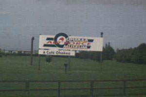
Images and information placed above are from http://www.airportsnewzealand.com/ We thank www.airportsnewzealand.com for the data.
Runway 09/27 8021 x 148 feet
|
||||||||||||||||||||||||||||||||||||||||||||||||||||||||||||||||||||||||||||||||||||||||||||||||||||||||||||||||||||||||||||||||||||||||||||||||||||||||||||||||||||||||||||||||||||||||||||||||||||||||||||||||||||||||||||||||||||||||||||||||||||||||||||||||||||||||||||||||||||||||||||||||||||||||||||||||||||||||||||||
| Runway 09 | |
|---|---|
| Surface | ASPHALT |
| True Heading | 109.0 |
| Latitude | -40.202222 40° 12' 08.00" S |
| Longitude | 175.372611 175° 22' 21.40" E |
| Elevation | 150.0 feet 46 meters |
| Slope | 0.0° |
| Landing Distance | 7535 feet 2297 meters |
| Takeoff Distance | 8021 feet 2445 meters |
| Displaced Threshold Length | 486 feet 148 meters |
| Lighting System | HIRL
BO VA |
| Runway 27 | |
|---|---|
| Surface | ASPHALT |
| True Heading | 289.0 |
| Latitude | -40.209417 40° 12' 33.90" S |
| Longitude | 175.399750 175° 23' 59.10" E |
| Elevation | 147.0 feet 45 meters |
| Slope | 0.0° |
| Landing Distance | 8021 feet 2445 meters |
| Takeoff Distance | 8021 feet 2445 meters |
| Lighting System | SF
HIRL BO VA |
| Runway 09L | |
|---|---|
| Surface | GRASS OR EARTH NOT GRADED OR ROLLED. |
| True Heading | 109.0 |
| Latitude | 0.000000 - |
| Longitude | 0.000000 - |
| Landing Distance | 1887 feet 575 meters |
| Takeoff Distance | 1887 feet 575 meters |
| Runway 27R | |
|---|---|
| Surface | GRASS OR EARTH NOT GRADED OR ROLLED. |
| True Heading | 289.0 |
| Latitude | 0.000000 - |
| Longitude | 0.000000 - |
| Landing Distance | 1887 feet 575 meters |
| Takeoff Distance | 1887 feet 575 meters |
| Runway 15 | |
|---|---|
| Surface | ASPHALT |
| True Heading | 168.0 |
| Latitude | -40.198333 40° 11' 54.00" S |
| Longitude | 175.385083 175° 23' 06.30" E |
| Elevation | 164.0 feet 50 meters |
| Slope | -0.5° |
| Landing Distance | 4899 feet 1493 meters |
| Takeoff Distance | 6998 feet 2133 meters |
| Displaced Threshold Length | 2099 feet 640 meters |
| Lighting System | HIRL
M |
| Runway 33 | |
|---|---|
| Surface | ASPHALT |
| True Heading | 348.0 |
| Latitude | -40.216750 40° 13' 00.30" S |
| Longitude | 175.390083 175° 23' 24.30" E |
| Elevation | 132.0 feet 40 meters |
| Slope | 0.5° |
| Landing Distance | 4899 feet 1493 meters |
| Takeoff Distance | 6998 feet 2133 meters |
| Displaced Threshold Length | 2099 feet 640 meters |
| Lighting System | HIRL
M |
| OHAKEA | |||||
|---|---|---|---|---|---|
| Type | ID | Channel | Freq | Country | State |
| NDB | OH | - | 218 | New Zealand | - |
| Latitude | Longitude | Airport |
| -40.201614 40° 12' 05.81" S |
175.393025 175° 23' 34.89" E |
NZOH |
| OHAKEA | |||||
|---|---|---|---|---|---|
| Type | ID | Channel | Freq | Country | State |
| VORTAC | OH | 027X | 109 | New Zealand | - |
| Latitude | Longitude | Airport |
| -40.209606 40° 12' 34.58" S |
175.391958 175° 23' 31.05" E |
NZOH |
The content above was published at Airports-Worldwide.com in 2004.
We don't guarantee the information is fresh and accurate. The data may be wrong or outdated.
For more up-to-date information please refer to other sources.

 |
|
Copyright 2004-2026 © by Airports-Worldwide.com, Vyshenskoho st. 36, Lviv 79010, Ukraine Legal Disclaimer |
 Operator:
Royal New Zealand Air force, RNZAF Base Ohakea
Operator:
Royal New Zealand Air force, RNZAF Base Ohakea