 |
 |
|
||||
|
Address: PO Box 193 Kaitaia New Zealand Phone: (09) 408 1880 Fax: (09) 408 1880 E-mail:
-
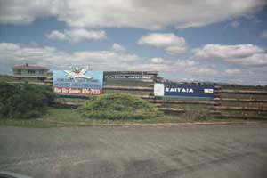
Images and information placed above are from http://www.airportsnewzealand.com/ We thank www.airportsnewzealand.com for the data.
Runway 12/30 4600 x 98 feet
|
|||||||||||||||||||||||||||||||||||||||||||||||||||||||||||||||||||||||||||||||||||||||||||||||||||||||||||||||||||||||||||||||||||||||||||||||||||||||||||||||||||||||||||||||||||||||||||||||||||||||||||||||||||||||||||||||||||||
| Runway 12 | |
|---|---|
| Surface | ASPHALT |
| True Heading | 143.0 |
| Latitude | -35.064250 35° 03' 51.30" S |
| Longitude | 173.281219 173° 16' 52.39" E |
| Elevation | 223.0 feet 68 meters |
| Slope | 1.0° |
| Landing Distance | 4600 feet 1402 meters |
| Takeoff Distance | 4600 feet 1402 meters |
| Lighting System | PCL
LIRL PAPI |
| Runway 30 | |
|---|---|
| Surface | ASPHALT |
| True Heading | 323.0 |
| Latitude | -35.074528 35° 04' 28.30" S |
| Longitude | 173.290700 173° 17' 26.52" E |
| Elevation | 270.0 feet 82 meters |
| Slope | -1.0° |
| Landing Distance | 4600 feet 1402 meters |
| Takeoff Distance | 4600 feet 1402 meters |
| Lighting System | PCL
LIRL PAPI |
| Runway 18 | |
|---|---|
| Surface | GRAVEL. |
| True Heading | 201.0 |
| Latitude | -35.069442 35° 04' 09.99" S |
| Longitude | 173.287781 173° 17' 16.01" E |
| Elevation | 257.0 feet 78 meters |
| Slope | 0.1° |
| Landing Distance | 3931 feet 1198 meters |
| Takeoff Distance | 4320 feet 1317 meters |
| Displaced Threshold Length | 259 feet 79 meters |
| Overrun Length | 130 feet 40 meters |
| Overrun Surface | PIECED STEEL PLANKING. |
| Runway 36 | |
|---|---|
| Surface | GRAVEL. |
| True Heading | 021.0 |
| Latitude | -35.080556 35° 04' 50.00" S |
| Longitude | 173.283889 173° 17' 02.00" E |
| Elevation | 261.0 feet 80 meters |
| Slope | -0.1° |
| Landing Distance | 4190 feet 1277 meters |
| Takeoff Distance | 4590 feet 1399 meters |
| Overrun Length | 400 feet 122 meters |
| Overrun Surface | PIECED STEEL PLANKING. |
| KAITAIA | |||||
|---|---|---|---|---|---|
| Type | ID | Channel | Freq | Country | State |
| NDB-DME | KT | 105X | 238 | New Zealand | - |
| Latitude | Longitude | Airport |
| -35.028589 35° 01' 42.92" S |
173.242358 173° 14' 32.49" E |
NZKT |
The content above was published at Airports-Worldwide.com in 2004.
We don't guarantee the information is fresh and accurate. The data may be wrong or outdated.
For more up-to-date information please refer to other sources.

 |
|
Copyright 2004-2026 © by Airports-Worldwide.com, Vyshenskoho st. 36, Lviv 79010, Ukraine Legal Disclaimer |
 Operator:
Kaitaia Aero Club Inc
Operator:
Kaitaia Aero Club Inc