|
 |
|
||||
|
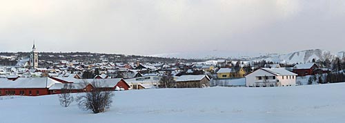
Røros Airport (IATA: RRS, ICAO: ENRO) is a regional airport serving the town of Røros in Sor-Trondelag, Norway. The airport is located 2 km west of the town centre and opened in 1957. The airport is the main base for the general aviation and flight training company Rørosfly. HistoryVarious airlines have served Røros, the first scheduled flight was operated by Braathens SAFE on 18 July 1957 with a de Havilland Heron aircraft. Braathens SAFE operated the airport as part of its Oslo-Trondheim route, with two daily stops. The airline used in the 1980s and 90s Boeing 737 aircraft. But the route was not proftitable for Braathens SAFE and has become a subsidized public service obligation route operated between 2001 and 2006 by Wideroe. On 1 April 1 2006, the scheduled service is provided by Coast Air operating ATR-42-300 airplanes seating 48 six days a week to Oslo Airport, Gardermoen. The airline has initially suffered from poor passenger numbers while residents have called for an extra departure and a different schedule. In 2000 the airport served 27,099 passengers [3], but the pullout of Braathens in 2001 caused the passenger traffic to drop by 75%. [4] Wideroe did succeed in recovering some of the lost traffic throughout 2004.
Coast Air which provided the sole scheduled passenger route between Røros and Oslo Airport, Gardermoen under a public service obligation filed for bankruptcy and ceased operations on January 23, 2008. This left Røros Airport with no scheduled passenger service, an event which upset the travel industry and major employers in the Røros region. The department for transportation worked to find a replacement to reopen service to Røros, contacting six different airlines. Three airlines, Wideroe, Air Norway and Danish Air Transport expressed interest to resume operations on the Oslo-Røros route. Wideroe was awarded a temporary contract and started operations February 4 2008. From 28 January to 28 March 2010, Skyways Express started two weekly round trips to Stockholm-Arlanda Airport, using Fokker 50 aircraft. Airlines and destinationsDanu Oro Transportas - Oslo-Gardermoen Skyways Express - Stockholm-Arlanda [seasonal, starts 28 January 2010] SummaryAirport type - Civil Operator - Avinor Location - Røros Elevation AMSL 2054 ft / 626 m Coordinates 62°34'42.28''N 11°20'32.45''E RunwaysDirection - 14/32 Length - 5643 ft, 1720 m Surface - Asphalt Contact usAirport service hours Monday - Friday: 10:30 - 18:30 Inquiries about Avinor Røros Airport Phone : (+47) 72 40 91 30 Visiting address Avinor, Røros Airport, 7361 Røros, Norway Mailing address Avinor, Røros Airport, Postboks 150, 2061 Gardermoen, Norway URL: http://www.avinor.no/en/airport/roros Images and information placed above are from Text from Wikipedia is available under the Creative Commons Attribution/Share-Alike License; additional terms may apply.
The content above was published at Airports-Worldwide.com in 2009. |
|||||||||||||||||||||||||||||||||||||||||||||||||||||||||||||||||||||||||||||||||||||||||||||||||

 |
|
Copyright 2004-2026 © by Airports-Worldwide.com, Vyshenskoho st. 36, Lviv 79010, Ukraine Legal Disclaimer |