|
|
Kempen Airport (Budel Airport) |
Kempen Airport or Budel Airport (Dutch: Vliegveld Kempen), also just called Budel after the nearby town, is a general aviation airport in the south-east of the Netherlands located 5 NM (9.3 km; 5.8 mi) west of Weert and near the border with Belgium. Its main runway, 03/21, is a 1,199 m (3,934 ft) long asphalt runway. There is a second runway for microlight aircraft only, located next to the main runway, and is 600 m (1,969 ft) long.
The airport opened in 1970, initially only with a grass runway. An asphalt runway was created in 1991 of 930 m (3,051 ft), which was expanded later to its current length. Approach and runway lighting followed, making the airport suitable for IFRflights. With around 80,000 movements (a movement being a takeoff or landing) a year, it is amongst the largest general aviation airports in the Netherlands. International flights are allowed to and from the airport and it is used extensively by business aircraft, accounting for 80% of all aircraft movements.
Kempen Airport
Budel Aerodrome
Vliegveld Kempen |
|
|
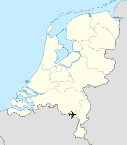
| Map |
|
|
| Summary |
| Airport type |
Public |
| Operator |
Budel Aerodrome b.v./ Kempen Airport |
| Location |
Budel |
| Elevation AMSL |
114 ft / 35 m |
| Coordinates |
51°15′16″N
005°36′03″E |
| Runways |
| Direction |
Length |
Surface |
| m |
ft |
| 03/21 |
1,199 |
3,934 |
Concrete/Asphalt |
| 03/21 |
600 |
1,969 |
Grass |
|
Accidents
- On October 26, 2009, a Pilatus PC-12 on its way to Frankfurt Egelsbach Airport crashed in a field shortly after take-off from Kempen Airport; the two people on board died. An investigation was performed by the Dutch Safety Boardhowever the cause of the accident was never conclusively determined.
The above content comes from Wikipedia and is published under free licenses – click here to read more.
* * *
| General Info
|
| Country |
Netherlands
|
| ICAO ID |
EHBD
|
| Time |
UTC+1(+2DT)
|
| Latitude |
51.255280
51° 15' 19.01" N
|
| Longitude |
5.601389
005° 36' 05.00" E
|
| Elevation |
114 feet
35 meters
|
| Magnetic Variation |
000° W (01/06)
|
| Operating Agency |
PRIVATE
|
| Daylight Saving Time |
Last Sunday in March to last Sunday in October
|
| Communications
|
RDO
SR/SS |
122.15
|
INFO
PPR aft opr hr |
122.15
|
| Runways
|
| ID |
Dimensions |
Surface |
PCN |
ILS
|
| 03/21 |
3934 x 75 feet
1199 x 23 meters |
ASPHALT |
- |
NO
|
| Navaids
|
| Type |
ID |
Name |
Channel |
Freq |
Distance From Field |
Bearing From Navaid
|
| TACAN |
EHV |
EINDHOVEN |
119X |
- |
14.4 NM |
145.6
|
| VOR-DME |
MAS |
MAASTRICHT |
023X |
108.6 |
21.8 NM |
322.6
|
| NDB |
THN |
THORN |
- |
434 |
9.8 NM |
297.1
|
| Supplies/Equipment
|
| Fuel |
100/130 MIL Spec, low lead, aviation gasoline (BLUE)
|
| Remarks
|
| CSTMS/IMG |
CSTMS avbl SR-SS, 1 hr PN.
|
| FUEL |
(NC100LL, A1)
|
| OPR HOURS |
VFR flt: Dur uniform daylight period btn 0800-1900Z++, all flt PPR 1 hr, AD authfone +31(0)495 69 79 49. Outside nml opr hr extra charge. IFR flt: Only outsideuniform daylight period btn 0600-2200Z++. Flt after uniform daylight period apply perms before 1300Z++ same day. Flt before uniform daylight period apply permsbefore 1500Z++ prev day. AD auth accept bus and medical flt only. All flt PPR and extra charge.
|
The content above was published at Airports-Worldwide.com in 2018.
We don't guarantee the information is fresh and accurate. The data may be wrong or outdated.
For more up-to-date information please refer to other sources.
|
|