 |
|
| Biratnagar Airport |
IATA: BIR – ICAO: VNVT
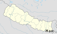
Location of airport in Nepal
|
| Summary |
| Airport type |
Public |
| Operator |
Government |
| Serves |
Biratnagar, Nepal |
| Elevation AMSL |
236 ft / 72 m |
| Coordinates |
26°28′53″N 087°15′50″E / 26.48139°N 87.26389°E / 26.48139; 87.26389 |
| Runways |
| Direction |
Length |
Surface |
| m |
ft |
| 09/27 |
1,505 |
4,938 |
Asphalt |
| Source: DAFIF |
Biratnagar Airport (IATA: BIR, ICAO: VNVT) is an airport serving Biratnagar, a city of the Morang district in the Kosi zone in Nepal. Facilities
Nepal government owned and operated, Biratnagar Airport began its service on 6 July 1958,[3] the same year the nation's first Royal Nepal Airlines began its scheduled domestic and international flights. The airport is the hub of the Eastern Region of the nation and supports 6 STOL airports: Taplejung, Bhojpur, Phaplu, Rumjatar, Lamidanda and Tumlingtar.
The airport boasts the highest domestic traffic. Civil Aviation is planning to enable Biratnagar Airport to operate bigger airliners like Boeing 747. Equipped with air traffic control, the airport is located at an elevation of 236 feet (72 m) above mean sea level. It has one runway designated 09/27 with an asphalt surface measuring 1,524 by 30 metres (5,000 ft × 98 ft).
Airlines and destinations
- Agni Air (Kathmandu)
- Buddha Air (Kathmandu)
- Gorkha Airlines (Tumlingtar)
- Nepal Airlines (Bhojpur, Lamidanda, Taplejung, Thamkharka, Tumlingtar)
- Sita Air (Kathmandu)
- Yeti Airlines (Kathmandu)
The above content comes from Wikipedia and is published under free licenses – click here to read more.
| General Info
|
| Country |
Nepal
|
| ICAO ID |
VNVT
|
| Time |
UTC+5:45
|
| Latitude |
26.481453
26° 28' 53.23" N
|
| Longitude |
87.264036
087° 15' 50.53" E
|
| Elevation |
236 feet
72 meters
|
| Magnetic Variation |
000° W (01/06)
|
| Operating Agency |
CIVIL GOVERNMENT, (LANDING FEES AND DIPLOMATIC CLEARANCE MAY BE REQUIRED)
|
| Operating Hours |
SEE REMARKS FOR OPERATING HOURS OR COMMUNICATIONS FOR POSSIBLE HOURS
|
| Communications
|
TWR
Opr SR-SS.
|
123.8
122.7
|
| Runways
|
| ID |
Dimensions |
Surface |
PCN |
ILS
|
| 09/27 |
4937 x 100 feet
1505 x 30 meters |
ASPHALT |
- |
NO
|
| Navaids
|
| Type |
ID |
Name |
Channel |
Freq |
Distance From Field |
Bearing From Navaid
|
| VOR-DME |
BRT |
BIRATNAGAR |
088X |
114.1 |
At Field |
-
|
| NDB |
VTN |
BIRATNAGAR |
- |
358 |
At Field |
-
|
| Supplies/Equipment
|
| Fuel |
Jet A1, without icing nhibitor.
|
| Remarks
|
| CAUTION |
Short final area Rwy 09, not vis fr con twr due WIP.
|
| FUEL |
(NC-A1)
|
| OPR HOURS |
Opr 0100-1215Z Jan-Feb,Nov-Dec; 0030-1245Z Mar-Apr,Sep-Oct; 0015-1300Z May-Aug.
|
The content above was published at Airports-Worldwide.com in 2010.
We don't guarantee the information is fresh and accurate. The data may be wrong or outdated.
For more up-to-date information please refer to other sources.
|
|


