 |
|
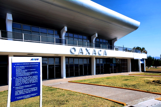
| Xoxocotlán International Airport |
 |
| IATA: OAX – ICAO: MMOX |
| Summary |
| Airport type |
Public |
| Operator |
Aeropuertos del Sureste (ASUR) |
| Location |
Oaxaca, Oaxaca |
| Elevation AMSL |
4989 ft / 1,521 m |
| Coordinates |
17°0′0″N 96°43′36″W / 17°N 96.72667°W / 17; -96.72667Coordinates: 17°0′0″N 96°43′36″W / 17°N 96.72667°W / 17; -96.72667 |
| Runways |
| Direction |
Length |
Surface |
| ft |
m |
| 01/19 |
8,038 |
2,450 |
Asphalt |
| Statistics (2009) |
| Total Passengers |
523,104 |
| Source: Grupo Aeroportuario del Sureste |
Xoxocotlán International airport (IATA: OAX, ICAO: MMOX) Is an international airport located at Oaxaca, Oaxaca, Mexico. It handles national and international air traffic of the city of Oaxaca. It only has one terminal. Airlines and destinations
Air Taxi Services
| Airlines |
Destinations |
| Aerotucán |
Huatulco, Puerto Escondido |
| Aerovega |
Huatulco, Puerto Escondido |
Domestic & International
| Airlines |
Destinations |
| Aeroméxico Connect |
Mexico City |
| Aeroméxico Travel |
Mexico City |
| Continental Express operated by ExpressJet Airlines |
Houston-Intercontinental |
| VivaAerobus |
Mexico City, Monterrey |
| Volaris |
Tijuana |
The above content comes from Wikipedia and is published under free licenses – click here to read more.
| General Info
|
| Country |
Mexico
|
| ICAO ID |
MMOX
|
| Time |
UTC-6(-5DT)
|
| Latitude |
16.999906
16° 59' 59.66" N
|
| Longitude |
-96.726639
096° 43' 35.90" W
|
| Elevation |
4989 feet
1521 meters
|
| Type |
Civil
|
| Magnetic Variation |
005° E (01/06)
|
| Beacon |
Yes
|
| Operating Agency |
CIVIL GOVERNMENT, (LANDING FEES AND DIPLOMATIC CLEARANCE MAY BE REQUIRED)
|
| Alternate Name |
OAXACA INTL
|
| Near City |
Oaxaca
|
| Operating Hours |
SEE REMARKS FOR OPERATING HOURS OR COMMUNICATIONS FOR POSSIBLE HOURS
|
| International Clearance Status |
Airport of Entry
|
| Daylight Saving Time |
First Sunday in April to the last Saturday in October
|
| Communications
|
| OAXACA TWR |
118.3
|
| OAXACA APP |
121.1
|
| Runways
|
| ID |
Dimensions |
Surface |
PCN |
ILS
|
| 01/19 |
8038 x 148 feet
2450 x 45 meters |
ASPHALT |
- |
NO
|
| Navaids
|
| Type |
ID |
Name |
Channel |
Freq |
Distance From Field |
Bearing From Navaid
|
| VOR-DME |
OAX |
OAXACA |
057X |
112 |
1.7 NM |
002.3
|
| Supplies/Equipment
|
| Fuel |
Jet A1, without icing nhibitor.
100/130 octane gasoline, leaded, MIL-L-5572F (GREEN)
|
| Remarks
|
| CAUTION |
Alban mountain elev 6430' 4.4 NM rad 328 OAX VOR. Acft must use pushback to leave commercial aviation apron.
|
| FUEL |
(NC-100LL, A1)
|
| OPR HOURS |
Opr 1200-0200Z++.
|
The content above was published at Airports-Worldwide.com in 2010.
We don't guarantee the information is fresh and accurate. The data may be wrong or outdated.
For more up-to-date information please refer to other sources.
|
|


