 |
|
"RAF Kuantan", "RMAF Kuantan" & "Kuantan Airfield" redirect here.
Sultan Ahmad Shah Airport / RMAF Kuantan
Lapangan Terbang Sultan Ahmad Shah / TUDM Kuantan |
 |
| IATA: KUA – ICAO: WMKD |
| Summary |
| Airport type |
Military / Public |
| Operator |
Military of Malaysia /
Malaysia Airports Holdings Berhad |
| Location |
Kuantan, Pahang, Malaysia |
| Elevation AMSL |
58 ft / 18 m |
| Coordinates |
03°46′30.63″N 103°12′30.86″E / 3.775175°N 103.2085722°E / 3.775175; 103.2085722 |
| Runways |
| Direction |
Length |
Surface |
| m |
ft |
| 18/36 |
2,804 |
9,200 |
Asphalt |
| Statistics (2008) |
| Passenger movements |
259,529 |
| Airfreight movements in tonnes |
70 |
| Aircraft movements |
3,551 |
| Source: official web site and DAFIF |
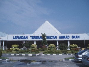
Sultan Ahmad Shah Airport (IATA: KUA, ICAO: WMKD) is an airport that serves Kuantan, a city in the state of Pahang in Malaysia. The airport is located 15 km from the city. In 2008, the airport handled 259,529 passengers on 3,551 flights, though the airport is able to handle over one million passengers annually. In 2008, Taiwan and Tourism Malaysia had co-operated that there were 23 charter flights directly from Taipei to Kuantan Airport, this condition had made Kuantan Sultan Ahmad Shah Airport the first airport in East Coast of Peninsular Malaysia that received international flights.
Passengers have to walk from the plane to the arrival hall. Airlines and destinations
| Airlines |
Destinations |
| Firefly |
Penang [Seasonal]Starting 1 Feb 2011, Singapore |
| Malaysia Airlines |
Kuala Lumpur |
Traffic and Statistics
Overall Operational Statistics
| Years |
Passenger Movements |
Aircraft Movements |
Cargo Movements in Metric Tonnes |
Cargo Movements in Kilograms |
| 2003 |
351,179 |
3,743 |
64 |
141 |
| 2004 |
349,375 |
3,748 |
64 |
141 |
| 2005 |
298,184 |
3,500 |
75 |
165 |
| 2006 |
273,005 |
2,748 |
109 |
240 |
| 2007 |
262,486 |
3,487 |
103 |
102,586 |
| 2008 |
259,529 |
3,551 |
70 |
70,079 |
Passenger facilities
The airport has an outdoor car park, a taxi stand, several small shops, an arrival hall and a departure hall. The front part of the building housing the shops and the check in counters is not air conditioned.
The above content comes from Wikipedia and is published under free licenses – click here to read more.
| General Info
|
| Country |
Malaysia
|
| ICAO ID |
WMKD
|
| Time |
UTC+8
|
| Latitude |
3.775389
03° 46' 31.40" N
|
| Longitude |
103.209056
103° 12' 32.60" E
|
| Elevation |
58 feet
18 meters
|
| Type |
Military
|
| Magnetic Variation |
000° E (01/06)
|
| Operating Agency |
MILITARY
|
| Operating Hours |
SEE REMARKS FOR OPERATING HOURS OR COMMUNICATIONS FOR POSSIBLE HOURS
|
| Communications
|
| TWR |
118.1
238.1
|
| GND |
289.6
120.4
|
| ATIS |
127.5
293.0
|
| APP |
118.1
249.3
|
| Runways
|
| ID |
Dimensions |
Surface |
PCN |
ILS
|
| 18/36 |
9200 x 150 feet
2804 x 46 meters |
ASPHALT |
- |
YES
|
| Navaids
|
| Type |
ID |
Name |
Channel |
Freq |
Distance From Field |
Bearing From Navaid
|
| VORTAC |
VKN |
KUANTAN |
084X |
113.7 |
At Field |
-
|
| Remarks
|
| CAUTION |
BASH, MET balloon released to 130,000' btn 0001-0230Z.
|
| FUEL |
(NC-100LL, A1+)
|
| OPR HOURS |
Opr 0001-0900Z Mon-Thur, 0001-0500Z and 0600-0900Z Fri, 0001-0600Z Sat, PPR Sun.
|
| RSTD |
PPR for all non-RMAF acft.
|
The content above was published at Airports-Worldwide.com in 2010.
We don't guarantee the information is fresh and accurate. The data may be wrong or outdated.
For more up-to-date information please refer to other sources.
|
|


