|
|
Karonga Airport (IATA: KGJ, ICAO: FWKA) is an airport serving Karonga, atown in the Northern Region of the Republic of Malawi and the best Airport in the Northern part of Malawi.
|
Karonga Airport
|
|
|
| Summary |
| Airport type |
Public |
| Owner |
Malawi Government |
| Operator |
Malawi Civil Aviation |
| Serves |
Karonga, Malawi |
| Location |
Bwiba |
| Elevation AMSL |
1,765 ft / 538 m |
| Coordinates |
09°57′12″S
033°53′34″E |
| Map |
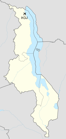
Location of airport in Malawi
|
| Runways |
| Direction |
Length |
Surface |
| m |
ft |
| 14/32 |
1,280 |
4,200 |
Asphalt |
|
Facilities
The airport resides at an elevation of 1,765 feet (538 m) above mean sea level. It has one runway designated 14/32 with an asphalt surface measuring 1,280 by 18 metres (4,199 ft × 59 ft).
The above content comes from Wikipedia and is published under free licenses – click here to read more.
| General Info
|
| Country |
Malawi
|
| ICAO ID |
FWKA
|
| Time |
UTC+2
|
| Latitude |
-9.953569
09° 57' 12.85" S
|
| Longitude |
33.893022
033° 53' 34.88" E
|
| Elevation |
1765 feet
538 meters
|
| Type |
Civil
|
| Magnetic Variation |
003° W (01/06)
|
| Operating Agency |
CIVIL GOVERNMENT, (LANDING FEES AND DIPLOMATIC CLEARANCE MAY BE REQUIRED)
|
| Operating Hours |
SEE REMARKS FOR OPERATING HOURS OR COMMUNICATIONS FOR POSSIBLE HOURS
|
| Communications
|
| A/G VOICE RDO |
118.1
|
| Runways
|
| ID |
Dimensions |
Surface |
PCN |
ILS
|
| 14/32 |
4200 x 59 feet
1280 x 18 meters |
ASPHALT |
010FCYT |
NO
|
| Navaids
|
| Type |
ID |
Name |
Channel |
Freq |
Distance From Field |
Bearing From Navaid
|
| VOR-DME |
VKA |
KARONGA |
100X |
115.3 |
At Field |
-
|
| NDB |
KA |
KARONGA |
- |
245 |
At Field |
-
|
| Remarks
|
| OPR HOURS |
Opr 0600-1500Z Mon-Fri,
|
The content above was published at Airports-Worldwide.com in 2020.
We don't guarantee the information is fresh and accurate. The data may be wrong or outdated.
For more up-to-date information please refer to other sources.
|
|