 |
|
Moshoeshoe I Intl Airport |
| Moshoeshoe I International Airport |
IATA: MSU – ICAO: FXMM
+
Moshoeshoe I International
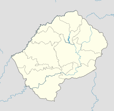
Locations of airport and Maseru in Lesotho
|
| Summary |
| Airport type |
Public |
| Operator |
Department of Civil Aviation |
| Serves |
Maseru, Lesotho |
| Location |
Mazenod |
| Elevation AMSL |
5,348 ft / 1,630 m |
| Coordinates |
29°27′44″S 027°33′09″E / 29.46222°S 27.5525°E / -29.46222; 27.5525 |
| Runways |
| Direction |
Length |
Surface |
| m |
ft |
| 04/22 |
3,200 |
10,498 |
Asphalt |
| 11/29 |
1,010 |
3,314 |
Asphalt |
| Source: DAFIF |
Moshoeshoe I International Airport (IATA: MSU, ICAO: FXMM) is an airport serving Maseru, the capital city of Lesotho. The airport is located in the town of Mazenod, about 18 km (11 mi) southeast of downtown Maseru. Facilities
The airport resides at an elevation of 5,348 feet (1,630 m) above mean sea level. It has two asphalt paved runways: 04/22 measuring 3,200 by 45 metres (10,499 × 148 ft) and 11/29 measuring 1,010 × 23 m (3,314 × 75 ft).
Airlines and destinations
| Airlines |
Destinations |
| South African Airways operated by Airlink |
Johannesburg |
| Mission Aviation Fellowship |
within Lesotho |
The above content comes from Wikipedia and is published under free licenses – click here to read more.
| General Info
|
| Country |
Lesotho
|
| ICAO ID |
FXMM
|
| Time |
UTC+2
|
| Latitude |
-29.462256
29° 27' 44.12" S
|
| Longitude |
27.552503
027° 33' 09.01" E
|
| Elevation |
5348 feet
1630 meters
|
| Type |
Civil
|
| Magnetic Variation |
022° W (01/06)
|
| Beacon |
Yes
|
| Operating Agency |
CIVIL GOVERNMENT, (LANDING FEES AND DIPLOMATIC CLEARANCE MAY BE REQUIRED)
|
| Near City |
Maseru
|
| Operating Hours |
SEE REMARKS FOR OPERATING HOURS OR COMMUNICATIONS FOR POSSIBLE HOURS
|
| International Clearance Status |
Airport of Entry
|
| Communications
|
| MASERU TWR |
118.5
4058
5680
|
| MASERU GND |
121.7
|
| MASERU APP |
120.7
|
| Runways
|
| ID |
Dimensions |
Surface |
PCN |
ILS
|
| 04/22 |
10498 x 148 feet
3200 x 45 meters |
ASPHALT |
052FBWT |
YES
|
| 11/29 |
3314 x 75 feet
1010 x 23 meters |
ASPHALT |
012FBYT |
NO
|
| Navaids
|
| Type |
ID |
Name |
Channel |
Freq |
Distance From Field |
Bearing From Navaid
|
| VOR-DME |
MZV |
MAZENOD |
119X |
117.2 |
2.4 NM |
036.6
|
| NDB |
ME |
BEREA |
- |
255 |
2.6 NM |
216.6
|
| Supplies/Equipment
|
| Fuel |
Jet A1, without icing nhibitor.
100/130 MIL Spec, low lead, aviation gasoline (BLUE)
|
| Other Fluids |
OX, Indicates oxygen servicing when type of servicing is unknown
|
| Remarks
|
| FUEL |
Avbl 0500-1600Z. (NC-100LL, A1)
|
| OPR HOURS |
Opr 0500-1600Z.
|
The content above was published at Airports-Worldwide.com in 2010.
We don't guarantee the information is fresh and accurate. The data may be wrong or outdated.
For more up-to-date information please refer to other sources.
|
|


