|
|
Wattay International Airport
ສະໜາມບິນສາກົນວັດໄຕ |
 |
| IATA: VTE – ICAO: VLVT |
| Summary |
| Airport type |
Military/Public/Civil Aviation Authority |
| Operator |
Military of Laos |
| Location |
Vientiane, Laos |
| Elevation AMSL |
564 ft / 172 m |
| Coordinates |
17°59′18″N 102°33′48″E / 17.98833°N 102.56333°E / 17.98833; 102.56333Coordinates: 17°59′18″N 102°33′48″E / 17.98833°N 102.56333°E / 17.98833; 102.56333 |
| Runways |
| Direction |
Length |
Surface |
| ft |
m |
| 13/31 |
9,843 |
3,000 |
Asphalt |
Wattay International Airport (IATA: VTE, ICAO: VLVT) is one of the few international airports in Laos. It is located 3 km (2 mi) outside its capital, Vientiane.
The airport consists of an old and small domestic terminal and a new international terminal. There is a military (air force) installation at one end of the airport.
The head office of Lao Air is on the airport property.
 | |
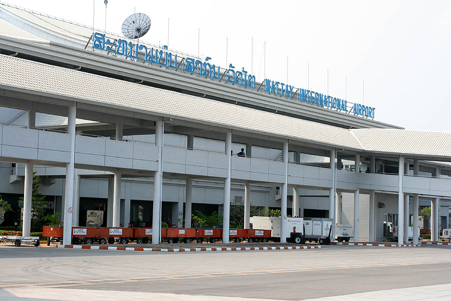
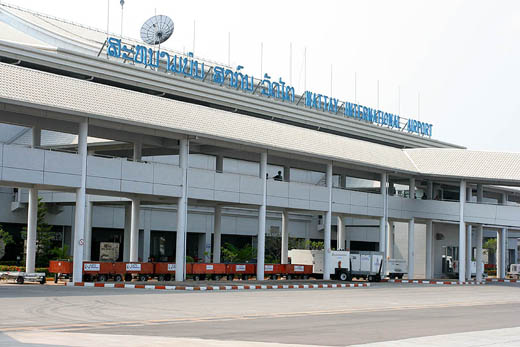
Vientiane Airport Terminal Building |
 | |
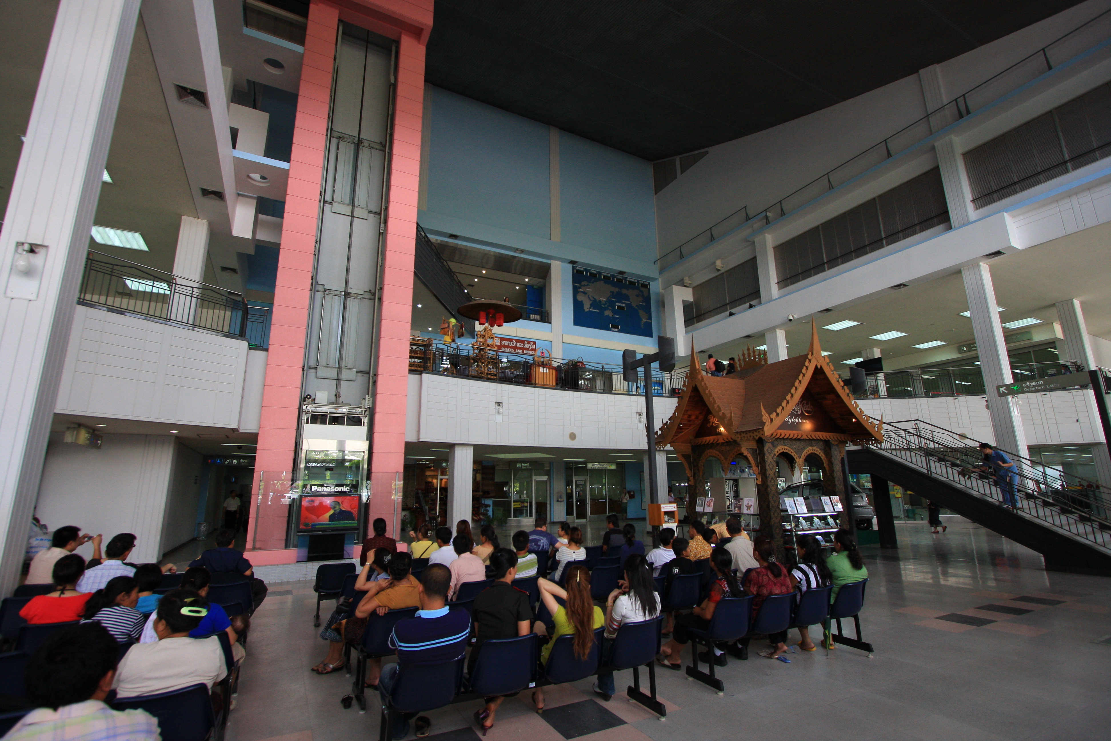
Vientiane Airport Terminal Interior |
Airlines and destinations
| Airlines |
Destinations |
| AirAsia |
Kuala Lumpur |
| China Eastern Airlines |
Kunming, Nanning |
| Lao Air |
Samneua, Phongsaly, Xayabouly |
| Lao Airlines |
Bangkok-Suvarnabhumi, Chiang Mai, Hanoi, Ho Chi Minh City [begins 19 October], Houei Sai, Kunming, Luang Namtha, Luang Prabang, Oudomxay, Pakse, Savanakhet, Siem Reap, Xieng Khuang |
| Thai Airways International |
Bangkok-Suvarnabhumi |
| Vietnam Airlines |
Hanoi, Phnom Penh |
Facilities
- Banks
- Bars
- Restaurants
- Duty-free shop
- Post office
- Shops
- Internet cafe
Transportation
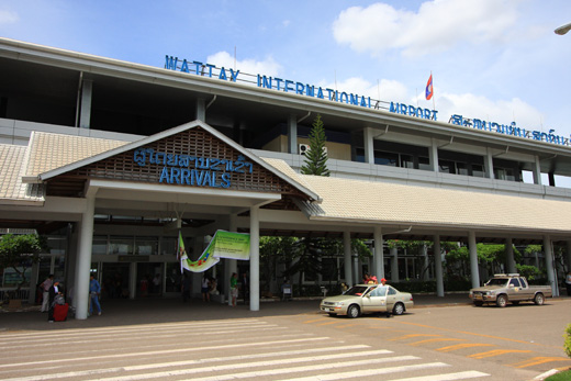
Access to airport by taxi, car and tuk-tuk. A taxi rank is located outside the main Arrivals Hall.
Accidents and incidents
- On 24 March 1976, Douglas C-47A XW-TAF and C-47Bs XW-TDF and XW-TDR or Royal Air Lao were damaged beyond economic repair in a storm.
The above content comes from Wikipedia and is published under free licenses – click here to read more.
| General Info
|
| Country |
Laos
|
| ICAO ID |
VLVT
|
| Time |
UTC+7
|
| Latitude |
17.988322
17° 59' 17.96" N
|
| Longitude |
102.563256
102° 33' 47.72" E
|
| Elevation |
564 feet
172 meters
|
| Type |
Joint (Civil and Military)
|
| Magnetic Variation |
000° W (01/06)
|
| Beacon |
Yes
|
| Operating Agency |
MILITARY - CIVIL JOINT USE AIRPORT
|
| Near City |
Vientiane
|
| Operating Hours |
SEE REMARKS FOR OPERATING HOURS OR COMMUNICATIONS FOR POSSIBLE HOURS
|
| International Clearance Status |
Airport of Entry
|
| Communications
|
| VIENTIANE TWR |
118.1
|
| VIENTIANE APP |
119.7
|
| Runways
|
| ID |
Dimensions |
Surface |
PCN |
ILS
|
| 13/31 |
9843 x 148 feet
3000 x 45 meters |
ASPHALT |
062FBWT |
YES
|
| Navaids
|
| Type |
ID |
Name |
Channel |
Freq |
Distance From Field |
Bearing From Navaid
|
| VOR-DME |
VTN |
VIENTIANE |
122X |
117.5 |
1.8 NM |
135.9
|
| NDB |
WY |
WATTAY |
- |
389 |
1.4 NM |
134.7
|
| Supplies/Equipment
|
| Fuel |
Jet A1, without icing nhibitor.
Aviation Gasoline (AVGAS), octane unknown.
|
| Remarks
|
| FUEL |
(NC-100LL, A1)
|
| OPR HOURS |
Opr 2300-1100Z, OT PN rqr prior 0900Z.
|
| RSTD |
No ngt ldg US mil acft.
|
The content above was published at Airports-Worldwide.com in 2010.
We don't guarantee the information is fresh and accurate. The data may be wrong or outdated.
For more up-to-date information please refer to other sources.
|
|