|
|
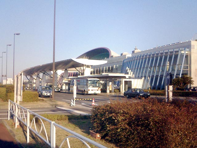
Takamatsu Airport
高松空港
Takamatsu Kūkō |
 |
| IATA: TAK – ICAO: RJOT |
| Summary |
| Airport type |
Public |
| Operator |
Ministry of Land, Infrastructure and Transport |
| Location |
Takamatsu |
| Elevation AMSL |
607 ft / 185 m |
| Coordinates |
34°12′51″N 134°00′56″E / 34.21417°N 134.01556°E / 34.21417; 134.01556 (Takamatsu Airport)Coordinates: 34°12′51″N 134°00′56″E / 34.21417°N 134.01556°E / 34.21417; 134.01556 (Takamatsu Airport) |
| Runways |
| Direction |
Length |
Surface |
| m |
ft |
| 14/32 |
2,500 |
8,202 |
Asphalt/Concrete |
| Japanese AIP at AIS Japan |
Takamatsu Airport (高松空港, Takamatsu Kūkō) (IATA: TAK, ICAO: RJOT) is a second class airport located 8 NM (15 km; 9.2 mi) south southwest of Takamatsu, Kagawa, Japan. It handles a very small number of international flights.
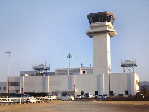 | |
Air Traffic Control Towers |
It is equipped with an Instrument Landing System, VHF Omni-directional Radio Range, Distance Measuring Equipment, Airport Surveillance Radar, approach lights, precision approach angle guidance lights, and more.
Airlines and destinations
| Airlines |
Destinations |
| All Nippon Airways |
Naha, Tokyo-Haneda |
| Asiana Airlines |
Seoul-Incheon |
| Japan Airlines |
Tokyo-Haneda |
| Japan Airlines operated by Japan Air Commuter |
Kagoshima |
The above content comes from Wikipedia and is published under free licenses – click here to read more.
| General Info
|
| Country |
Japan
|
| ICAO ID |
RJOT
|
| Time |
UTC+9
|
| Latitude |
34.214167
34° 12' 51.00" N
|
| Longitude |
134.015556
134° 00' 56.00" E
|
| Elevation |
607 feet
185 meters
|
| Type |
Civil
|
| Magnetic Variation |
007° W (01/06)
|
| Beacon |
Yes
|
| Operating Agency |
CIVIL GOVERNMENT, (LANDING FEES AND DIPLOMATIC CLEARANCE MAY BE REQUIRED)
|
| Island Group |
Shikoku I
|
| Operating Hours |
SEE REMARKS FOR OPERATING HOURS OR COMMUNICATIONS FOR POSSIBLE HOURS
|
| Communications
|
| TWR |
118.3
126.2
135.9
261.2
|
| TCA |
119.025
315.8
|
| DEP |
120.4
261.2
|
| ATIS |
127.45
|
| APP |
121.2
120.4
261.2
|
| Communications Remarks |
|
| TWR |
(135.9 for position reports only).
|
| Runways
|
| ID |
Dimensions |
Surface |
PCN |
ILS
|
| 08/26 |
8200 x 200 feet
2499 x 61 meters |
ASPHALT |
053FAXT |
YES
|
| Navaids
|
| Type |
ID |
Name |
Channel |
Freq |
Distance From Field |
Bearing From Navaid
|
| VORTAC |
TZC |
TAKAMATSU |
122X |
117.5 |
7.4 NM |
162.3
|
| VOR-DME |
KTE |
KAGAWA |
021X |
108.4 |
At Field |
-
|
| Supplies/Equipment
|
| Fuel |
Jet A1+, Jet A1 with icing inhibitor.
100/130 MIL Spec, low lead, aviation gasoline (BLUE)
|
| Remarks
|
| FUEL |
(NC-100, A1)
|
| LGT |
PAPI Rwy 08 MEHT 74'; Rwy 26 - 66'.
|
| OPR HOURS |
Opr 2230-1230Z.
|
The content above was published at Airports-Worldwide.com in 2010.
We don't guarantee the information is fresh and accurate. The data may be wrong or outdated.
For more up-to-date information please refer to other sources.
|
|