|
|
Sendai Airport
仙台空港
Sendai Kūkō |
 |
| IATA: SDJ – ICAO: RJSS |
| Summary |
| Airport type |
Public |
| Operator |
Ministry of Land, Infrastructure, Transport and Tourism |
| Location |
Sendai |
| Elevation AMSL |
6 ft / 2 m |
| Coordinates |
38°08′23″N 140°55′01″E / 38.13972°N 140.91694°E / 38.13972; 140.91694 (Sendai Airport)Coordinates: 38°08′23″N 140°55′01″E / 38.13972°N 140.91694°E / 38.13972; 140.91694 (Sendai Airport) |
| Website |
www.sdj-airport.com |
| Runways |
| Direction |
Length |
Surface |
| m |
ft |
| 09/27 |
3,000 |
9,842 |
Asphalt concrete |
| 12/30 |
1,200 |
3,937 |
Asphalt concrete |
| Source: Japanese AIP at AIS Japan |
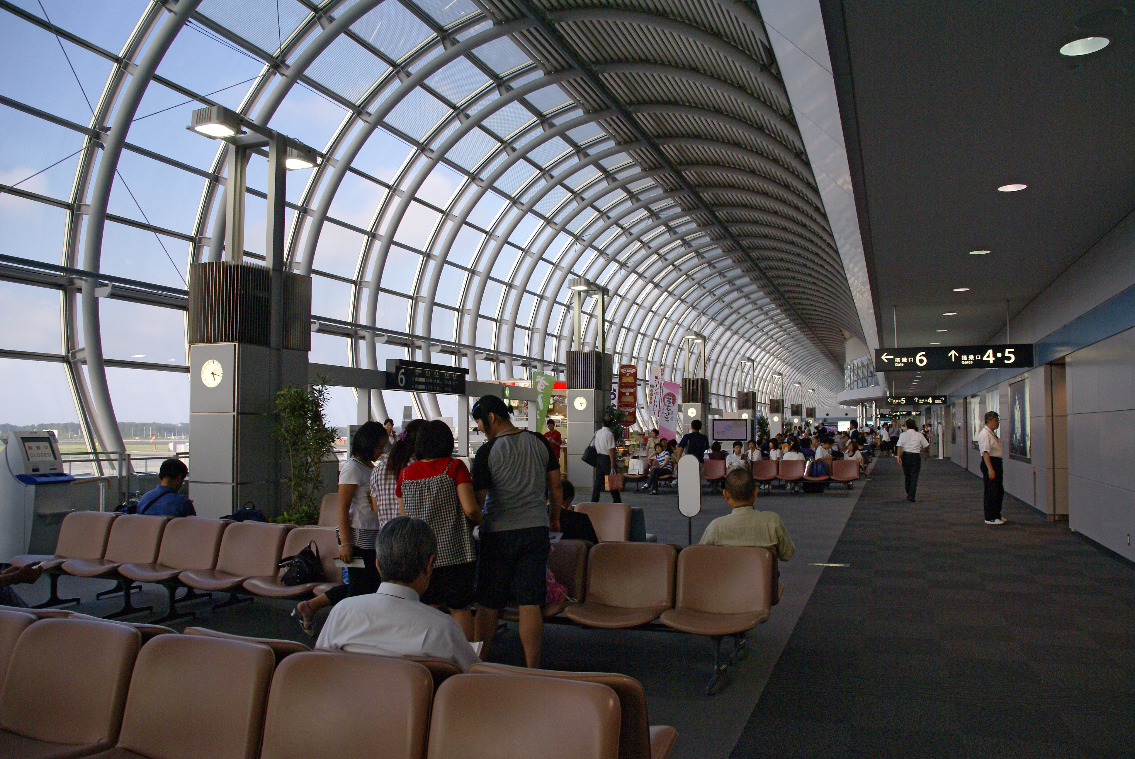
Sendai Airport (仙台空港, Sendai Kūkō) (IATA: SDJ, ICAO: RJSS) is a second class airport located in Natori, Miyagi, 13.6 km (8.5 mi) south southeast of Sendai Station, Sendai, Japan. Terminal building
The terminal building was designed by Gyo Obata, of the St. Louis architecture firm Hellmuth, Obata & Kassabaum.
Access (railway)
The Sendai Airport Line, which connects the airport to Sendai Station, opened on March 18, 2007. The journey to the city takes 17-25 minutes.
Airlines and destinations
| Airlines |
Destinations |
Terminal |
| Air China |
Beijing-Capital, Dalian, Shanghai-Pudong |
International |
| Air Do |
Sapporo-Chitose |
Domestic |
| All Nippon Airways |
Fukuoka, Komatsu, Nagoya-Centrair, Naha, Osaka-Itami, Sapporo-Chitose |
Domestic |
| All Nippon Airways operated by Air Central |
Tokyo-Narita |
Domestic |
| All Nippon Airways operated by Ibex Airlines |
Fukuoka, Hiroshima, Komatsu, Osaka-Itami, Tokyo-Narita |
Domestic |
| Asiana Airlines |
Seoul-Incheon |
International |
| China Southern Airlines |
Changchun |
International |
| Continental Airlines operated by Continental Micronesia |
Guam |
International |
| Dragonair |
Hong Kong |
International (Starts December 1, 2010) |
| EVA Air |
Taipei-Taoyuan |
International |
| Japan Airlines |
Fukuoka, Sapporo-Chitose |
Domestic |
| Japan Airlines operated by JAL Express |
Nagoya-Centrair, Osaka-Itami |
Domestic |
Charter flights
Hong Kong Airlines - Hong Kong
The above content comes from Wikipedia and is published under free licenses – click here to read more.
| General Info
|
| Country |
Japan
|
| ICAO ID |
RJSS
|
| Time |
UTC+9
|
| Latitude |
38.139722
38° 08' 23.00" N
|
| Longitude |
140.916944
140° 55' 01.00" E
|
| Elevation |
15 feet
5 meters
|
| Type |
Civil
|
| Magnetic Variation |
007° W (01/06)
|
| Beacon |
Yes
|
| Operating Agency |
CIVIL GOVERNMENT, (LANDING FEES AND DIPLOMATIC CLEARANCE MAY BE REQUIRED)
|
| Island Group |
Honshu I
|
| Operating Hours |
SEE REMARKS FOR OPERATING HOURS OR COMMUNICATIONS FOR POSSIBLE HOURS
|
| Communications
|
| TWR |
118.7
126.2
|
TCA
Opr 2300-1030Z.
|
121.025
225.2
|
| GND |
121.7
|
| DEP |
120.0
|
| ATIS |
126.45
|
| APP |
120.4
261.2
362.3
|
| Runways
|
| ID |
Dimensions |
Surface |
PCN |
ILS
|
| 09/27 |
9842 x 150 feet
3000 x 46 meters |
ASPHALT |
058FBXT |
YES
|
| 12/30 |
3940 x 150 feet
1201 x 46 meters |
ASPHALT |
012FCYT |
NO
|
| Navaids
|
| Type |
ID |
Name |
Channel |
Freq |
Distance From Field |
Bearing From Navaid
|
| VOR-DME |
SDE |
SENDAI |
110X |
116.3 |
At Field |
-
|
| Supplies/Equipment
|
| Fuel |
Jet A1+, Jet A1 with icing inhibitor.
100/130 octane gasoline, leaded, MIL-L-5572F (GREEN)
Unknown fuel type or whether there is any fuel.
|
| Remarks
|
| CSTMS/AG/IMG |
CSTMS, AG and IMG avbl with PN 2330-0800Z Mon-Fri; 2330-0330Z Sat.
|
| FUEL |
(NC-100, A1)
|
| LGT |
Apch Guidance Lgt at 3000' and 2000' fr thld Rwy 09. PAPI MEHT Rwy 09, 74'; Rwy12,45'; Rwy 27, 65'; Rwy 30, 44'. PAPI Rwy 30 GS 3. .
|
| MISC |
Rwy 09-27 ovrn 200'; Rwy 12 ovrn 300'; Rwy 30 ovrn 400'.
|
| NS ABTMT |
See FLIP PLANNING AP/3.
|
| OPR HOURS |
Opr 2230-1230Z.
|
| RSTD |
Until Jan 2007, Rwy 09-27 clsd btw 1230Z-2200Z dly, exc PPR. WIP.
|
| TRAN ALERT |
Tran maint not avbl. Hgr space avbl.
|
The content above was published at Airports-Worldwide.com in 2010.
We don't guarantee the information is fresh and accurate. The data may be wrong or outdated.
For more up-to-date information please refer to other sources.
|
|