 |
|
Sapporo Okadama Airport
札幌丘珠空港
Sapporo Okadama Kūkō |
 |
| IATA: OKD – ICAO: RJCO |
| Summary |
| Airport type |
Public |
| Operator |
Japan Defense Agency, Ministry of Transport |
| Serves |
Sapporo |
| Location |
Higashi-ku, Sapporo |
| Elevation AMSL |
26 ft / 8 m |
| Coordinates |
43°07′03″N 141°22′53″E / 43.1175°N 141.38139°E / 43.1175; 141.38139 (Sapporo Okadama Airport)Coordinates: 43°07′03″N 141°22′53″E / 43.1175°N 141.38139°E / 43.1175; 141.38139 (Sapporo Okadama Airport) |
| Website |
www.okadama-airport.co.jp |
| Runways |
| Direction |
Length |
Surface |
| ft |
m |
| 14/32 |
4,921 |
1,500 |
Asphalt |
| Statistics (2006) |
| Passengers |
384,183 |
| Source: Japanese AIP at AIS Japan |
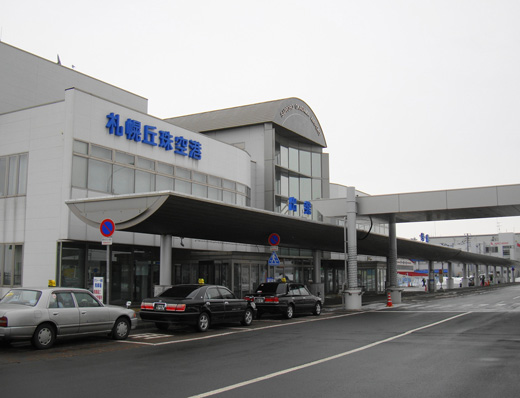
Sapporo Okadama Airport (札幌丘珠空港, Sapporo Okadama Kūkō) (IATA: OKD, ICAO: RJCO) is an airport located 4 NM (7.4 km; 4.6 mi) north of the city center of Sapporo, Japan. Its scheduled airline service is limited to turboprop flights to other cities in Hokkaidō: larger aircraft use New Chitose Airport, 45 km (28 mi) south of the city. The airport is also used by the Japan Self-Defense Forces and by corporate and general aviation operators: an adjacent facility houses the air traffic control center for Hokkaido and the Tohoku region. History
Okadama was constructed between 1942 and 1944 as an airfield for the Imperial Japanese Army. Following Japan's surrender to the United States in 1945, ending World War II, the United States Army Air Force took over the airfield, holding it until the end of the US occupation in 1952. Following the occupation, the field reverted to the Japan Self-Defense Forces. Civilian passenger operations began in 1956.
Airlines and destinations
| Airlines |
Destinations |
| Hokkaidō Air System |
Hakodate, Kushiro |
JGSDF units
- Northern Air Corps Headquarters (Beechcraft King Air 350)
- Northern Helicopter Corps (H-6, UH-1)
- No. 7 Division Airborne
- No. 11 Division Airborne
Ground transportation
- Hokuto Kotsu Bus
- Hokkaidō Chūō Bus
The above content comes from Wikipedia and is published under free licenses – click here to read more.
| General Info
|
| Country |
Japan
|
| ICAO ID |
RJCO
|
| Time |
UTC+9
|
| Latitude |
43.116139
43° 06' 58.10" N
|
| Longitude |
141.380220
141° 22' 48.79" E
|
| Elevation |
25 feet
8 meters
|
| Type |
Joint (Civil and Military)
|
| Magnetic Variation |
009° W (01/06)
|
| Beacon |
Yes
|
| Operating Agency |
MILITARY - CIVIL JOINT USE AIRPORT
|
| Island Group |
Hokkaido I
|
| Operating Hours |
SEE REMARKS FOR OPERATING HOURS OR COMMUNICATIONS FOR POSSIBLE HOURS
|
| Communications
|
TWR
Opr HS, OT O/R 1 hr PN rqr.
|
126.2
138.05
140.5
304.8
|
| GND |
121.8
|
| CON |
127.5
246.1
132.1
255.2
|
| Runways
|
| ID |
Dimensions |
Surface |
PCN |
ILS
|
| 14/32 |
4920 x 148 feet
1500 x 45 meters |
ASPHALT |
- |
NO
|
| Navaids
|
| Type |
ID |
Name |
Channel |
Freq |
Distance From Field |
Bearing From Navaid
|
| VOR-DME |
SPE |
SAPPORO |
086X |
113.9 |
4.9 NM |
145.1
|
| NDB |
SP |
SAPPORO |
- |
357 |
4.1 NM |
149.6
|
| Supplies/Equipment
|
| Fuel |
80/87 octane gasoline, leaded, MIL-L-5572F (RED)
Jet fuel avaiable but type is unknown.
|
| Remarks
|
| FUEL |
J4 (NC-100LL, J)
|
| LGT |
Thld lgt Rwy 14-32. PAPI MEHT Rwy 14 - 45', Rwy 32 - 39'.
|
| MISC |
Minor acft maint, eng repair, and hgr space avbl.
|
| OPR HOURS |
Opr 2200-1200Z (Apr-Oct), 2200-1000Z (Nov-Mar).
|
| RSTD |
PPR all mil tran acft, 24 hr PN Base OPS 011-781-8321 extn 272.
|
The content above was published at Airports-Worldwide.com in 2010.
We don't guarantee the information is fresh and accurate. The data may be wrong or outdated.
For more up-to-date information please refer to other sources.
|
|


