 |
|
Okayama Airport
岡山空港
Okayama Kūkō |
 |
| IATA: OKJ – ICAO: RJOB |
| Summary |
| Airport type |
Public |
| Location |
Okayama |
| Elevation AMSL |
785 ft / 239 m |
| Coordinates |
34°45′25″N 133°51′19″E / 34.75694°N 133.85528°E / 34.75694; 133.85528 (Okayama Airport)Coordinates: 34°45′25″N 133°51′19″E / 34.75694°N 133.85528°E / 34.75694; 133.85528 (Okayama Airport) |
| Runways |
| Direction |
Length |
Surface |
| m |
ft |
| 07/25 |
3,000 |
9,843 |
Asphalt concrete |
| Source: Japanese AIP at AIS Japan |
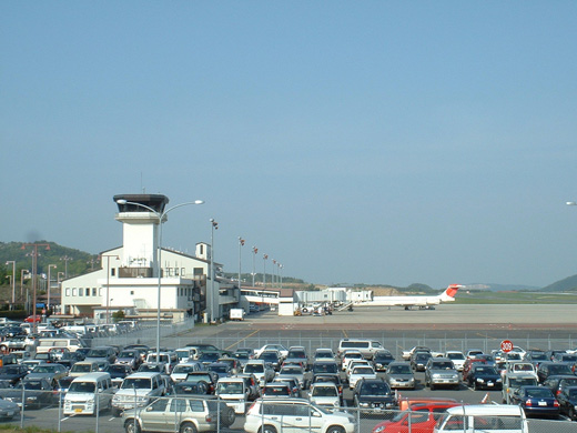
Okayama Airport (岡山空港, Okayama Kūkō) (IATA: OKJ, ICAO: RJOB) is an airport in Okayama Prefecture, Japan.
It is located 18 km (11 mi) northwest of central Okayama City and 11.5 km (7.1 mi) northwest or 30 minutes by bus from Okayama Station. It is about 10 minutes from the Okayama interchange, Sanyo Expressway. Airlines and destinations
| Airlines |
Destinations |
| All Nippon Airways |
Tokyo-Haneda, Sapporo-Chitose |
| China Eastern Airlines |
Beijing-Capital, Dalian, Shanghai-Pudong |
| Continental Airlines operated by Continental Micronesia |
Guam |
| Japan Airlines |
Tokyo-Haneda |
| Japan Airlines operated by Japan Transocean Air |
Okinawa |
| Japan Air Commuter |
Kagoshima |
| Korean Air |
Seoul-Incheon |
 | |
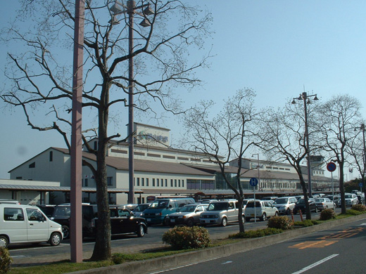
A view of the Okayama Airport terminal and control tower from the parking lot |
The above content comes from Wikipedia and is published under free licenses – click here to read more.
| General Info
|
| Country |
Japan
|
| ICAO ID |
RJOB
|
| Time |
UTC+9
|
| Latitude |
34.756944
34° 45' 25.00" N
|
| Longitude |
133.855278
133° 51' 19.00" E
|
| Elevation |
806 feet
246 meters
|
| Type |
Civil
|
| Magnetic Variation |
007° W (01/06)
|
| Beacon |
Yes
|
| Operating Agency |
CIVIL GOVERNMENT, (LANDING FEES AND DIPLOMATIC CLEARANCE MAY BE REQUIRED)
|
| Island Group |
Honshu I
|
| Operating Hours |
SEE REMARKS FOR OPERATING HOURS OR COMMUNICATIONS FOR POSSIBLE HOURS
|
| Communications
|
| TWR |
124.3
126.2
|
| TAKAMATSU APP |
120.4
261.2
121.2
|
| Runways
|
| ID |
Dimensions |
Surface |
PCN |
ILS
|
| 07/25 |
9843 x 150 feet
3000 x 46 meters |
ASPHALT |
063FBXT |
YES
|
| Navaids
|
| Type |
ID |
Name |
Channel |
Freq |
Distance From Field |
Bearing From Navaid
|
| VORTAC |
OKC |
OKAYAMA |
106X |
115.9 |
9.4 NM |
310.1
|
| VOR-DME |
OYE |
KIBI |
047X |
111 |
1.1 NM |
075.6
|
| Supplies/Equipment
|
| Fuel |
Jet A, without icing inhibitor.
100/130 MIL Spec, low lead, aviation gasoline (BLUE)
|
| Remarks
|
| FUEL |
A1
|
| LGT |
PAPI Rwy 07 MEHT 66', Rwy 25 - 74'. Thld lgt Rwy 07-25.
|
| MISC |
Rwy grooved.
|
| OPR HOURS |
Opr 2200-1230Z.
|
The content above was published at Airports-Worldwide.com in 2010.
We don't guarantee the information is fresh and accurate. The data may be wrong or outdated.
For more up-to-date information please refer to other sources.
|
|


