 |
|
Memanbetsu Airport
女満別空港 |
 |
| IATA: MMB – ICAO: RJCM |
| Summary |
| Airport type |
Public |
| Operator |
Government |
| Location |
Memanbetsu, Ōzora, Hokkaidō, Japan |
| Elevation AMSL |
109 ft / 33 m |
| Coordinates |
43°52′50″N 144°09′51″E / 43.88056°N 144.16417°E / 43.88056; 144.16417 (Memanbetsu Airport)Coordinates: 43°52′50″N 144°09′51″E / 43.88056°N 144.16417°E / 43.88056; 144.16417 (Memanbetsu Airport) |
| Runways |
| Direction |
Length |
Surface |
| m |
ft |
| 18/36 |
2,500 |
8,202 |
Asphalt concrete |
| Source: Japanese AIP at AIS Japan |
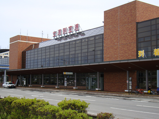
Memanbetsu Airport (女満別空港, Memanbetsu Kūkō) (IATA: MMB, ICAO: RJCM) is an airport in the Memanbetsu section of Ōzora, a town in Hokkaidō, Japan.
The airport was located in the Town of Memanbetsu until 2006, when a merger consolidated Memanbetsu and the Village of Higashimokoto into the Town of Ōzora.
The airport is close to Shiretoko National Park. The airport consistently has over one million passengers per year.
Airlines and destinations
| Airlines |
Destinations |
| Air Do |
Tokyo-Haneda |
| All Nippon Airways operated by Air Nippon Network |
Nagoya-Centrair, Sapporo-Chiotse |
| Japan Airlines |
Tokyo-Haneda |
| Japan Airlines operated by JAL Express |
Sapporo-Chitose, Tokyo-Haneda |
The above content comes from Wikipedia and is published under free licenses – click here to read more.
| General Info
|
| Country |
Japan
|
| ICAO ID |
RJCM
|
| Time |
UTC+9
|
| Latitude |
43.880606
43° 52' 50.18" N
|
| Longitude |
144.164053
144° 09' 50.59" E
|
| Elevation |
135 feet
41 meters
|
| Type |
Civil
|
| Magnetic Variation |
009° W (01/06)
|
| Beacon |
Yes
|
| Operating Agency |
CIVIL GOVERNMENT, (LANDING FEES AND DIPLOMATIC CLEARANCE MAY BE REQUIRED)
|
| Island Group |
Hokkaido I
|
| Operating Hours |
SEE REMARKS FOR OPERATING HOURS OR COMMUNICATIONS FOR POSSIBLE HOURS
|
| Communications
|
TWR
2300-1200Z
|
118.85
126.2
|
| Runways
|
| ID |
Dimensions |
Surface |
PCN |
ILS
|
| 18/36 |
8202 x 150 feet
2500 x 46 meters |
ASPHALT |
083FCXT |
YES
|
| Navaids
|
| Type |
ID |
Name |
Channel |
Freq |
Distance From Field |
Bearing From Navaid
|
| VOR-DME |
TBE |
MEMANBETSU |
045Y |
110.85 |
At Field |
-
|
| Supplies/Equipment
|
| Fuel |
Unknown fuel type or whether there is any fuel.
|
| Remarks
|
| CAUTION |
Clsd Memanbetsu Arpt 1500' N.
|
| FUEL |
(NC-100LL, A1)
|
| LGT |
Rwy dist mrk. PAPI Rwy 18-36 MEHT 61'.
|
| MISC |
Rwy grooved.
|
| OPR HOURS |
Opr 2300-1200Z.
|
The content above was published at Airports-Worldwide.com in 2010.
We don't guarantee the information is fresh and accurate. The data may be wrong or outdated.
For more up-to-date information please refer to other sources.
|
|


