|
|
Hakodate Airport
函館空港
Hakodate Kūkō |
 |
| IATA: HKD – ICAO: RJCH |
| Summary |
| Airport type |
Public |
| Operator |
MLIT |
| Serves |
Hakodate, Japan |
| Elevation AMSL |
112 ft / 34 m |
| Coordinates |
41°46′12″N 140°49′19″E / 41.77°N 140.82194°E / 41.77; 140.82194 (Hakodate Airport)Coordinates: 41°46′12″N 140°49′19″E / 41.77°N 140.82194°E / 41.77; 140.82194 (Hakodate Airport) |
| Website |
www.hkd.mlit.go.jp/... |
| Runways |
| Direction |
Length |
Surface |
| m |
ft |
| 12/30 |
3,000 |
9,842 |
Asphalt/Concrete |
| Source: Japanese AIP at AIS Japan |
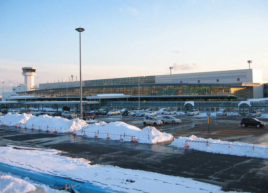
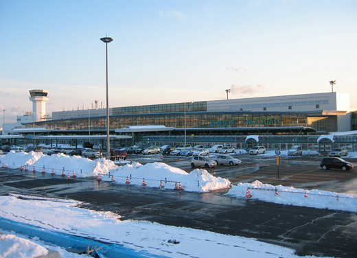
Hakodate Airport (函館空港, Hakodate Kūkō) (IATA: HKD, ICAO: RJCH), is an airport located 7.6 km (4.7 mi) east of Hakodate Station in Hakodate, a city in Hokkaidō, Japan. It is operated by the Ministry of Land, Infrastructure and Transport. History
Hakodate airport opened in 1961 and is located by the seas around 10 km (6.2 mi) from the city centre.
On September 6, 1976, Soviet pilot Viktor Belenko defected to the West by landing a MiG-25 Foxbat aircraft at Hakodate Airport.
Airlines and destinations
 | |
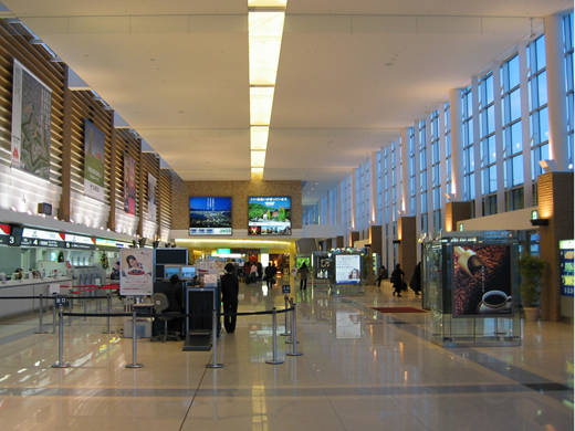
Hakodate Airport Passenger Terminal Building |
| Airlines |
Destinations |
| Air Do |
Tokyo-Haneda |
| All Nippon Airways |
Tokyo-Haneda |
| All Nippon Airways operated by Air Nippon |
Osaka-Kansai, Nagoya-Centrair |
| All Nippon Airways operated by Air Nippon Network |
Sapporo-Chitose |
| Japan Airlines |
Tokyo-Haneda |
| Japan Airlines operated by Hokkaido Air System |
Asahikawa, Kushiro, Okushiri, Sapporo-Okadama |
| Korean Air |
Seoul-Incheon |
| SAT Airlines |
Yuzhno-Sakhalinsk |
Charter
- Asiana Airlines (Seoul-Incheon)
- Dragonair (Hong Kong)
- Hong Kong Express Airways (Hong Kong)
- Mandarin Airlines (Taipei-Taoyuan)
Ground transportation
Scheduled buses operate to Hakodate Station and the Onuma Prince Hotel.
The above content comes from Wikipedia and is published under free licenses – click here to read more.
| General Info
|
| Country |
Japan
|
| ICAO ID |
RJCH
|
| Time |
UTC+9
|
| Latitude |
41.770000
41° 46' 12.00" N
|
| Longitude |
140.821944
140° 49' 19.00" E
|
| Elevation |
151 feet
46 meters
|
| Type |
Civil
|
| Magnetic Variation |
009° W (01/06)
|
| Beacon |
Yes
|
| Operating Agency |
CIVIL GOVERNMENT, (LANDING FEES AND DIPLOMATIC CLEARANCE MAY BE REQUIRED)
|
| Island Group |
Hokkaido I
|
| Operating Hours |
SEE REMARKS FOR OPERATING HOURS OR COMMUNICATIONS FOR POSSIBLE HOURS
|
| Communications
|
| TWR |
118.35
258.3
126.2
|
| DEP |
121.0
127.9
|
| ATIS |
126.6
|
| APP |
119.0
121.0
258.9
|
| Runways
|
| ID |
Dimensions |
Surface |
PCN |
ILS
|
| 12/30 |
9842 x 150 feet
3000 x 46 meters |
ASPHALT |
083FCXT |
YES
|
| Navaids
|
| Type |
ID |
Name |
Channel |
Freq |
Distance From Field |
Bearing From Navaid
|
| VOR-DME |
HWE |
HAKODATE |
070X |
112.3 |
At Field |
-
|
| NDB |
HW |
HAKODATE |
- |
388 |
At Field |
-
|
| Supplies/Equipment
|
| Fuel |
Jet fuel avaiable but type is unknown.
100/130 MIL Spec, low lead, aviation gasoline (BLUE)
|
| Remarks
|
| CAUTION |
Rwy 30 trees 194' 105 2707' fr thld cntr.
|
| CSTMS/AG/IMG |
Avbl.
|
| FUEL |
(NC-100LL, A1)
|
| LGT |
PAPI Rwy 12 MEHT - 65', Rwy 30 - 74'. Thld lgt Rwy 12-30.
|
| OPR HOURS |
Opr 2230-1130Z.
|
The content above was published at Airports-Worldwide.com in 2010.
We don't guarantee the information is fresh and accurate. The data may be wrong or outdated.
For more up-to-date information please refer to other sources.
|
|