 |
 |
|
||||
|
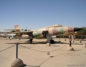
Completed in 1941 as RAF Aqir (arab name Akir), to the IDF/AF in May 1948. Major RAF base during WW2. Located East of Ashdod, on the East coast. Also known as Ekron. ICAO code: LLEK. Location coordinates: N31 50 E034 50, elevation: 295 ft (90 m). Three runways: 15/33 degrees of 9022 ft (2750 m) length, 00/18 degrees of 9022 ft (2750 m) length and 09/27 degrees of 6004 ft (1830 m) length. Home base for 106, 114, 118, 119, 133, 148, 201, 505, the Flight Test Center and unit 669. Used by the Flight School up until April 1966. Key base for IDF/AF nuclear weapons, and also operational and training centre for all IDF paratroopers. Today more a military town than just and airbase. Note: correct spelling is NOT Tel Nov. Tel Nof reportedly is the location of nuclear weapons storage bunkers. This large airbase is located only a few miles from Tirosh, where nuclear weapons for its missions are reportedly stored. Just to the south of the Zachariah Jericho 2 training pad are several bunkers for contain nuclear gravity bombs for attack aircraft at the Tel Nof air base a few kilometers to the northwest.
Images and information placed above are from
Runway 15R/33L7835 x 150 feet
|
||||||||||||||||||||||||||||||||||||||||||||||||||||||||||||||||||||||||||||||||||||||||||||||||||||||||||||||||||||||||||||||||||||||||||||||||||||||||||||||||||||||||||||||||||||||||||||||||||||||||||||||||||||||||||||||
| Runway 15R | |
|---|---|
| Surface | ASPHALT |
| True Heading | 151.0 |
| Latitude | 31.847164 31° 50' 49.79" N |
| Longitude | 34.820711 034° 49' 14.56" E |
| Elevation | 171.0 feet 52 meters |
| Slope | -0.1° |
| Landing Distance | 7835 feet 2388 meters |
| Takeoff Distance | 8939 feet 2725 meters |
| Overrun Length | 1104 feet 336 meters |
| Overrun Surface | ASPHALT |
| Lighting System | HIRL |
| Runway 33L | |
|---|---|
| Surface | ASPHALT |
| True Heading | 331.0 |
| Latitude | 31.828297 31° 49' 41.87" N |
| Longitude | 34.833122 034° 49' 59.24" E |
| Elevation | 165.0 feet 50 meters |
| Slope | 0.1° |
| Landing Distance | 7835 feet 2388 meters |
| Takeoff Distance | 8541 feet 2603 meters |
| Overrun Length | 706 feet 215 meters |
| Overrun Surface | ASPHALT |
| Lighting System | HIRL |
| Runway 15L | |
|---|---|
| Surface | ASPHALT |
| True Heading | 151.0 |
| Latitude | 31.847567 31° 50' 51.24" N |
| Longitude | 34.826508 034° 49' 35.43" E |
| Elevation | 165.0 feet 50 meters |
| Slope | 0.6° |
| Landing Distance | 7830 feet 2387 meters |
| Takeoff Distance | 8800 feet 2682 meters |
| Overrun Length | 970 feet 296 meters |
| Overrun Surface | ASPHALT |
| Lighting System | HIRL |
| Runway 33R | |
|---|---|
| Surface | ASPHALT |
| True Heading | 331.0 |
| Latitude | 31.828694 31° 49' 43.30" N |
| Longitude | 34.838908 034° 50' 20.07" E |
| Elevation | 213.0 feet 65 meters |
| Slope | -0.6° |
| Landing Distance | 7830 feet 2387 meters |
| Takeoff Distance | 8820 feet 2688 meters |
| Overrun Length | 990 feet 302 meters |
| Overrun Surface | ASPHALT |
| Lighting System | HIRL |
| Runway 18 | |
|---|---|
| Surface | ASPHALT |
| True Heading | 184.0 |
| Latitude | 31.846892 31° 50' 48.81" N |
| Longitude | 34.818461 034° 49' 06.46" E |
| Landing Distance | 7880 feet 2402 meters |
| Takeoff Distance | 8858 feet 2700 meters |
| Overrun Length | 978 feet 298 meters |
| Overrun Surface | ASPHALT |
| Lighting System | HIRL |
| Runway 36 | |
|---|---|
| Surface | ASPHALT |
| True Heading | 004.0 |
| Latitude | 31.825242 31° 49' 30.87" N |
| Longitude | 34.817281 034° 49' 02.21" E |
| Landing Distance | 7880 feet 2402 meters |
| Takeoff Distance | 8858 feet 2700 meters |
| Overrun Length | 978 feet 298 meters |
| Overrun Surface | ASPHALT |
| Lighting System | HIRL |
The content above was published at Airports-Worldwide.com in 2005.
We don't guarantee the information is fresh and accurate. The data may be wrong or outdated.
For more up-to-date information please refer to other sources.

 |
|
Copyright 2004-2026 © by Airports-Worldwide.com, Vyshenskoho st. 36, Lviv 79010, Ukraine Legal Disclaimer |
 Tel
Nof Airbase (Canaf 8).
Tel
Nof Airbase (Canaf 8).