 |
 |
|
||||
|
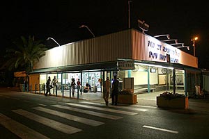
The majority of international activities at Sde Dov take place in summer, by Arkia and Israir, to short hop destinations, and private flights departing from Terminal 2. Sde Dov is located in the Dan Region, close to one of the northern suburbs of the city of Tel Aviv, and at present also serves the military. The Airport was handed over to the Airports Authority for operation only. Arkia Airlines and Israir Airlines operate from the Airport, which serves as their home base, El Rom Airlines and other airlines operate flight services, such as: Romantic / pleasure flights over the country, , air taxis and helicopter flights. In 1997, Sde Dov was declared an International Airport for private flights.
Country Code: +972 ~ IDD Access Code: 00 ~ Domestic Prefix: 0 ~ Time
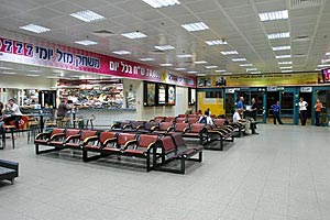
Zone: GMT+2 AFTN: LLSDZPZX Airfield Data: Fire Category 5 Airlines Serving Airport: AiT, Arkia, El-Rom, Israir Passenger Facilities: Annual Capacity 950,000, 7 check-in desks, 3 gates, 1 baggage claim belt, 45 long term parking spaces Additional Information: International flights can be conducted for Israeli pilots only. Non Israeli can use BGN airports for inbound. ATM machining. Address: Tel Aviv, Sde Dov, Israel, Tel Aviv Tel Aviv, Sde Dov, Israel, Telephone numbers of the airport management Fax: (03) 699-1058 Email: gabik at iaa gov il WEB: http://www.iaa gov il/Rashat/en-US/Airports/SdeDov/
Images and information placed above are from
Runway 03/215712 x 98 feet
|
||||||||||||||||||||||||||||||||||||||||||||||||||||||||||||||||||||||||||||||||||||||||||||||||||||||||||||||||||||||||||||||||||||||||||||||||||||||||||||||||||||||||||||||||||||||||||||||
| Runway 03 | |
|---|---|
| Surface | ASPHALT |
| True Heading | 028.0 |
| Latitude | 32.107736 32° 06' 27.85" N |
| Longitude | 34.777961 034° 46' 40.66" E |
| Elevation | 14.0 feet 4 meters |
| Slope | 0.3° |
| Landing Distance | 5371 feet 1637 meters |
| Takeoff Distance | 5712 feet 1741 meters |
| Displaced Threshold Length | 341 feet 104 meters |
| Lighting System | MIRL
PAPI |
| Runway 21 | |
|---|---|
| Surface | ASPHALT |
| True Heading | 208.0 |
| Latitude | 32.121586 32° 07' 17.71" N |
| Longitude | 34.786514 034° 47' 11.45" E |
| Elevation | 33.0 feet 10 meters |
| Slope | -0.3° |
| Landing Distance | 5482 feet 1671 meters |
| Takeoff Distance | 5712 feet 1741 meters |
| Displaced Threshold Length | 230 feet 70 meters |
| Lighting System | MIRL
PAPI |
| SDE DOV | |||||
|---|---|---|---|---|---|
| Type | ID | Channel | Freq | Country | State |
| NDB | TAV | - | 348 | Israel | - |
| Latitude | Longitude | Airport |
| 32.109500 32° 06' 34.20" N |
34.781061 034° 46' 51.82" E |
LLSD |
The content above was published at Airports-Worldwide.com in 2005.
We don't guarantee the information is fresh and accurate. The data may be wrong or outdated.
For more up-to-date information please refer to other sources.

 |
|
Copyright 2004-2024 © by Airports-Worldwide.com, Vyshenskoho st. 36, Lviv 79010, Ukraine Legal Disclaimer |
 Dov
Hoz Airport, commonly known as Sde Dov, serves
mainly for domestic flights to the north of the country, to Ein Yahav
and to Eilat.
Dov
Hoz Airport, commonly known as Sde Dov, serves
mainly for domestic flights to the north of the country, to Ein Yahav
and to Eilat.
 Information: