 |
 |
|
||||
|
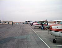
Airport Code : EIY City : Ein Yahav Longitude : 35° 11' 0" E Images and information placed above are from
Runway 01/193943 x 80 feet
|
||||||||||||||||||||||||||||||||||||||||||||||||||||||||||||||||||||||||||||||||||||||||||||
| Runway 01 | |
|---|---|
| Surface | ASPHALT |
| True Heading | 011.0 |
| Latitude | 30.616331 30° 36' 58.79" N |
| Longitude | 35.202142 035° 12' 07.71" E |
| Landing Distance | 3943 feet 1202 meters |
| Takeoff Distance | 3943 feet 1202 meters |
| Runway 19 | |
|---|---|
| Surface | ASPHALT |
| True Heading | 191.0 |
| Latitude | 30.626983 30° 37' 37.14" N |
| Longitude | 35.204508 035° 12' 16.23" E |
| Landing Distance | 3943 feet 1202 meters |
| Takeoff Distance | 3943 feet 1202 meters |
The content above was published at Airports-Worldwide.com in 2005.
We don't guarantee the information is fresh and accurate. The data may be wrong or outdated.
For more up-to-date information please refer to other sources.

 |
|
Copyright 2004-2026 © by Airports-Worldwide.com, Vyshenskoho st. 36, Lviv 79010, Ukraine Legal Disclaimer |
 Israel
Military Airfield
Israel
Military Airfield