|
 |
|
||||
|
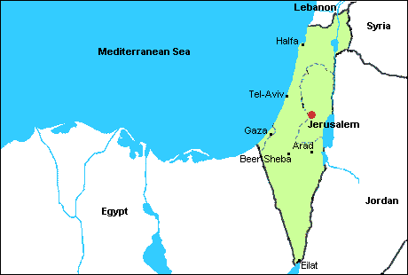
Arad is a modern city in southern Israel, on the border of the Judean Desert, 25 km west of the Dead Sea and 45 km east of Beer-Sheva, near the famous Masada (Metzada), in the South District of Israel. Arad is a thriving town, founded in 1962 by a group of young Israelis, most of them ex-kibbutzniks and ex-moshavniks who were seeking an environment free of the urban ills of overcrowding, traffic, noise, and pollution. The town's growth has closely followed a well-designed city plan. Arad's present population is about 28,000 (2003 estimate) and reflects the broad spectrum of Israeli society. There are Ashkenazim and Sefardim, secular and religious, Bedouins and Black Hebrews, native-born Israelis and new immigrants. It is notable for its clean air and therefore serves as a major attaction to asthmatics worldwide. Arad is named after the biblical town located at Tel Arad (see Biblical archaeology regarding famous ostraca found here). Geographical structure COMMERCE & SERVICES Arad boasts a modern commercial center comprised of stores and offices, banks and shopping centers and the central post office. In 1994, local entrepreneurs established a 13,000 sq. m. (140,000 sq. ft) shopping mall. This mall includes many shops as well as cinemas, and food and restaurant chains. Arad also has a weekly open market (shuk) where fresh produce, household goods and clothing can be bought at reasonable prices. INDUSTRY Arad is located at the center of the main quarrying area in Israel, which constitutes the heart of Israel’s advanced chemical industry. This industry’s existence is fundamentally due to the mineral resources of the Dead Sea and the rich mineral fields in the area. These resources are exploited by various industrial plants in the Israel Chemical’s Ltd. group (ICL): Dead Sea Works, Dead Sea Bromine Co. Rotem Amfert Negev and Dead Sea Periclase. These companies together employ some 4,500 workers, a large number of who are from Arad. In Arad’s Industrial Park, which covers an area of about 1000 dunams (250 acres.), plants have been set up in fields such as electronics, electricity, plastics, toys, wood, textile and food, which employ about 1,500 workers. The most notable of these industries is the Motorola South Israel plant, which manufactures communications, control and monitoring equipment, electronic equipment and cellular telephones.
Images and information placed above are from
Runway 08/264593 x 45 feet
|
||||||||||||||||||||||||||||||||||||||||||||||||||||||||||||||||||||||||||||||||||||||||||||||||||||||||||||
| Runway 08 | |
|---|---|
| Surface | ASPHALT |
| True Heading | 079.0 |
| Latitude | 31.227414 31° 13' 38.69" N |
| Longitude | 35.183689 035° 11' 01.28" E |
| Landing Distance | 4593 feet 1400 meters |
| Takeoff Distance | 4593 feet 1400 meters |
| Lighting System | LIRL
V |
| Runway 26 | |
|---|---|
| Surface | ASPHALT |
| True Heading | 259.0 |
| Latitude | 31.229758 31° 13' 47.13" N |
| Longitude | 35.198092 035° 11' 53.13" E |
| Landing Distance | 4593 feet 1400 meters |
| Takeoff Distance | 4593 feet 1400 meters |
| Lighting System | LIRL
V |
The content above was published at Airports-Worldwide.com in 2005.
We don't guarantee the information is fresh and accurate. The data may be wrong or outdated.
For more up-to-date information please refer to other sources.

 |
|
Copyright 2004-2026 © by Airports-Worldwide.com, Vyshenskoho st. 36, Lviv 79010, Ukraine Legal Disclaimer |