|
 |
|
||||
|
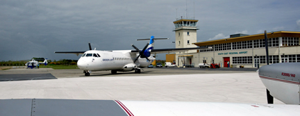
Managing Director: Peter Tawse +353 (0)51 875589 Airfield Data: Fire Category 4 Airlines Serving Airport: British Airways, Emerald Airways, Suckling
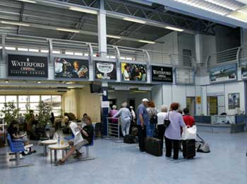
Passenger Facilities: Annual Capacity 150,000, 3 check-in desks, 100 short term parking spaces, 50 long term parking spaces, Cafeterias, Bars, Duty Free Shop, Car Rental, Taxi Service/Rank, First Aid, Baby/Parent Room, Disabled Access/Facilities e-mail: watapt at tinet ie
Images and information placed above are from http://www.azworldairports.com/ http://www.flywaterford.com/ We thank them for the data!
Runway 03/214701 x 98 feet
|
||||||||||||||||||||||||||||||||||||||||||||||||||||||||||||||||||||||||||||||||||||||||||||||||||||||||||||||||||||||||||||||||||||||||||||||||||||||||||||||||||||||||||||||||||||||||
| Runway 03 | |
|---|---|
| Surface | ASPHALT |
| True Heading | 021.0 |
| Latitude | 52.181186 52° 10' 52.27" N |
| Longitude | -7.090719 007° 05' 26.59" W |
| Landing Distance | 4406 feet 1343 meters |
| Takeoff Distance | 4701 feet 1433 meters |
| Displaced Threshold Length | 295 feet 90 meters |
| Lighting System | HIRL
A2 PAPI |
| Runway 21 | |
|---|---|
| Surface | ASPHALT |
| True Heading | 201.0 |
| Latitude | 52.193214 52° 11' 35.57" N |
| Longitude | -7.083203 007° 04' 59.53" W |
| Landing Distance | 4231 feet 1290 meters |
| Takeoff Distance | 4701 feet 1433 meters |
| Displaced Threshold Length | 470 feet 143 meters |
| Lighting System | HIRL
X PAPI |
| WATERFORD | |||||
|---|---|---|---|---|---|
| Type | ID | Channel | Freq | Country | State |
| NDB | WTD | - | 368 | Ireland | - |
| Latitude | Longitude | Airport |
| 52.189000 52° 11' 20.40" N |
-7.083344 007° 05' 00.04" W |
EIWF |
The content above was published at Airports-Worldwide.com in 2005.
We don't guarantee the information is fresh and accurate. The data may be wrong or outdated.
For more up-to-date information please refer to other sources.

 |
|
Copyright 2004-2026 © by Airports-Worldwide.com, Vyshenskoho st. 36, Lviv 79010, Ukraine Legal Disclaimer |
 Waterford
Airport, Irish Republic, Killowen, Co Waterford
Waterford
Airport, Irish Republic, Killowen, Co Waterford