|
|
Srinagar Airport
Sheikh ul Alam Airport |
IATA: SXR – ICAO: VISR
 |
| Summary |
| Airport type |
Public / Military |
| Serves |
Srinagar |
| Elevation AMSL |
1,655 m / 5,429 ft |
| Coordinates |
33°59′13.7″N 074°46′27.3″E / 33.987139°N 74.77425°E / 33.987139; 74.77425 |
| Runways |
| Direction |
Length |
Surface |
| m |
ft |
| 13/31 |
3,685 |
12,090 |
Asphalt |
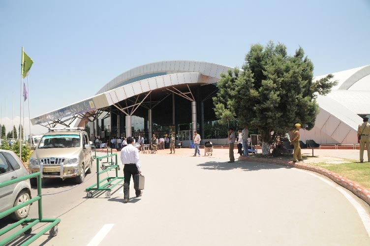
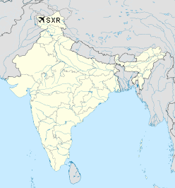
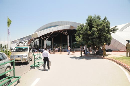
Sheikh ul Alam Airport (Hindi: शेख़ उल आलम हवाई अड्डा) commonly known as Srinagar Airport (Hindi: श्रीनगर हवाई अड्डा), is an international airport in Srinagar in Jammu and Kashmir, India (IATA: SXR, ICAO: VISR).
It has been named after one of the greatest saints of Kashmir, Sheikh Noor-ud-din Noorani, popularly known to Kashmiris as Sheikh-ul-Alam.
Currently the airport has undergone extensive renovations, including improving the runway, a new terminal for departure and arrival, air bridges and other operational facilities, and was inaugurated on 14 February 2009 by an Air India flight from Dubai. Seasonal Hajj pilgrimage charters to Jeddah are also operated from Srinagar.
 |
|
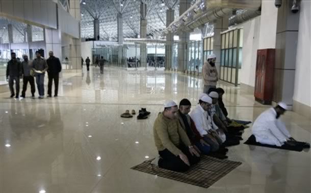
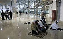
Muslims praying at Srinagar Airport. |
Airlines and destinations
| Airlines |
Destinations |
| GoAir |
Delhi, Goa, Jammu, Mumbai |
| Indian Airlines |
Delhi, Jammu, Leh |
| IndiGo |
Delhi, Jammu |
| Jet Airways |
Delhi |
| JetLite |
Delhi, Jammu, Mumbai |
| Kingfisher Airlines |
Chandigarh, Delhi, Jaipur, Jammu, Pune |
| SpiceJet |
Bangalore, Delhi, Jammu, Mumbai |
The above content comes from Wikipedia and is published under free licenses – click here to read more.
| General Info
|
| Country |
India
|
| ICAO ID |
VISR
|
| Time |
UTC+5:30
|
| Latitude |
33.987139
33° 59' 13.70" N
|
| Longitude |
74.774250
074° 46' 27.30" E
|
| Elevation |
5429 feet
1655 meters
|
| Type |
Joint (Civil and Military)
|
| Magnetic Variation |
002° E (01/06)
|
| Operating Agency |
MILITARY - CIVIL JOINT USE AIRPORT
|
| Communications
|
TWR
Opr SR-SS.
|
127.9
|
RDO
Opr 0330-0800Z.
|
8939
|
| Communications Remarks |
|
| A/G |
A/G-(mil) voice: rdo 8939.
|
| Runways
|
| ID |
Dimensions |
Surface |
PCN |
ILS
|
| 13/31 |
12090 x 150 feet
3685 x 46 meters |
ASPHALT |
- |
NO
|
| Navaids
|
| Type |
ID |
Name |
Channel |
Freq |
Distance From Field |
Bearing From Navaid
|
| VOR-DME |
SNG |
SRINAGAR |
106X |
115.9 |
1.3 NM |
130.1
|
| NDB |
SNG |
SRINAGAR |
- |
220 |
At Field |
-
|
| Supplies/Equipment
|
| Fuel |
Jet A1, without icing nhibitor.
115/145 octane gasoline, leaded, MIL-L-5572F (PURPLE)
|
| Remarks
|
| A-GEAR |
BARRIER- type unk.
|
| FUEL |
(NC-80, 100LL, 115, A1)
|
| MISC |
Ldg fees.
|
The content above was published at Airports-Worldwide.com in 2010.
We don't guarantee the information is fresh and accurate. The data may be wrong or outdated.
For more up-to-date information please refer to other sources.
|
|