|
|
Þórshöfn Airport (Icelandic: Þórshafnarflugvöllur) (IATA: THO, ICAO: BITN) is an airport located in Þórshöfn, a village in northeast Iceland. It is also referred to as Thorshofn Airport in many English-language sources.
Þórshöfn Airport was previously located about 4.8 km to the northeast, at 66°15′07″N
15°16 23″W, near Sauðanes, and had the ICAO code BITH (but the same IATA code – THO). It had a slightly shorter runway with a gravel surface, which has since been closed.
|
Þórshöfn Airport
Þórshafnarflugvöllur
|
|
|
| Summary |
| Airport type |
Public |
| Operator |
ISAVIA |
| Serves |
Þórshöfn, Iceland |
| Elevation AMSL |
64 ft / 20 m |
| Coordinates |
66°13′06″N
015°20′08″W |
| Map |
Location of Airport in Iceland
|
| Runways |
| Direction |
Length |
Surface |
| m |
ft |
| 02/20 |
1,199 |
3,934 |
Asphalt |
|
Airlines and destinations
| Destinations |
| Norlandair |
Akureyri, Vopnafjörður |
Accidents and incidents
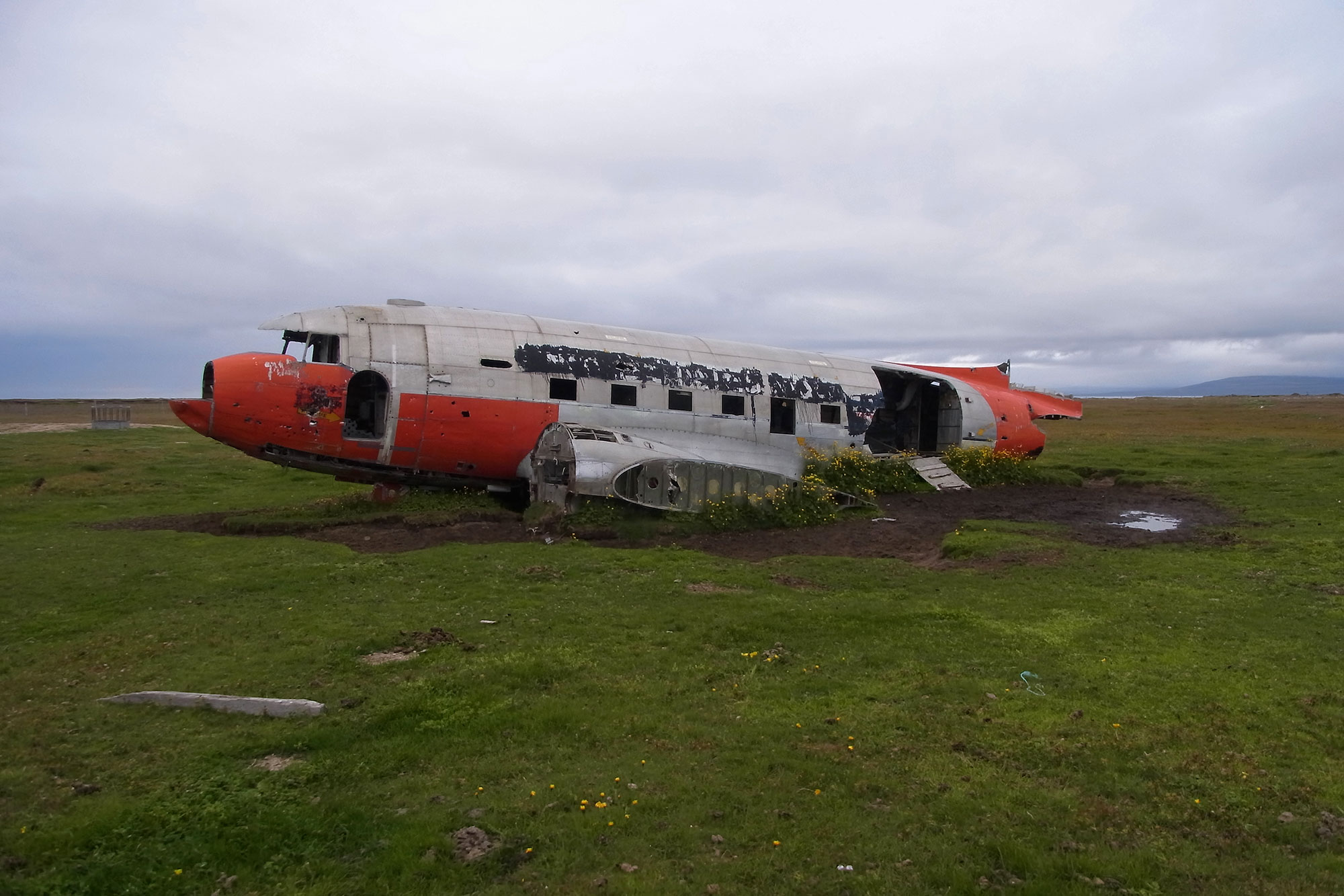
The wreck of the DC-3 is nowadays used as a sheep and horse shelter on private land
- In July 1969, Douglas R4D-6 Bu 150187 of the United States Navy was damaged beyond economic repair in an accident at Þórshöfn Airport. Pilot Russell W. Sims Jr, Executive Officer of NAS Keflavik, was flying in supplies and mail when cross winds, unimproved runway surface coupled with what the investigative report stated was pilot error was not able to keep control of the plane upon landing, going off the runway surface and destroying the landing gear. Another source states that the aircraft swung off the runway during takeoff.
The above content comes from Wikipedia and is published under free licenses – click here to read more.
| General
Info
|
| Country |
Iceland
|
| ICAO
ID |
BITN
|
| Time |
UTC
0
|
| Latitude |
66.218453
66 13' 06.43" N
|
| Longitude |
-15.335625
015 20' 08.25" W
|
| Elevation |
65
feet
20 meters
|
| Magnetic
Variation |
014
W (01/06)
|
| Operating
Agency |
CIVIL
GOVERNMENT, (LANDING FEES AND DIPLOMATIC CLEARANCE MAY BE REQUIRED)
|
| Operating
Hours |
SEE
REMARKS FOR OPERATING HOURS OR COMMUNICATIONS FOR POSSIBLE HOURS
|
| Communications
|
| INFO |
118.1
|
REYKJAVIK
ACC
Opr H24. |
119.7
|
| Runways
|
| ID |
Dimensions |
Surface |
PCN |
ILS
|
| 02/20
|
3934
x 98 feet
1199 x 30 meters |
BITUMINOUS,
TAR OR ASPHALT MIXED IN PLACE, OILED. |
- |
NO
|
| Navaids
|
| Type |
ID |
Name |
Channel |
Freq |
Distance
From Field |
Bearing
From Navaid
|
| NDB |
TN |
THORSHOFN |
- |
373 |
At
Field |
-
|
| Remarks
|
| OPR
HOURS |
Opr
0800-1200Z Sun-Fri, clsd Sat. |
The content above was published at Airports-Worldwide.com in 2019.
We don't guarantee the information is fresh and accurate. The data may be wrong or outdated.
For more up-to-date information please refer to other sources.
|
|