|
|
Hornafjörður Airport or Hornafjordur Airport (IATA: HFN, ICAO: BIHN) is an airport serving Höfn, Iceland. The airport is 5 kilometres (3.1 mi) north of the town.
The Hornafjordur non-directional beacon (Ident: HN) is located 1.24 nautical miles off the threshold of runway 36.
|
Hornafjörður Airport
|
|
|
| Summary |
| Airport type |
Public |
| Operator |
Isavia |
| Location |
Höfn, Iceland |
| Elevation AMSL |
24 ft / 7 m |
| Coordinates |
64°17′44″N
15°13′38″W |
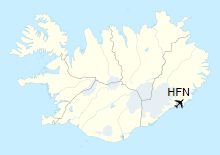
| Map |
Location of Airport in Iceland
|
| Runways |
| Direction |
Length |
Surface |
| m |
ft |
| 18/36 |
1,500 |
4,921 |
Asphalt |
|
| Statistics (2016) |
|
|
The above content comes from Wikipedia and is published under free licenses – click here to read more.
| General
Info
|
| Country |
Iceland
|
| ICAO
ID |
BIHN
|
| Time |
UTC
0
|
| Latitude |
64.295556
64 17' 44.00" N
|
| Longitude |
-15.227222
015 13' 38.00" W
|
| Elevation |
24
feet
7 meters
|
| Magnetic
Variation |
013
W (01/06)
|
| Operating
Agency |
CIVIL
GOVERNMENT, (LANDING FEES AND DIPLOMATIC CLEARANCE MAY BE REQUIRED)
|
| Near
City |
Hofn
|
| Operating
Hours |
SEE
REMARKS FOR OPERATING HOURS OR COMMUNICATIONS FOR POSSIBLE HOURS
|
| Communications
|
| INFO |
118.1
|
REYKJAVIK
CON
Opr H24. |
119.7
|
| Runways
|
| ID |
Dimensions |
Surface |
PCN |
ILS
|
| 18/36
|
4921
x 148 feet
1500 x 45 meters |
BITUMINOUS,
TAR OR ASPHALT MIXED IN PLACE, OILED. |
- |
NO
|
| Navaids
|
| Type |
ID |
Name |
Channel |
Freq |
Distance
From Field |
Bearing
From Navaid
|
| NDB |
HN |
HORNAFJORDUR |
- |
330 |
1.6 NM |
002.7
|
| Supplies/Equipment
|
| Fuel |
Jet
A1, without icing nhibitor.
100/130 MIL Spec, low lead, aviation gasoline (BLUE) |
| Remarks
|
| CAUTION |
Rwy
18-36 is Double Sfc Dressing. Use brakes with ctn and use as big
a turning rad as possible. PAPI on-crs has obst pent when flying
considerably either side of ctrline within 10 up to 6 NM.
|
| CSTMS/IMG |
Avbl
O/R.
|
| FUEL |
Avbl
PN. (NC-100LL, A1)
|
| LGT |
Lead
in lgt Rwy 18/36.
|
| OPR
HOURS |
Opr
0715-1830Z Mon-Fri, 0715-1700Z Sat, Sun. OT O/R.
|
| RSTD |
PAPI
for Rwy 18 usable only wi 1.7 NM. |
The content above was published at Airports-Worldwide.com in 2019.
We don't guarantee the information is fresh and accurate. The data may be wrong or outdated.
For more up-to-date information please refer to other sources.
|
|