|
|
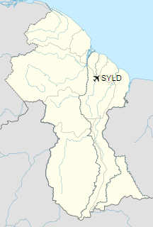
Linden Airport (ICAO: SYLD) is an airport serving Linden, the capital of the Upper Demerara-Berbice region of Guyana.
|
Linden Airport
|
|
|
| Summary |
| Airport type |
Public |
| Operator |
Government |
| Serves |
Linden, Guyana |
| Elevation AMSL |
180 ft / 55 m |
| Coordinates |
5°57′57″N
58°16′13″W |
| Map |
|
|
| Runways |
| Direction |
Length |
Surface |
| ft |
m |
| 11/29 |
5,000 |
1,524 |
Asphalt |
|
Facilities
The airport elevation is 180 feet (55 m) above mean sea level. Its runway is designated 11/29 with an asphalt surface measuring 5,000 by 98 feet (1,524 m × 30 m).
The above content comes from Wikipedia and is published under free licenses – click here to read more.
| General Info
|
| Country |
Guyana
|
| ICAO ID |
SYLD
|
| Time |
UTC-4
|
| Latitude |
5.965922
05° 57' 57.32" N
|
| Longitude |
-58.270336
058° 16' 13.21" W
|
| Elevation |
180 feet
55 meters
|
| Magnetic Variation |
015° W (01/06)
|
| Operating Agency |
CIVIL GOVERNMENT, (LANDING FEES AND DIPLOMATIC CLEARANCE MAY BE REQUIRED)
|
| Runways
|
| ID |
Dimensions |
Surface |
PCN |
ILS
|
| 11/29 |
5000 x 98 feet
1524 x 30 meters |
ASPHALT |
- |
NO
|
The content above was published at Airports-Worldwide.com in 2020.
We don't guarantee the information is fresh and accurate. The data may be wrong or outdated.
For more up-to-date information please refer to other sources.
|
|