|
|
Lethem Airport (IATA: LTM, ICAO: SYLT) is an airport serving Lethem, a town in the Upper Takutu-Upper Essequibo region of Guyana.
|
Lethem Airport
|
- IATA: LTM
- ICAO: SYLT
- WMO: 81006
|
| Summary |
| Airport type |
Public |
| Operator |
Government |
| Serves |
Lethem |
| Elevation AMSL |
351 ft / 107 m |
| Coordinates |
3°22′20″N
59°47′25″W |
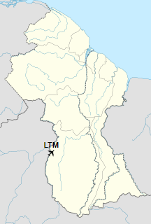
| Map |
Location of the airport in Guyana
|
| Runways |
| Direction |
Length |
Surface |
| m |
ft |
| 07/25 |
1,825 |
5,988 |
Asphalt |
|
The above content comes from Wikipedia and is published under free licenses – click here to read more.
| General Info
|
| Country |
Guyana
|
| ICAO ID |
SYLT
|
| Time |
UTC-4
|
| Latitude |
3.372761
03° 22' 21.94" N
|
| Longitude |
-59.789439
059° 47' 21.98" W
|
| Elevation |
351 feet
107 meters
|
| Magnetic Variation |
014° W (01/06)
|
| Operating Agency |
CIVIL GOVERNMENT, (LANDING FEES AND DIPLOMATIC CLEARANCE MAY BE REQUIRED)
|
| Operating Hours |
SUNRISE TO SUNSET (SR-SS)
|
| Runways
|
| ID |
Dimensions |
Surface |
PCN |
ILS
|
| 07/25 |
5985 x 98 feet
1824 x 30 meters |
ASPHALT |
- |
NO
|
| Remarks
|
| OPR HOURS |
Opr SR-SS.
|
The content above was published at Airports-Worldwide.com in 2020.
We don't guarantee the information is fresh and accurate. The data may be wrong or outdated.
For more up-to-date information please refer to other sources.
|
|