|
Kamarang Airport (IATA: KAR, ICAO: SYKM) is an airport serving the town of Kamarang, in the Cuyuni-Mazaruni Region of Guyana.
The Kamarang non-directional beacon (Ident: KAM) is 2 kilometres (1.2 mi) north of the field.
It appears that the runway has been paved but that is not yet shown by Google Earth (on 19-Dec-2016). According to other sources on the Internet,
the paved runway (asphalt) is 1220 metres long (4000') by 18 metres wide (60").
|
Kamarang Airport |
- IATA: KAR
- ICAO: SYKM
- WMO: 81005
|
| Summary |
| Serves |
Kamarang |
| Elevation AMSL |
1,601 ft / 488 m |
| Coordinates |
5°51′55″N
60°36′50″W |
| Map |
|
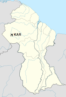
Location in Guyana
|
| Runways |
| Direction |
Length |
Surface |
| m |
ft |
| 07/25 |
1,000 |
3,281 |
Asphalt |
|
|
Sources: Google Maps GCM |
The above content comes from Wikipedia and is published under free licenses – click here to read more.
The content above was published at Airports-Worldwide.com in 2020.
We don't guarantee the information is fresh and accurate. The data may be wrong or outdated.
For more up-to-date information please refer to other sources.
|


