 |
|
San Marcos Airport (ICAO: MGSM) is a high elevation airport serving the city of San Marcos, the capital of San Marcos Department in Guatemala.
The airport is on the southwest side of the city.
San Marcos is in a high mountain basin. There is nearby mountainous terrain north and south of the airport, and distant mountainous terrain to the east and west.
The Tapachula VOR-DME (Ident: TAP) is located 34.5 nautical miles (63.9 km) west-southwest of the airport.
|
San Marcos Airport |
|
|
| Summary |
| Airport type |
Public |
| Serves |
San Marcos, Guatemala |
| Elevation AMSL |
7,933 ft / 2,418 m |
| Coordinates |
14°57′20″N
91°48′25″W |
| Map |
|
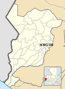
Location in San Marcos Department
|
| Runways |
| Direction |
Length |
Surface |
| m |
ft |
| 06/24 |
1,175 |
3,855 |
Asphalt |
|
|
Source: Google Maps GCM SkyVector |
The above content comes from Wikipedia and is published under free licenses – click here to read more.
The content above was published at Airports-Worldwide.com in 2020.
We don't guarantee the information is fresh and accurate. The data may be wrong or outdated.
For more up-to-date information please refer to other sources.
|
|


