|
|
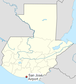
San José Airport (IATA: GSJ, ICAO: MGSJ) (Aeropuerto de Puerto San José, Escuintla) serves the city of Puerto San José, the recreative town of Monterrico, the port of Puerto Quetzal and the eastern Guatemalan Pacific coast. It is operated and administrated by DGAC — Dirección General de Aeronáutica Civil de Guatemala. San José Airport is in the western part of the city of Puerto San José, near the Pacific coast.
|
San José Airport
|
|
|
| Summary |
| Airport type |
Military/Public |
| Operator |
DGAC |
| Serves |
Puerto San José, Guatemala |
| Elevation AMSL |
29 ft / 9 m |
| Coordinates |
13°56′10″N
90°50′09″W |
| Map |
|
|
| Runways |
| Direction |
Length |
Surface |
| m |
ft |
| 15/33 |
2,010 |
6,594 |
Asphalt |
|
Facilities
The airport has been recently refurbished and reopened in September 2007, as part of a nationwide airport rehabilitation program. Improvements include:
- a newly built 2,500 m2 (27,000 sq ft) terminal building with car park
- a newly built tower
- newly asphalted an amplified runway with illumination and signage
As at 5 December 2008 there is no new control tower nor is there runway or approach lighting.
The San Jose VOR-DME (Ident: SJO) is located on the field.
Airlines
- Transportes Aéreos Guatemaltecos (charter flights).
- Air Venture Tours (charter flights only)
The above content comes from Wikipedia and is published under free licenses – click here to read more.
| General Info
|
| Country |
Guatemala
|
| ICAO ID |
MGSJ
|
| Time |
UTC-6
|
| Latitude |
13.936192
13° 56' 10.29" N
|
| Longitude |
-90.835833
090° 50' 09.00" W
|
| Elevation |
29 feet
9 meters
|
| Type |
Joint (Civil and Military)
|
| Magnetic Variation |
003° E (01/06)
|
| Operating Agency |
MILITARY - CIVIL JOINT USE AIRPORT
|
| Operating Hours |
SUNRISE TO SUNSET (SR-SS)
|
| Runways
|
| ID |
Dimensions |
Surface |
PCN |
ILS
|
| 15/33 |
6595 x 150 feet
2010 x 46 meters |
ASPHALT |
020FAWT |
NO
|
| Navaids
|
| Type |
ID |
Name |
Channel |
Freq |
Distance From Field |
Bearing From Navaid
|
| VOR-DME |
SJO |
SAN JOSE |
088X |
114.1 |
At Field |
-
|
| NDB |
SGA |
SAN JOSE |
- |
425 |
1.5 NM |
080.9
|
| Supplies/Equipment
|
| Fuel |
100/130 octane gasoline, leaded, MIL-L-5572F (GREEN)
|
| Remarks
|
| FUEL |
(NC-100, A1)
|
| OPR HOURS |
Opr SR-SS.
|
| RSTD |
PPR exc emerg. Flt over Naval Base (3 NM SE) proh blw 2000'. Copter proh fr ldg inside the Puerto Quetzal polygon. Clsd to intl ops.
|
| TFC PAT |
Rwy 15 rgt hand only.
|
The content above was published at Airports-Worldwide.com in 2020.
We don't guarantee the information is fresh and accurate. The data may be wrong or outdated.
For more up-to-date information please refer to other sources.
|
|