|
Malacatán Airport (ICAO: MGML) is an airport serving the town of Malacatán in the San Marcos Department of Guatemala.
The runway is in the countryside 2 kilometres (1.2 mi) west of the town. The Tapachula VOR-DME (Ident: TAP)
is located 18.1 nautical miles (33.5 km) southwest of the airport.
|
Malacatán Airport |
|
|
| Summary |
| Airport type |
Public |
| Serves |
Malacatán, Guatemala |
| Elevation AMSL |
1,194 ft / 364 m |
| Coordinates |
14°54′28″N
92°05′20″W |
| Map |
|
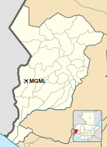
Location in San Marcos Department
|
| Runways |
| Direction |
Length |
Surface |
| m |
ft |
| 10/29 |
940 |
3,084 |
Grass |
|
|
Source: Google Maps GCM |
The above content comes from Wikipedia and is published under free licenses – click here to read more.
The content above was published at Airports-Worldwide.com in 2020.
We don't guarantee the information is fresh and accurate. The data may be wrong or outdated.
For more up-to-date information please refer to other sources.
|


