 |
|
Huehuetenango Airport (IATA: HUG, ICAO: MGHT) is an airport serving the city of Huehuetenango, the capital of Huehuetenango Department, Guatemala.
The airport is in the southwestern section of the city, which is in a high elevation basin. There is rising terrain
1.6 kilometres (1 mi) northwest of the runway, with distant mountainous terrain in all quadrants.
The Huehuetenango non-directional beacon (Ident: HUE) is located on the field.
|
Huehuetenango Airport |
|
|
| Summary |
| Airport type |
Public |
| Serves |
Huehuetenango, Guatemala |
| Elevation AMSL |
6,135 ft / 1,870 m |
| Coordinates |
15°19′00″N
91°30′20″W |
| Map |
|
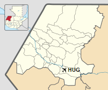
Location in Huehuetenango Department
|
| Runways |
| Direction |
Length |
Surface |
| m |
ft |
| 06/24 |
825 |
2,707 |
Asphalt |
|
|
Source: Google Maps GCM SkyVector |
Airlines and destinations
| Airlines |
Destinations |
| Aereo Ruta Maya |
Guatemala City |
| Transportes Aéreos Guatemaltecos |
Guatemala City |
The above content comes from Wikipedia and is published under free licenses – click here to read more.
The content above was published at Airports-Worldwide.com in 2020.
We don't guarantee the information is fresh and accurate. The data may be wrong or outdated.
For more up-to-date information please refer to other sources.
|
|


