 |
|
El Naranjo Airport (IATA: ENJ) is a rural airstrip near El Naranjo, a settlement in the diffuse agricultural community between Masagua, Obero,
and Torremolinos in Escuintla Department, Guatemala.
The San Jose VOR-DME (Ident: SJO) is located 10.5 nautical miles (19.4 km) south of the airstrip.
|
El Naranjo Airport |
|
|
| Summary |
| Airport type |
Public |
| Serves |
Masagua, Guatemala |
| Elevation AMSL |
140 ft / 43 m |
| Coordinates |
14°06′25″N
90°49′03″W |
| Map |
|
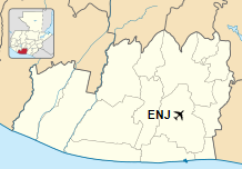
Location in Escuintla Department
|
| Runways |
| Direction |
Length |
Surface |
| m |
ft |
| 17/35 |
840 |
2,756 |
Grass |
|
|
Source: Google Maps GCM |
The above content comes from Wikipedia and is published under free licenses – click here to read more.
The content above was published at Airports-Worldwide.com in 2020.
We don't guarantee the information is fresh and accurate. The data may be wrong or outdated.
For more up-to-date information please refer to other sources.
|
|


