|
Coatepeque Airport (IATA: CTF, ICAO: MGCT) is an airport serving Coatepeque, a city in the Quetzaltenango Department of Guatemala.
The airport is in a wooded area on the southwest side of town.
It has a small terminal and a runway 900 meters long.
The Retalhuleu non-directional beacon (Ident: REU) is located 15 nautical miles
(28 km) southeast of the airport. The Tapachula VOR-DME (Ident: TAP) is located 29.2 nautical miles (54.1 km) west-northwest of the airport.
|
Coatepeque Airport |
|
|
| Summary |
| Airport type |
Public |
| Location |
Coatepeque, Guatemala |
| Elevation AMSL |
1,486 ft / 453 m |
| Coordinates |
14°41′40″N
91°52′55″W |
| Map |
|
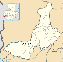
Location in Quetzaltenango Department
|
| Runways |
| Direction |
Length |
Surface |
| m |
ft |
| 07/25 |
900 |
2,953 |
Asphalt |
|
|
Source: GCM Google Maps SkyVector |
The above content comes from Wikipedia and is published under free licenses – click here to read more.
The content above was published at Airports-Worldwide.com in 2020.
We don't guarantee the information is fresh and accurate. The data may be wrong or outdated.
For more up-to-date information please refer to other sources.
|


