|
 |
|
||||
|
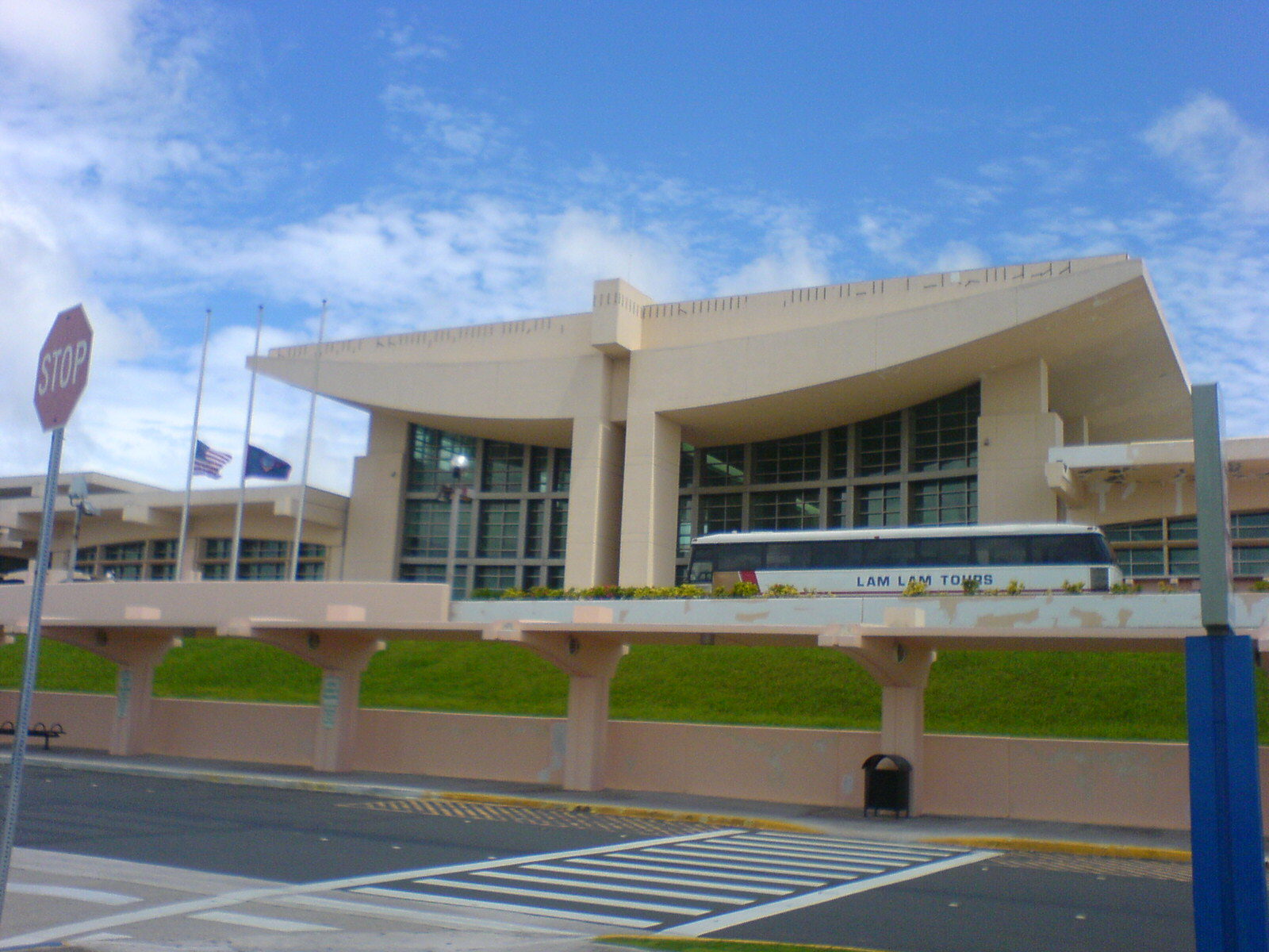
Antonio B. Won Pat International Airport (IATA: GUM, ICAO: PGUM), also known as Guam International Airport, is an airport located in Tamuning and Barrigada, three miles east of the capital city of Hagåtña (formerly Agana) in the U.S. territory of Guam. It is named for Antonio Borja Won Pat, the first delegate from Guam to the United States House of Representatives, and is operated by the A.B. Won Pat Guam International Airport Authority (GIAA), an agency of the Government of Guam. The airport is a hub for Continental Micronesia and the cargo carrier Asia Pacific Airlines. HistoryThe airport's history began as Naval Air Station Agana (Brewer Field) after World War II. Operations of the civilian terminal (Guam International Air Terminal) was passed onto the Government of Guam's Department of Commerce in 1969. In 1975, the Guam International Airport Authority (GIAA) was created as a separate agency. After NAS Agana was closed in April 1995, GIAA took over the entire airport's operations. The first passenger terminal building was opened in 1982. The current, much larger terminal building was opened in phases between 1996 and 1998. A Houston Chronicle article in 2008 stated that expected subsequent military buildup and population growth could lead to an expansion of Continental Micronesia flights to and from the airport. Customs, immigration, and security inspectionsArrival passenger inspection is conducted by the U.S. Customs and Border Protection (CBP, immigration only) and Guam Customs & Quarantine Agency (GCQA). Departure security checks are conducted by the U.S. Transportation Security Administration (TSA). CustomsSince Guam is outside the United States customs jurisdiction, passengers from all arrival flights go through GCQA inspection, and departing passengers on the Honolulu-bound flight (currently the only Stateside departure) go through a normal USCBP customs inspection upon arrival. ImmigrationThe USCBP inspects all arriving passengers except nonstop flights from the States. Passengers arriving from the U.S. Commonwealth of the Northern Mariana Islands (CNMI) also have to go through USCBP inspection as the Northern Marianas are a separate U.S. immigration jurisdiction. For U.S. citizens, passports are not required to enter Guam from the CNMI (i.e., other forms of ID proving admissibility are accepted), but are required for those transiting a foreign country between the States and Guam. The USCBP also conducts a pre-clearance of nonstop passengers bound for Honolulu. Because of the Guam & CNMI Visa Waiver Program, which gives tourists from certain Asian countries visa-free entry (to Guam and the CNMI but not the States), Honolulu-bound passengers are inspected for their admissibility to the U.S. Transit passengers (except from Honolulu) are also inspected by the USCBP before being allowed to proceed to their connecting gate. However, since there is no need to clear Guam customs, no baggage claim is necessary. SecurityThe TSA conducts security inspection for all departing passengers and all transit passengers not arriving from the States and the CNMI, which are already screened by TSA at their origins. However, Guam-Honolulu passengers who have onward connections must go through TSA inspection again in Honolulu because they will have come into contact with their checked baggages during U.S. customs inspection there. Terminal design problem post 9/11
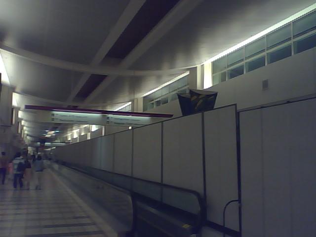
Since all flights require customs or immigration inspection, the airport's post-security concourse and gate area was not designed to separate arriving and departing passengers. The only normal passenger entrance is through security and the only normal exit is through immigration. Except for the few gates designated for Honolulu arrivals, which route passengers directly to customs, all other gates do not have a separate arrival corridor. Arrival passengers walk directly into the gates waiting area, and in the past could actually purchase food or merchandises before entering the immigration hall. The original design is said to be compliant with security standards at the time of opening. However, after the September 11 attacks in 2001, the U.S. government began to require separation of uninspected arrival passengers. The airport initially used a system of chairs, moving sidewalks, retractable belts and security/police staffing to usher arriving passengers from the gate to the immigration hall without coming into physical contact with departing passengers. In recent years, semi-permanent movable walls separate much of the length of the terminal building into two halves, decreasing the need for human staffing and those lighter objects previously in use. Old terminal building
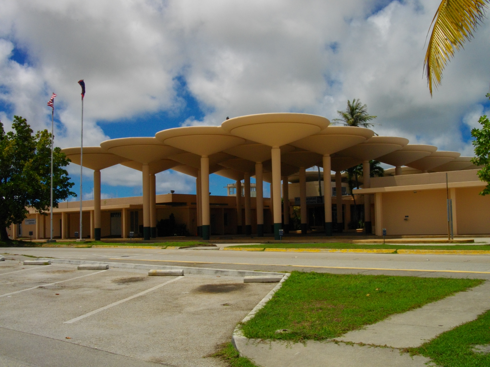
After the current terminal building opened, he old terminal building became the Commuter Terminal (serving Freedom Air and Pacific Island Aviation). Now that those carriers moved to the main terminal, the old terminal serves as the corporate headquarters of Continental Micronesia. Airlines and destinations
AccidentsSeveral fatal accidents have occurred on and near Guam over the years. In total, 367 deaths occurred from 6 different aircraft accidents. The most recent accident occurred in 1997, when Korean Air Flight 801, a Boeing 747, crashed as it was attempting to land at the airport. For a comprehensive list of all accidents relating to Guam, visit the Aviation Safety Network database by linking to it from the external links section below. On June 10, 2009, Jetstar Airways Flight 20 flying from Kansai International Airport to Gold Coast Airport experienced a small fire in the cockpit apparently caused by a fault in the heating system. The fire was quickly extinguished by the pilots who subsequently diverted the plane to Guam. All 203 people on board were unharmed in the incident. Jetstar and the Australian Transport Safety Bureau are currently examining the full cause of the fire. Military useThe airport was built by the Japanese Navy about 1943, calling the military airfield Guamu Dai Ni (Guam No. 2) as part of their defense of the Marianas. After the island was recaptured by American forces in 1944, it was renamed Agana Airfield, due to the proximity of the town. After being repaired in October 1944, the United States Army Air Force Seventh Air Force used the airfield as a base for the 11th Bombardment Group, which flew B-24 Liberator bombers from the station until being moved to Okinawa in July 1945. With the reassignment of the heavy bombers, the 41st Photographic Reconnaissance Squadron flew long-range reconnaissance aircraft (F-4 P-38 Lightnings) from the field until January 1946. After the war, the USAAF used the airfield for fighter defense of the Marianas (21st Fighter Group), (549th Night Fighter Squadron) until early 1947 and as a transport hub (9th Troop Carrier Squadron). In 1947, the USAAF turned over the airfield to the United States Navy, which consolidated its facilities with those at the closing Harmon Air Force Base in 1949, and operated Naval Air Station, Agana until it was closed by the 1993 Base Realignment and Closure (BRAC) Commission. The above content comes from Wikipedia and is published under free licenses – click here to read more.
The content above was published at Airports-Worldwide.com in 2010. |
||||||||||||||||||||||||||||||||||||||||||||||||||||||||||||||||||||||||||||||||||||||||||||||||||||||||||||||||||||||||||||||||||||||||||||||||||||||||||||||||||||||||||||||||||||||||||||||||||||||||||||||||||||||||||||||||||||||||||||||||||||||||||||||||||||||

 |
|
Copyright 2004-2026 © by Airports-Worldwide.com, Vyshenskoho st. 36, Lviv 79010, Ukraine Legal Disclaimer |