|
|
Maripasoula Airport (IATA: MPY, ICAO: SOOA) is an airport 3.5 km (1.9 NM) north of Maripasoula, a commune in the arrondissement of Saint-Laurent-du-Maroni in French Guiana. It is near the Lawa River, which forms the border between French Guiana and Suriname.
The Maripasoula non-directional beacon (Ident: MP) is located on the field.
|
Maripasoula Airport
|
|
|
| Summary |
| Airport type |
Public |
| Operator |
Conseil Général de la Guyane |
| Serves |
Maripasoula, French Guiana |
| Elevation AMSL |
377 ft / 115 m |
| Coordinates |
3°39′27″N
54°02′14″W |
| Map |
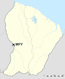
Location of airport in French Guiana
|
| Runways |
| Direction |
Length |
Surface |
| m |
ft |
| 07/25 |
1,200 |
3,937 |
Concrete |
|
Airlines and destinations
| Destinations |
| Air Guyane Express |
Cayenne, Grand Santi, Saint-Laurent du Maroni, Saül |
The above content comes from Wikipedia and is published under free licenses – click here to read more.
| General Info
|
| Country |
French Guiana
|
| Time |
UTC-3
|
| Latitude |
3.655635
03° 39' 20.29" N
|
| Longitude |
-54.039577
054° 02' 22.48" W
|
| Elevation |
406 feet
124 meters
|
| Magnetic Variation |
017° W (01/06)
|
| Operating Agency |
PRIVATE
|
| Runways
|
| ID |
Dimensions |
Surface |
PCN |
ILS
|
| 07/25 |
3935 x 49 feet
1199 x 15 meters |
CONCRETE. |
010RDWU |
NO
|
| Navaids
|
| Type |
ID |
Name |
Channel |
Freq |
Distance From Field |
Bearing From Navaid
|
| NDB |
MP |
MARIPASOULA |
- |
385 |
At Field |
-
|
The content above was published at Airports-Worldwide.com in 2020.
We don't guarantee the information is fresh and accurate. The data may be wrong or outdated.
For more up-to-date information please refer to other sources.
|
|