|
|
Carcassonne Airport
Aéroport de Carcassonne |
| IATA: CCF – ICAO: LFMK
Location of airport in France
|
| Summary |
| Airport type |
Public |
| Operator |
CCI Carcassonne Limoux Castelnaudary |
| Serves |
Carcassonne, France |
| Elevation AMSL |
434 ft / 132 m |
| Coordinates |
43°12′57″N 002°18′31″E / 43.21583°N 2.30861°E / 43.21583; 2.30861 |
| Website |
carcassonne.aeroport.fr |
| Runways |
| Direction |
Length |
Surface |
| m |
ft |
| 10/28 |
2,050 |
6,726 |
Asphalt |
| 10L/28R |
800 |
2,625 |
Grass |
| Sources: French AIP, UAF, DAFIF |
Carcassonne Airport (French: Aéroport de Carcassonne) (IATA: CCF, ICAO: LFMK) is an airport serving Carcassonne and the south of Languedoc. The airport is located on the northern edge of the city, 3 km (2 mi) from the city center, in the Aude department. It is also known as Salvaza Airport, Carcassonne Salvaza Airport or Carcassonne Airport in Pays Cathare (Aéroport de Carcassonne en Pays Cathare).
The airport handles commercial national and international flights as well as private, non-regular air traffic. It can cater for aircraft operating under VFR.
In the late 1990s the airport started taking budget flights to and from European airports and in 2006 had regular flight connections with Dublin, Shannon, Stansted, Liverpool, East Midlands and Charleroi. Facilities
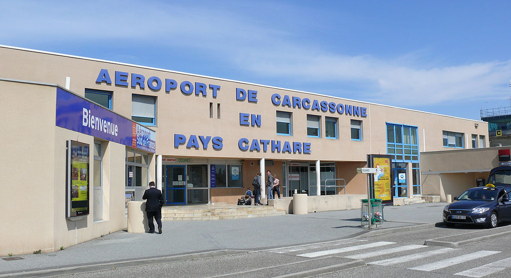
Salvaza Airport
Click to enlarge
The airport resides at an elevation of 434 feet (132 m) above mean sea level. It has one paved runway designated which measures 2,050 by 45 metres (6,726 × 148 ft). It also has a parallel unpaved runway with a grass surface measuring 800 by 30 metres (2,625 × 98 ft).
Airlines and scheduled destinations
| Airlines |
Destinations |
| Ryanair |
Brussels South-Charleroi , Dublin, East Midlands [seasonal], Glasgow-Prestwick [seasonal], Leeds/Bradford, Liverpool [seasonal], London-Stansted, Porto [seasonal] |
The above content comes from Wikipedia and is published under free licenses – click here to read more.
| General Info
|
| Country |
France
|
| ICAO ID |
LFMK
|
| Time |
UTC+1(+2DT)
|
| Latitude |
43.215978
43° 12' 57.52" N
|
| Longitude |
2.306317
002° 18' 22.74" E
|
| Elevation |
433 feet
132 meters
|
| Magnetic Variation |
000° W (01/06)
|
| Operating Agency |
CIVIL GOVERNMENT, (LANDING FEES AND DIPLOMATIC CLEARANCE MAY BE REQUIRED)
|
| Near City |
Carcassonne
|
| Operating Hours |
SEE REMARKS FOR OPERATING HOURS OR COMMUNICATIONS FOR POSSIBLE HOURS
|
| Daylight Saving Time |
Last Sunday in March to last Sunday in October
|
| Communications
|
| CARCASSONNE TWR |
121.0
|
| ATIS |
120.025
|
TOULOUSE APP
Opr H24
|
123.85
|
| Runways
|
| ID |
Dimensions |
Surface |
PCN |
ILS
|
| 10/28 |
6726 x 148 feet
2050 x 45 meters |
ASPHALT |
045FCWT |
YES
|
| Supplies/Equipment
|
| Fuel |
Jet A1, without icing nhibitor.
100/130 MIL Spec, low lead, aviation gasoline (BLUE)
|
| Remarks
|
| CSTMS/AG/IMG |
Avbl 0530-2130Z++ Mon-Fri; 0630Z++ to SS+30 Sat; 0700-2130Z++ Sun, hol.
|
| FUEL |
Avbl 0530-2130Z++ Mon-Fri; 0700Z++-SS+30 Sat, Sun and hol. (NC-100LL, A1)
|
| LGT |
PAPI Rwy 28 GS 4 . Pilot ctl lgt avbl.
|
| OPR HOURS |
Opr HX or by NOTAM.
|
| RSTD |
NORDO proh. Avoid ovft of city.
|
The content above was published at Airports-Worldwide.com in 2010.
We don't guarantee the information is fresh and accurate. The data may be wrong or outdated.
For more up-to-date information please refer to other sources.
|
|