|
|
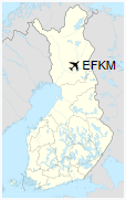
Kemijärvi Airfield is an airfield in Kemijärvi, Finland, about 7 nautical miles (13 km; 8 mi) west of Kemijärvi town centre.
|
Kemijärvi Airfield
Kemijärven lentokenttä
|
|
|
| Summary |
| Airport type |
Public |
| Operator |
Municipality of Kemijärvi |
| Location |
Kemijärvi, Finland |
| Elevation AMSL |
692 ft / 211 m |
| Coordinates |
66°42′57″N
027°09′26″E |
| Map |
|
|
| Runways |
| Direction |
Length |
Surface |
| m |
ft |
| 17/35 |
1,400 |
4,593 |
Asphalt |
|
The above content comes from Wikipedia and is published under free licenses – click here to read more.
| General Info
|
| Country |
Finland
|
| ICAO ID |
EFKM
|
| Time |
UTC+2(+3DT)
|
| Latitude |
66.712883
66° 42' 46.38" N
|
| Longitude |
27.156786
027° 09' 24.43" E
|
| Elevation |
692 feet
211 meters
|
| Magnetic Variation |
010° E (01/06)
|
| Operating Agency |
CIVIL GOVERNMENT, (LANDING FEES AND DIPLOMATIC CLEARANCE MAY BE REQUIRED)
|
| Operating Hours |
NO OPERATING HOURS LISTED
|
| Daylight Saving Time |
Last Sunday in March to last Sunday in October
|
| Runways
|
| ID |
Dimensions |
Surface |
PCN |
ILS
|
| 17/35 |
4593 x 75 feet
1400 x 23 meters |
ASPHALT |
- |
NO
|
| Remarks
|
| CAUTION |
Gldr act with acft tows and winch launches to 2700' AGL.
|
| OPR HOURS |
Opr HX.
|
The content above was published at Airports-Worldwide.com in 2020.
We don't guarantee the information is fresh and accurate. The data may be wrong or outdated.
For more up-to-date information please refer to other sources.
|
|