|
|
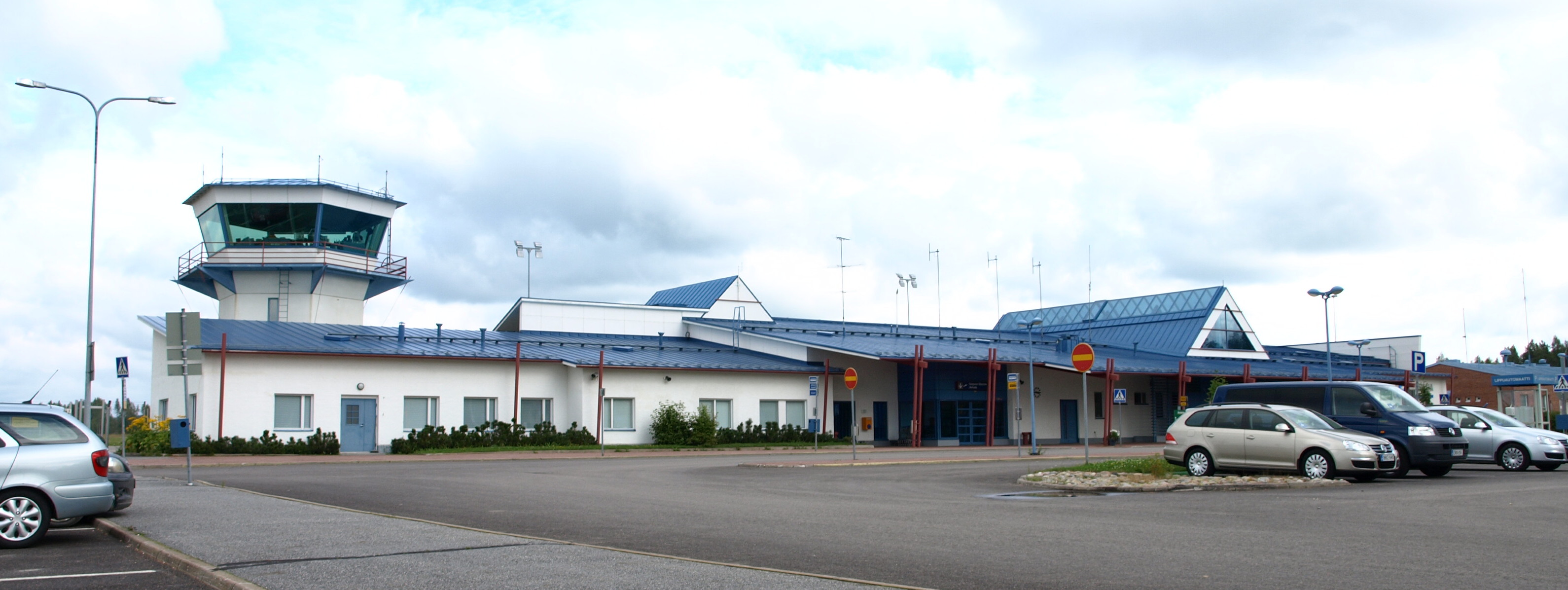
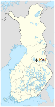
Kajaani Airport (IATA: KAJ, ICAO: EFKI) is an airport in Paltaniemi, Kajaani, Finland, approximately 7 kilometres (4 mi) northwest of Kajaani city centre.
|
Kajaani Airport
Kajaanin lentoasema
|
|
|
|
| Summary |
| Airport type |
Public |
| Operator |
Finavia |
| Location |
Kajaani, Finland |
| Elevation AMSL |
483 ft / 147 m |
| Coordinates |
64°17′03″N
027°41′15″E |
| Website |
finavia.fi |
| Map |
|
|
| Runways |
| Direction |
Length |
Surface |
| ft |
m |
| 07/25 |
8,199 |
2,500 |
Asphalt |
|
| Statistics (2018) |
| Passengers |
88,815 |
| Landings |
1 093 |
|
History
Construction of the airport began in 1939 with the runway being completed in the autumn. However, because of the outbreak of World War II it would not be until the 22 June 1956 that the airport would be officially opened.
Airlines and destinations
| Destinations |
| Finnair |
Helsinki, Jyväskylä |
Statistics
Annual passenger statistics for Kajaani Airport
| Year |
Domestic passengers |
International passengers |
Total passengers |
Change |
| 2005 |
93,470 |
5,985 |
99,455 |
−4,4% |
| 2006 |
87,273 |
5,464 |
92,737 |
−6,8% |
| 2007 |
87,061 |
3,741 |
90,802 |
−2,1% |
| 2008 |
81,243 |
3,366 |
84,609 |
−6,8% |
| 2009 |
70,848 |
2,552 |
73,400 |
−13,3% |
| 2010 |
63,980 |
2,033 |
66,013 |
−10,1% |
| 2011 |
74,985 |
3,110 |
78,095 |
+18,3% |
| 2012 |
70,369 |
7,483 |
77,852 |
-0,3% |
| 2013 |
69,817 |
4,741 |
74,558 |
-4,2% |
| 2014 |
67,981 |
3,873 |
71,854 |
-3,6% |
| 2015 |
81,096 |
2,933 |
84,029 |
+16,9% |
| 2016 |
84,160 |
1,693 |
85,853 |
+2,2% |
| 2017 |
84,724 |
2,731 |
87,455 |
+1,9% |
| 2018 |
85,286 |
3,529 |
88,815 |
+1,6% |
Awards
The airport was Finavia airport of the year in 1994, 1997 and 2007.
Ground transportation
| Means of transport at Kajaani Airport |
| Means of transport |
Operator |
Route |
Destinations |
Website |
Notes |
| Bus |
Kajaani Local Traffic |
4 |
Kajaani Market Square (Finnish: Kauppatori) |
www.kajaani.fi |
On rush hours |
| Bus |
A. Kyllönen Oy |
Airbus |
Sotkamo bus station (via Kajaani Market Square and Vuokatti) |
www.akyllonen.fi |
According to flight schedules |
The above content comes from Wikipedia and is published under free licenses – click here to read more.
| General Info
|
| Country |
Finland
|
| ICAO ID |
EFKI
|
| Time |
UTC+2(+3DT)
|
| Latitude |
64.285472
64° 17' 07.70" N
|
| Longitude |
27.692414
027° 41' 32.69" E
|
| Elevation |
483 feet
147 meters
|
| Type |
Civil
|
| Magnetic Variation |
009° E (01/06)
|
| Operating Agency |
CIVIL GOVERNMENT, (LANDING FEES AND DIPLOMATIC CLEARANCE MAY BE REQUIRED)
|
| Daylight Saving Time |
Last Sunday in March to last Sunday in October
|
| Communications
|
ATIS
Opr H24.
|
114.9
|
| AFIS |
118.1
119.7
|
| Runways
|
| ID |
Dimensions |
Surface |
PCN |
ILS
|
| 07/25 |
8199 x 157 feet
2499 x 48 meters |
ASPHALT |
065FBWT |
YES
|
| Navaids
|
| Type |
ID |
Name |
Channel |
Freq |
Distance From Field |
Bearing From Navaid
|
| VOR-DME |
KNI |
KAINUU |
096X |
114.9 |
1.0 NM |
70.7
|
| NDB |
KAJ |
KAJAANI |
- |
337 |
4.3 NM |
71.2
|
| Supplies/Equipment
|
| Fuel |
Jet A1, without icing nhibitor.
100/130 MIL Spec, low lead, aviation gasoline (BLUE)
|
| Remarks
|
| CAUTION |
Bird haz migration rte Mar thru May and Sep thru Nov.
|
| CSTMS/IMG |
CSTMS avbl with 1.5 hr PN, IMG avbl with 2 hr PN. Req for svc dur office hr: 0600-1415Z++ Mon-Fri.
|
| FUEL |
Avbl O/R 1 hr PN, fone C358-400-584 815. (NC-100LL, A1)
|
| MISC |
Ldg fees.
|
| OPR HOURS |
Opr HO.
|
The content above was published at Airports-Worldwide.com in 2020.
We don't guarantee the information is fresh and accurate. The data may be wrong or outdated.
For more up-to-date information please refer to other sources.
|
|