|
|
Arba Minch Airport (IATA: AMH, ICAO: HAAM) is an airport serving Arba Minch, a city in the Southern Nations, Nationalities, and Peoples’ Region (SNNPR) in Ethiopia. The name of the city and airport may also be transliterated as Arba Mintch. The airport is located 5 km (3 miles) northeast of the city centre, near Lake Abaya.Arba Minch Airport (IATA: AMH, ICAO: HAAM) is an airport serving Arba Minch, a city in the Southern Nations, Nationalities, and Peoples’ Region (SNNPR) in Ethiopia. The name of the city and airport may also be transliterated as Arba Mintch. The airport is located 5 km (3 miles) northeast of the city centre, near Lake Abaya.
|
Arba Minch Airport
|
|
|
| Summary |
| Airport type |
Public / Military |
| Operator |
Ethiopian Airports Enterprise |
| Serves |
Arba Minch, Ethiopia |
| Elevation AMSL |
1,187 m / 3,894 ft |
| Coordinates |
06°02′23″N
037°35′25″E |
| Map |
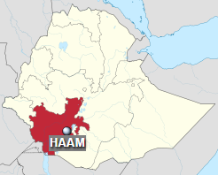
Location of airport in Ethiopia (SNNPR in red)
|
| Runways |
| Direction |
Length |
Surface |
| m |
ft |
| 03/21 |
2,800 |
9,186 |
Asphalt concrete |
|
Facilities
The airport sits at an elevation of 1,187 metres (3,894 ft) above mean sea level. It has one runway designated 03/21 with an asphalt concrete surface measuring 2,800 by 45 metres (9,186 ft × 148 ft).
Airlines and destinations
| Destinations |
| Ethiopian Airlines |
Addis Ababa, Goba |
Military use
In October 2011 it was confirmed that the U.S. Seventeenth Air Force was operating General Atomics MQ-9A Reaper unmanned aerial vehicles from the airport for reconnaissance over Somalia. Master Sergeant James Fisher, spokesman for the 17th Air Force, said that an unspecified number of Air Force personnel are working at the Ethiopian airfield “to provide operation and technical support for our security assistance programs.” He also said that the drone flights “will continue as long as the government of Ethiopia welcomes our cooperation on these varied security programs.” The United States military has spent millions of dollars upgrading the airbase to handle the Reapers, and is being used to surveil al-Shabab, but will not conduct airstrikes from the base. However, according to OSGEOINT, mapped imagery of the MQ-9A ranges may also suggest mission support to other countries outside of Somalia.
Air Force (magazine notes in its 2012/13 annual survey of units that the 409th Air Expeditionary Group operates ISR aircraft from unspecified locations in the United States Air Forces Africa area of responsibility. In early April 2012, the second drone crash in four months was reported at the Reaper detachment in Mahe, Seychelles.
The enclave at the base closed down during January 2016.
The above content comes from Wikipedia and is published under free licenses – click here to read more.
| General Info
|
| Country |
Ethiopia
|
| ICAO ID |
HAAM
|
| Time |
UTC+3
|
| Latitude |
6.039389
06° 02' 21.80" N
|
| Longitude |
37.590453
037° 35' 25.63" E
|
| Elevation |
3895 feet
1187 meters
|
| Magnetic Variation |
001° E (01/06)
|
| Operating Agency |
CIVIL GOVERNMENT, (LANDING FEES AND DIPLOMATIC CLEARANCE MAY BE REQUIRED)
|
| Operating Hours |
SEE REMARKS FOR OPERATING HOURS OR COMMUNICATIONS FOR POSSIBLE HOURS
|
| Runways
|
| ID |
Dimensions |
Surface |
PCN |
ILS
|
| 03/21 |
9170 x 153 feet
2795 x 47 meters |
ASPHALT |
050FCXT |
NO
|
| Navaids
|
| Type |
ID |
Name |
Channel |
Freq |
Distance From Field |
Bearing From Navaid
|
| NDB |
AM |
ARBA MINCH |
- |
275 |
1.3 NM |
213.1
|
| Remarks
|
| OPR HOURS |
Opr Mon, Fri, Sat 0500-1400Z.
|
The content above was published at Airports-Worldwide.com in 2019.
We don't guarantee the information is fresh and accurate. The data may be wrong or outdated.
For more up-to-date information please refer to other sources.
|
|