|
Los Comandos Airport (ICAO: MSLD) is an airstrip serving the town of San Francisco Gotera in Morazán Department, El Salvador.
The runway is 3 kilometres (1.9 mi) north of the town. There is rising terrain to the north.
The Soto Cano VORTAC (Ident: ESC) is located 48.9 nautical miles (90.6 km) northeast of Los Comandos. The Toncontin VOR-DME (Ident: TNT) is located 54.3 nautical miles (100.6 km) east-northeast of the airstrip.
|
Los Comandos Airport
|
|
|
| Summary |
| Airport type |
Public |
| Serves |
San Francisco Gotera |
| Elevation AMSL |
919 ft / 280 m |
| Coordinates |
13°43′35″N
88°06′25″W |
| Map |
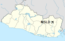
Location of the airport in El Salvador
|
| Runways |
| Direction |
Length |
Surface |
| m |
ft |
| 01/19 |
985 |
3,232 |
Asphalt |
|
The above content comes from Wikipedia and is published under free licenses – click here to read more.
| General Info
|
| Country |
El Salvador
|
| ICAO ID |
MSLD
|
| Time |
UTC-6
|
| Latitude |
13.726156
13° 43' 34.16" N
|
| Longitude |
-88.106736
088° 06' 24.25" W
|
| Elevation |
919 feet
280 meters
|
| Magnetic Variation |
001° E (01/06)
|
| Operating Agency |
PRIVATE
|
| Alternate Name |
SAN FRANCISCO GOTERA
|
| Runways
|
| ID |
Dimensions |
Surface |
PCN |
ILS
|
| 01/19 |
3280 x 50 feet
1000 x 15 meters |
ASPHALT |
- |
NO
|
| Remarks
|
| OPR HOURS |
Opr SR-SS.
|
The content above was published at Airports-Worldwide.com in 2019.
We don't guarantee the information is fresh and accurate. The data may be wrong or outdated.
For more up-to-date information please refer to other sources.
|