|
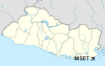
El Tamarindo Airport (ICAO: MSET) is an airport serving El Tamarindo, a coastal town in the La Unión Department of El Salvador.
The runway is crossways on a point (Punta de Amapala) at the entrance to the Gulf of Fonseca, and approaches to either end are over the water.
|
El Tamarindo Airport
|
|
|
| Summary |
| Airport type |
Private |
| Serves |
El Tamarindo, El Salvador |
| Elevation AMSL |
10 ft / 3 m |
| Coordinates |
13°09′45″N
087°54′17″W |
| Map |
|
|
| Runways |
| Direction |
Length |
Surface |
| m |
ft |
| 15/33 |
1,341 |
4,400 |
Asphalt |
|
The above content comes from Wikipedia and is published under free licenses – click here to read more.
| General Info
|
| Country |
El Salvador
|
| ICAO ID |
MSET
|
| Time |
UTC-6
|
| Latitude |
13.162608
13° 09' 45.39" N
|
| Longitude |
-87.904767
087° 54' 17.16" W
|
| Elevation |
10 feet
3 meters
|
| Magnetic Variation |
001° E (01/06)
|
| Operating Agency |
PRIVATE
|
| Runways
|
| ID |
Dimensions |
Surface |
PCN |
ILS
|
| 15/33 |
4400 x 75 feet
1341 x 23 meters |
ASPHALT |
- |
NO
|
| Remarks
|
| OPR HOURS |
Opr SR-SS.
|
The content above was published at Airports-Worldwide.com in 2019.
We don't guarantee the information is fresh and accurate. The data may be wrong or outdated.
For more up-to-date information please refer to other sources.
|