|
|
Mariscal Sucre Intl Airport |
Mariscal Sucre International Airport
Aeropuerto Internacional Mariscal Sucre |
 |
| IATA: UIO – ICAO: SEQU |
| Summary |
| Airport type |
Public / Military |
| Operator |
Quiport |
| Serves |
Quito, Ecuador |
| Elevation AMSL |
9,228 ft / 2,813 m |
| Coordinates |
00°08′28″S 078°29′17″W / 0.14111°S 78.48806°W / -0.14111; -78.48806 |
| Website |
www.quiport.com |
| Runways |
| Direction |
Length |
Surface |
| m |
ft |
| 17/35 |
3,120 |
10,236 |
Asphalt |
| Source: DAFIF |
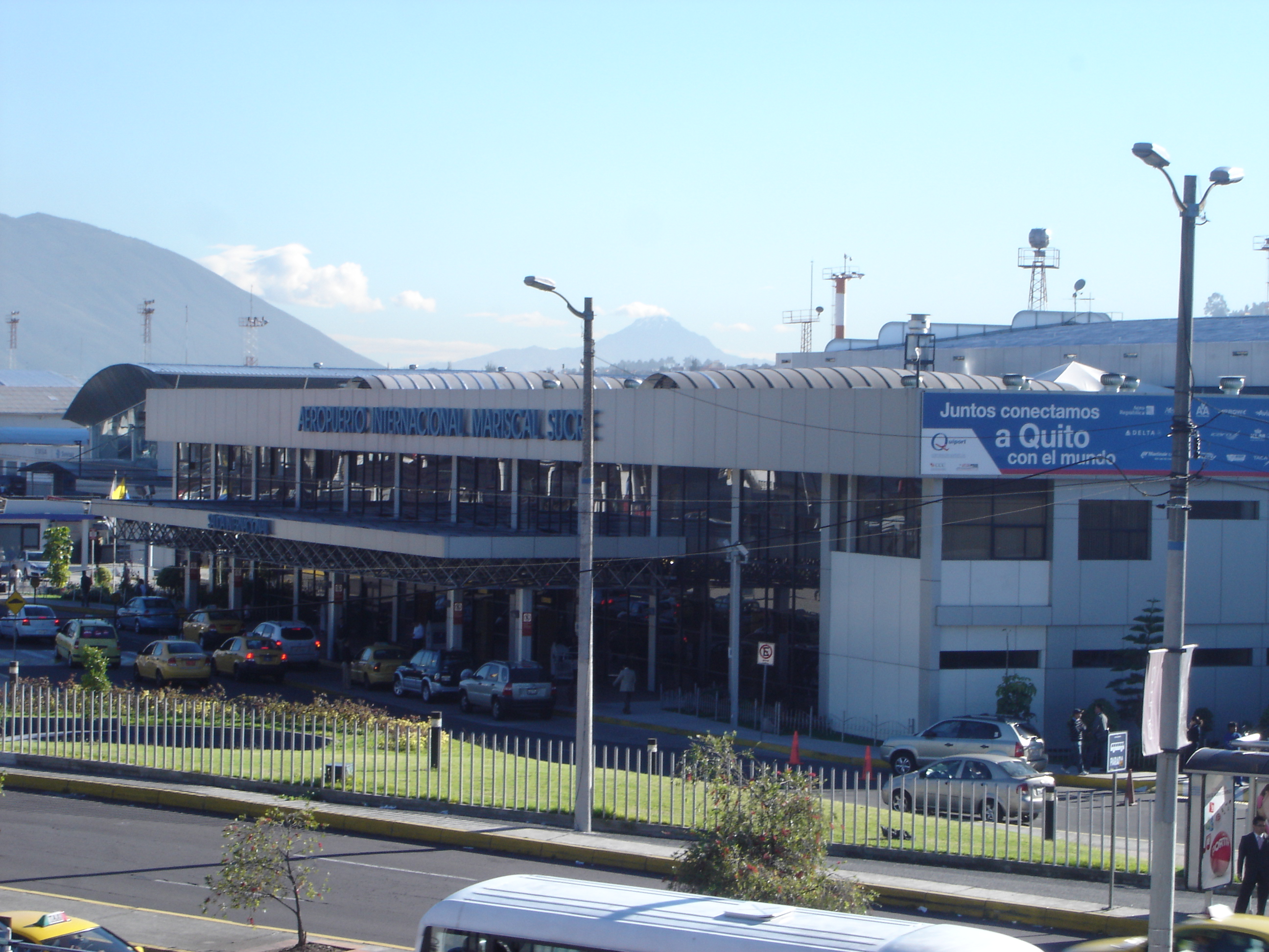
Mariscal Sucre International Airport (IATA: UIO, ICAO: SEQU) is the international airport serving Quito, the capital city of Ecuador. It is named after Venezuelan born Antonio José de Sucre, known as the "Gran Mariscal de Ayacucho" (English: "Grand Marshal of Ayacucho"), a hero of Ecuadorian and Latin American independence. It began operations in 1960, and currently handles about 3.9 million passengers and 125,000 metric tons of freight per year. The airport, one of the highest in the world (at 2800 meters AMSL) is located in the northern part of the city, in the Chaupicruz parish, within 5 minutes of Quito's financial center; the terminals are located at the intersection of Amazonas and La Prensa avenues.
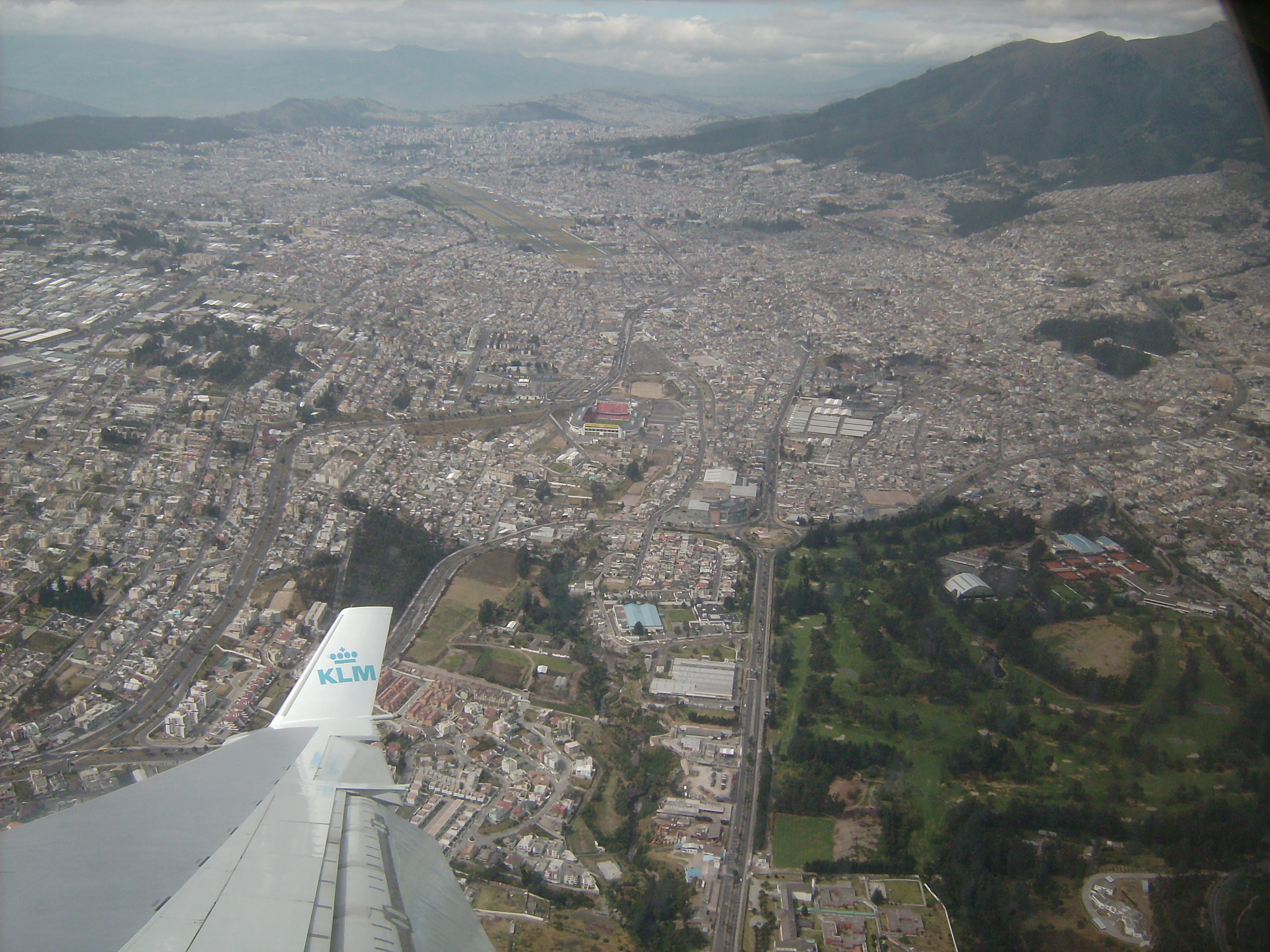
Due to its location (in the middle of a city surrounded by mountains), the current airport cannot be expanded to accommodate any larger aircraft or an increase in air traffic. Its operation poses higher risks, too; six serious accidents and several incidents have taken place in recent years. A new airport is being built in the Tababela parish, about 18 km to the east of the city. This is being constructed by a private consortium (including Aecon) and is slated to begin operations in November 2011.
The airport charges an international departure tax of US $40.80 as of March 1, 2009. This must be paid at a cashier's desk in US Dollars. Facilities
The existing airport consists of one terminal split into a national and international area. It is equipped with five swing gates capable of directing arriving passengers to either Immigration or to baggage claim. In addition, there are numerous ground slots where passengers walk to the aircraft from the terminal.
Terminals, airlines and destinations
 | |
Airport location within the city |
| Airlines |
Destinations |
Terminal |
| AeroGal |
Baltra, Bogotá, Cuenca, Guayaquil, Manta, New York-JFK, San Cristóbal |
D, I |
| AeroRepública |
Bogotá |
I |
| American Airlines |
Miami |
I |
| Avianca operated by AeroGal |
Bogotá |
I |
| Continental Airlines |
Houston-Intercontinental |
I |
| Copa Airlines |
Panama City |
I |
| Delta Air Lines |
Atlanta |
I |
| Iberia |
Madrid |
I |
| Icaro |
Coca, Guayaquil, Manta |
D |
| KLM |
Amsterdam, Bonaire |
I |
| LAN Ecuador |
Baltra, Buenos Aires-Ezeiza, Cuenca, Guayaquil, Madrid, Miami, Santiago de Chile |
D, I |
| LAN Perú |
Cali, Lima, Medellín-Córdova |
I |
| SAEREO |
Macas, Santa Rosa |
D |
| Santa Barbara Airlines |
Caracas |
I |
| TACA operated by Lacsa |
San José de Costa Rica |
I |
| TACA Peru |
Lima, Medellín-Córdova |
I |
| TAME |
Baltra, Coca, Cuenca, Esmeraldas, Guayaquil, Lago Agrio, Loja Machala, San Cristóbal |
D |
| VIP |
Coca, Guayaquil, Lago Agrio, Salinas |
D |
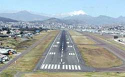 | |
View of the runway from the north. |
Cargo airlines and destinations
| Airlines |
Destinations |
| ABSA Cargo Airline |
São Paulo-Viracopos, Miami |
| AeroSucre |
Bogotá |
| Atlas Air |
New York-JFK |
| Cargolux |
São Paulo-Viracopos, Luxembourg City |
| Cielos Airlines |
Lima, Miami |
| DHL Aero Expreso |
Miami |
| FedEx Express |
Miami |
| Florida West International Airways |
Miami |
| Jade Cargo International |
Shenzhen [seasonal] |
| KLM Cargo |
Amsterdam |
| LAN Cargo |
Miami, Santiago de Chile, Buenos Aires-Ezeiza |
| Línea Aérea Carguera de Colombia |
Bogotá, Miami |
| Líneas Aéreas Suramericanas |
Bogotá |
| Lufthansa Cargo |
Frankfurt |
| Martinair |
Amsterdam, Miami, San Jose de Costa Rica |
| MasAir |
Mexico City, Los Angeles |
| Singapore Airlines Cargo |
Bogotá, Brussels, São Paulo-Viracopos |
| Southern Air |
Miami |
| TAMPA Cargo |
Bogotá, Medellín, Miami |
| UPS |
Miami |
| World Airways Cargo |
Miami |
Accidents and incidents
- September 30, 2010: Troops from the Ecuadorian airforce took control of Mariscal Sucre International Airport in protest of Ecuadorian president, Rafael Correa.
- October 27, 2009: An Ecuadorian Air Force HAL Dhruv helicopter crashed during display maneuvers at Mariscal Sucre International Airport, with both pilots sustaining only minor scratches and no casualties. The aircraft was flying in military formation next to two other helicopters at the time of the incident.
- March 19, 2009: An Ecuadorian Air Force Beechcraft B200 King Air struck a building in the Guápulo district of Quito while on approach to Mariscal Sucre International Airport in heavy fog. All five occupants of the aircraft were killed, as well as two people on the ground.
- September 23, 2008: An Icaro Air Fokker F28 Mk4000 skidded off of the runway. There were no injuries among the 62 passengers, but the aircraft was written off.
- November 9, 2007: An Iberia Airlines Airbus A340-600 was badly damaged after sliding off the runway. The landing gear collapsed and two engines were dislodged. All 333 passengers and crew were evacuated via inflatable slides, but no serious injuries were reported.
- January 17, 2003: A TAME Fokker F28 Mk4000 ran off the runway after takeoff was abandoned due to a tire blowout. The nose gear collapsed, and the aircraft came to rest 81 meters past the runway threshold. There were no injuries.
- August 29, 1998: A Cubana de Aviación Tupolev Tu-154M overshot the runway killing the 14-member crew, 56 of the 77 passengers and 10 people on the ground.
- May 1, 1996: A Fly Linhas Aéreas Boeing 727-200 aborted takeoff in rainy weather, but overshot the runway, crossing a road that lay at the end of runway 35. The aircraft had been overloaded. No injuries were reported.
- May 3, 1995: A Gulfstream II operated by American Jet selected the wrong VOR frequency during a nighttime approach to Quito; the jet flew 12 miles further south than it should have, striking the Sincholagua volcano at 16,000 feet. All seven occupants were killed.
- December 10, 1992: A North American Sabreliner 60 operated by the Ecuadorian Air Force clipped a 10-story building under construction 3 kilometers south of the airport. The aircraft crashed into a residential area, killing all 10 on board and 3 more on the ground.
- June 3, 1988: A North American Sabreliner 40 operated by the Ecuadorian Air Force flew into a mountain on the outskirts of Quito, killing all 11 on board.
- September 18, 1984: An AECA (Aeroservicios Ecuatorianos) Douglas DC-8-50 freighter failed to achieve altitude during takeoff, running off the end of the runway and crashing into a residential area 460 meters past the runway, destroying 25 houses, killing all 4 crewmembers as well as 49 people on the ground.
- April 29, 1982: A Lockheed C-130 Hercules operated by the Ecuadorian Air Force crashed into a mountain near Quito while executing a missed approach; 7 were killed.
- January 27, 1980: An Avianca Boeing 720 landed too fast, too far down the runway, and consequently overran, collapsing the nosegear. No injuries were reported.
- November 7, 1960: An AREA Ecuador Fairchild F-27 crashed into a mountain 16 kilometers south of Quito during its approach. 37 occupants were killed.
The above content comes from Wikipedia and is published under free licenses – click here to read more.
| General Info
|
| Country |
Ecuador
|
| ICAO ID |
SEQU
|
| Time |
UTC-5
|
| Latitude |
-0.141144
00° 08' 28.12" S
|
| Longitude |
-78.488214
078° 29' 17.57" W
|
| Elevation |
9228 feet
2813 meters
|
| Type |
Joint (Civil and Military)
|
| Magnetic Variation |
001° W (01/06)
|
| Beacon |
Yes
|
| Operating Agency |
MILITARY - CIVIL JOINT USE AIRPORT
|
| Alternate Name |
QUITO
|
| Near City |
Quito
|
| Operating Hours |
SEE REMARKS FOR OPERATING HOURS OR COMMUNICATIONS FOR POSSIBLE HOURS
|
| International Clearance Status |
Airport of Entry
|
| Communications
|
| QUITO TWR |
118.1
|
| QUITO RDO |
126.9
121.5
|
| GND |
121.9
|
| ATIS |
115.3
114.8
|
| QUITO APP |
119.7
121.2
|
| Runways
|
| ID |
Dimensions |
Surface |
PCN |
ILS
|
| 17/35 |
10236 x 151 feet
3120 x 46 meters |
ASPHALT |
042FBXT |
YES
|
| Navaids
|
| Type |
ID |
Name |
Channel |
Freq |
Distance From Field |
Bearing From Navaid
|
| VOR-DME |
QMS |
MONJAS SUR |
095X |
114.8 |
5.7 NM |
355.2
|
| NDB |
ZUI |
ASCAZUBI |
- |
290 |
9.9 NM |
255.1
|
| Supplies/Equipment
|
| Fuel |
Jet A1, without icing nhibitor.
100/130 MIL Spec, low lead, aviation gasoline (BLUE)
|
| Remarks
|
| CAUTION |
Several obst lgtd and unlghtd to 3840 feet within 2 NM, 1 lghtd SW and 1 unlghtdSE of arpt. Bird haz.
|
| FUEL |
A1 (Avbl 1100-0500Z, Repsol Comercial de Prodctos, Ecuafuel C593-2-433-827), (NC-100LL)
|
| LGT |
PAPI Rwy 35 GS 3.12 .
|
| RSTD |
NORDO proh.
|
The content above was published at Airports-Worldwide.com in 2010.
We don't guarantee the information is fresh and accurate. The data may be wrong or outdated.
For more up-to-date information please refer to other sources.
|
|